Gagarawa elevation
Gagarawa (Jigawa), Nigeria elevation is 374 meters and Gagarawa elevation in feet is 1227 ft above sea level [src 1]. Gagarawa is a seat of a second-order administrative division (feature code) with elevation that is 77 meters (253 ft) bigger than average city elevation in Nigeria.
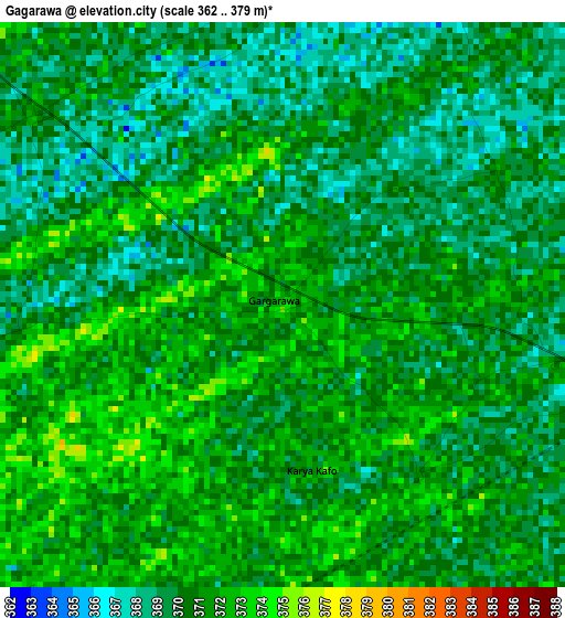
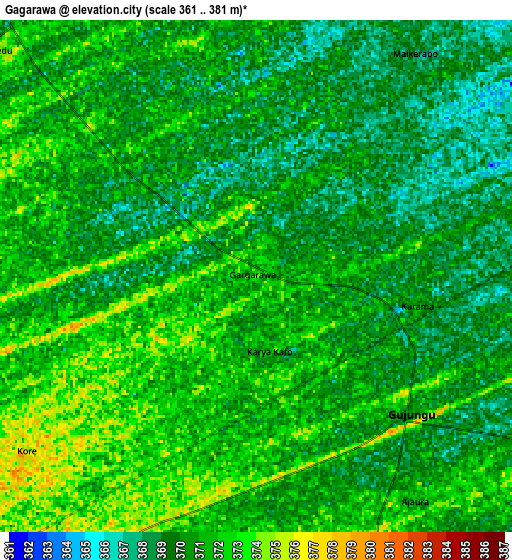
Below is the Elevation map of Gagarawa, which displays elevation range with different colors. Scale of the first map is from 362 to 379 m (1188 to 1243 ft) with average elevation of 370.2 meters (=1215 ft) [note 1]
These maps also provides idea of topography and contour of this city, they are displayed at different zoom levels. More info about maps, scale and edge coordinates you can find below images.
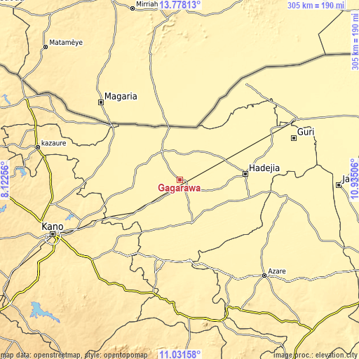
| \ | Map #1 | Map #2 | Topo.Map |
| Scale [m] | 362..379 m | 361..381 m | × |
| Scale [ft] | 1188..1243 ft | 1184..1250 ft | × |
| Average | 370.2 m = 1215 ft | 370.3 m = 1215 ft | × |
| Width | 9.54 km = 5.9 mi | 19.09 km = 11.9 mi | 305.4 km = 189.8 mi |
| Height | 9.54 km = 5.9 mi | 19.09 km = 11.9 mi | 305.4 km = 189.8 mi |
| ↑Max Latitude | 12.451395° | 12.494303° | 13.77813° |
| Latitude at center | 12.40848° | 12.40848° | 12.40848° |
| ↓Min Latitude | 12.365558° | 12.322628° | 11.03158° |
| ← Min Longitude | 9.484865° | 9.440919° | 8.12256° |
| Longitude center | 9.52881° | 9.52881° | 9.52881° |
| →Max Longitude | 9.572755° | 9.616701° | 10.93506° |
Nearby cities:
Cities around Gagarawa sort by population:
• Gumel elevation 369 m
28.7 km,  327°
327°
• Ringim 392 m
49 km,  234°
234°
• Kafin Hausa 364 m
45.6 km,  114°
114°
• Maigatari 366 m
45.3 km,  348°
348°
• Auyo 364 m
45.3 km,  100°
100°
• Sule Tankarkar 377 m
43.5 km,  311°
311°
• Malam Madori 360 m
42 km,  65°
65°
• Jahun 374 m
38.5 km,  163°
163°
• Garki 380 m
36.9 km,  274°
274°
• Taura 384 m
33.5 km, 232°
• Miga 372 m
27.5 km,  133°
133°
• Kaugama 366 m
23.7 km, 72°
Multilingual:
 En español:
Gagarawa elevación 374 m.
 En France:
Gagarawa élévation 374 m.
 Auf Deutsch:
Gagarawa höhe über dem Meeresspiegel ist 374 m.

Sources and notes:
- [note 1] Map square and city borders are not equal. Map elevation data is calculated only from area inside that square.
- [src 1] Elevation data from geonames database provided with same terms of usage.
- [src 2] The elevation map of Gagarawa is generated using elevation data from NASA's 3 arcsec (90m) resolution SRTM data.
- [src 3] Base (background) map © OpenStreetMap contributors tiles are generated by Geofabrik and OpenTopoMap.
Copyright & License:
This Gagarawa Elevation Map is licensed under CC BY-SA. You may reuse any part from this page, if you give a proper credit by linking to this URL:
 More info on terms of use page.