Gora elevation
Gora (Katsina, Malumfashi), Nigeria elevation is 593 meters and Gora elevation in feet is 1946 ft above sea level [src 1]. Gora is a populated place (feature code) with elevation that is 296 meters (971 ft) bigger than average city elevation in Nigeria.
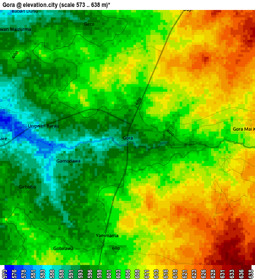
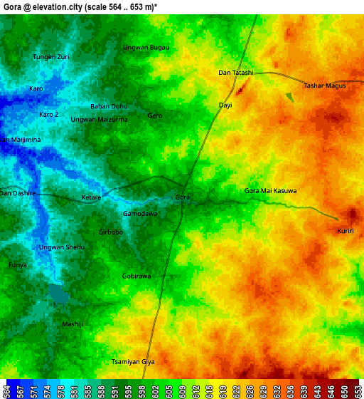
Below is the Elevation map of Gora, which displays elevation range with different colors. Scale of the first map is from 573 to 638 m (1880 to 2093 ft) with average elevation of 604.3 meters (=1983 ft) [note 1]
These maps also provides idea of topography and contour of this city, they are displayed at different zoom levels. More info about maps, scale and edge coordinates you can find below images.
| \ | Map #1 | Map #2 | Topo.Map |
| Scale [m] | 573..638 m | 564..653 m | × |
| Scale [ft] | 1880..2093 ft | 1850..2142 ft | × |
| Average | 604.3 m = 1983 ft | 607.4 m = 1993 ft | × |
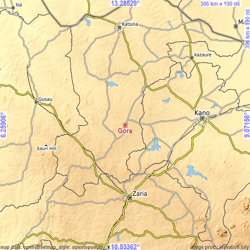
| Width | 9.56 km = 5.9 mi | 19.12 km = 11.9 mi | 306 km = 190.1 mi |
| Height | 9.56 km = 5.9 mi | 19.12 km = 11.9 mi | 306 km = 190.1 mi |
| ↑Max Latitude | 11.955935° | 11.998924° | 13.28529° |
| Latitude at center | 11.91294° | 11.91294° | 11.91294° |
| ↓Min Latitude | 11.869938° | 11.826929° | 10.53362° |
| ← Min Longitude | 7.621365° | 7.577419° | 6.25906° |
| Longitude center | 7.66531° | 7.66531° | 7.66531° |
| →Max Longitude | 7.709255° | 7.753201° | 9.07156° |
Nearby cities:
Cities around Gora sort by population:
• Malumfashi elevation 618 m
14.6 km,  199°
199°
• Gwarzo 581 m
29.2 km,  89°
89°
• Bakori 656 m
47.6 km,  213°
213°
• Kankara 595 m
27.7 km,  274°
274°
• Musawa 578 m
24.1 km,  1°
1°
• Jikamshi 565 m
31.3 km,  22°
22°
• Dan Musa 492 m
52.9 km,  317°
317°
• Rogo 611 m
43.6 km,  156°
156°
• Karaye 542 m
40.7 km,  110°
110°
• Shanono 584 m
38.7 km,  66°
66°
• Matazu 535 m
35.9 km, 1°
• Kafur 587 m
29.8 km,  174°
174°
Multilingual:
 En español:
Gora elevación 593 m.
 En France:
Gora élévation 593 m.


Sources and notes:
- [note 1] Map square and city borders are not equal. Map elevation data is calculated only from area inside that square.
- [src 1] Elevation data from geonames database provided with same terms of usage.
- [src 2] The elevation map of Gora is generated using elevation data from NASA's 3 arcsec (90m) resolution SRTM data.
- [src 3] Base (background) map © OpenStreetMap contributors tiles are generated by Geofabrik and OpenTopoMap.
Copyright & License:
This Gora Elevation Map is licensed under CC BY-SA. You may reuse any part from this page, if you give a proper credit by linking to this URL:
 More info on terms of use page.