Lame elevation
Lame (Bauchi, Toro), Nigeria elevation is 711 meters and Lame elevation in feet is 2333 ft above sea level [src 1]. Lame is a populated place (feature code) with elevation that is 414 meters (1358 ft) bigger than average city elevation in Nigeria.
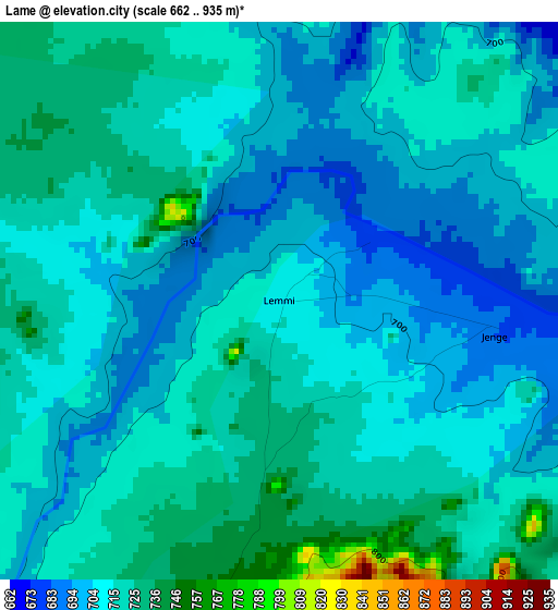
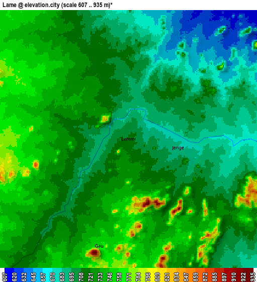
Below is the Elevation map of Lame, which displays elevation range with different colors. Scale of the first map is from 662 to 935 m (2172 to 3068 ft) with average elevation of 711.3 meters (=2334 ft) [note 1]
These maps also provides idea of topography and contour of this city, they are displayed at different zoom levels. More info about maps, scale and edge coordinates you can find below images.
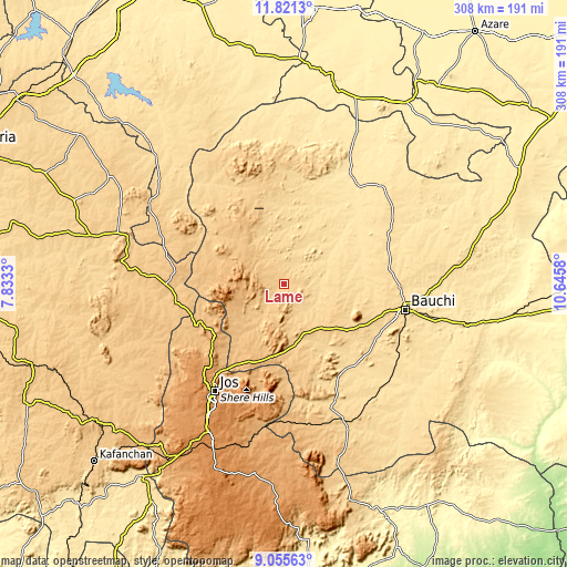
| \ | Map #1 | Map #2 | Topo.Map |
| Scale [m] | 662..935 m | 607..935 m | × |
| Scale [ft] | 2172..3068 ft | 1991..3068 ft | × |
| Average | 711.3 m = 2334 ft | 716.2 m = 2350 ft | × |
| Width | 9.61 km = 6 mi | 19.22 km = 11.9 mi | 307.5 km = 191.1 mi |
| Height | 9.61 km = 6 mi | 19.22 km = 11.9 mi | 307.5 km = 191.1 mi |
| ↑Max Latitude | 10.484755° | 10.527963° | 11.8213° |
| Latitude at center | 10.44154° | 10.44154° | 10.44154° |
| ↓Min Latitude | 10.398319° | 10.355093° | 9.05563° |
| ← Min Longitude | 9.195605° | 9.151659° | 7.8333° |
| Longitude center | 9.23955° | 9.23955° | 9.23955° |
| →Max Longitude | 9.283495° | 9.327441° | 10.6458° |
Nearby cities:
Cities around Lame sort by population:
• Jos elevation 1186 m
68.6 km,  213°
213°
• Bauchi 623 m
67.7 km,  102°
102°
• Lere 753 m
73.2 km,  265°
265°
• Dass 617 m
57.6 km,  148°
148°
• Saminaka 765 m
60.5 km, 266°
• Yamrat 553 m
73.9 km,  119°
119°
• Bununu 579 m
78.7 km,  142°
142°
• Bassa 1168 m
77.9 km,  224°
224°
• Ririwai 890 m
63.8 km,  301°
301°
• Kafin Madaki 556 m
63.2 km,  64°
64°
• Angware 938 m
52.1 km,  196°
196°
• Toro 978 m
46.5 km, 203°
Multilingual:
 En español:
Lame elevación 711 m.
 En France:
Lame élévation 711 m.


Sources and notes:
- [note 1] Map square and city borders are not equal. Map elevation data is calculated only from area inside that square.
- [src 1] Elevation data from geonames database provided with same terms of usage.
- [src 2] The elevation map of Lame is generated using elevation data from NASA's 3 arcsec (90m) resolution SRTM data.
- [src 3] Base (background) map © OpenStreetMap contributors tiles are generated by Geofabrik and OpenTopoMap.
Copyright & License:
This Lame Elevation Map is licensed under CC BY-SA. You may reuse any part from this page, if you give a proper credit by linking to this URL:
 More info on terms of use page.