Tlamaya Grande elevation
Tlamaya Grande (Puebla, Tlapacoya), Mexico elevation is 734 meters and Tlamaya Grande elevation in feet is 2408 ft above sea level [src 1]. Tlamaya Grande is a populated place (feature code) with elevation that is 580 meters (1903 ft) smaller than average city elevation in Mexico.
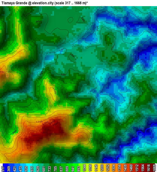
Below is the Elevation map of Tlamaya Grande, which displays elevation range with different colors. Scale of the first map is from 317 to 1668 m (1040 to 5472 ft) with average elevation of 767.8 meters (=2519 ft) [note 1]
These maps also provides idea of topography and contour of this city, they are displayed at different zoom levels. More info about maps, scale and edge coordinates you can find below images.
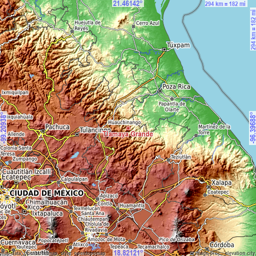
| \ | Map #1 | Topo.Map |
| Scale [m] | 317..1668 m | × |
| Scale [ft] | 1040..5472 ft | × |
| Average | 767.8 m = 2519 ft | × |
| Width | 9.17 km = 5.7 mi | 293.6 km = 182.4 mi |
| Height | 9.17 km = 5.7 mi | 293.6 km = 182.4 mi |
| ↑Max Latitude | 20.188141° | 21.46142° |
| Latitude at center | 20.14689° | 20.14689° |
| ↓Min Latitude | 20.105628° | 18.82121° |
| ← Min Longitude | -97.847075° | -99.20938° |
| Longitude center | -97.80313° | -97.80313° |
| →Max Longitude | -97.759185° | -96.39688° |
Nearby cities:
Cities around Tlamaya Grande sort by population:
• Filomeno Mata elevation 705 m
11.9 km,  60°
60°
• Chicontla 325 m
11.2 km,  345°
345°
• Tlacotepec (San Mateo) 1306 m
10.8 km,  206°
206°
• Amixtlán 1248 m
11 km,  177°
177°
• Xochinanacatlán 963 m
11.2 km,  298°
298°
• Jopala 646 m
11.7 km,  80°
80°
• Tlaltepango 1318 m
7.7 km,  268°
268°
• Buenos Aires 585 m
5.8 km, 82°
• Bienvenido 783 m
6.7 km,  113°
113°
• Quamila 1064 m
12.2 km,  280°
280°
• Cuautotola 1365 m
8.7 km, 176°
• San Pedro Tlaolantongo 296 m
9.4 km,  0°
0°
Multilingual:
 En español:
Tlamaya Grande elevación 734 m.
 En France:
Tlamaya Grande élévation 734 m.
 Auf Deutsch:
Tlamaya Grande höhe über dem Meeresspiegel ist 734 m.

Sources and notes:
- [note 1] Map square and city borders are not equal. Map elevation data is calculated only from area inside that square.
- [src 1] Elevation data from geonames database provided with same terms of usage.
- [src 2] The elevation map of Tlamaya Grande is generated using elevation data from NASA's 3 arcsec (90m) resolution SRTM data.
- [src 3] Base (background) map © OpenStreetMap contributors tiles are generated by Geofabrik and OpenTopoMap.
Copyright & License:
This Tlamaya Grande Elevation Map is licensed under CC BY-SA. You may reuse any part from this page, if you give a proper credit by linking to this URL:
 More info on terms of use page.