La Y elevation
La Y (State of Mexico, Otzolotepec), Mexico elevation is 2576 meters and La Y elevation in feet is 8451 ft above sea level [src 1]. La Y is a populated place (feature code) with elevation that is 1262 meters (4140 ft) bigger than average city elevation in Mexico.
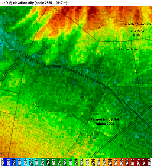
Below is the Elevation map of La Y, which displays elevation range with different colors. Scale of the first map is from 2555 to 2617 m (8383 to 8586 ft) with average elevation of 2584.1 meters (=8478 ft) [note 1]
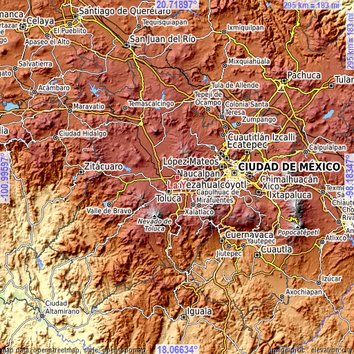
These maps also provides idea of topography and contour of this city, they are displayed at different zoom levels. More info about maps, scale and edge coordinates you can find below images.
| \ | Map #1 | Topo.Map |
| Scale [m] | 2555..2617 m | × |
| Scale [ft] | 8383..8586 ft | × |
| Average | 2584.1 m = 8478 ft | × |
| Width | 9.22 km = 5.7 mi | 294.9 km = 183.2 mi |
| Height | 9.22 km = 5.7 mi | 295 km = 183.3 mi |
| ↑Max Latitude | 19.439505° | 20.71897° |
| Latitude at center | 19.39806° | 19.39806° |
| ↓Min Latitude | 19.356604° | 18.06634° |
| ← Min Longitude | -99.633665° | -100.99597° |
| Longitude center | -99.58972° | -99.58972° |
| →Max Longitude | -99.545775° | -98.18347° |
Nearby cities:
Cities around La Y sort by population:
• Villa Cuauhtémoc elevation 2586 m
3.9 km,  57°
57°
• San Nicolás Tolentino 2583 m
4.7 km,  156°
156°
• San Lorenzo Oyamel 2605 m
4.1 km,  17°
17°
• Jicaltepec Cuexcontitlán 2592 m
4.8 km,  234°
234°
• San Diego los Padres Cuexcontitlán Sección 5 B 2588 m
3.4 km,  224°
224°
• San Diego Linares 2651 m
5.2 km,  255°
255°
• Fraccionamiento Rinconada del Valle 2577 m
2.2 km,  48°
48°
• Llano de la Y 2580 m
2.8 km,  280°
280°
• Ejido de Dolores 2591 m
4.4 km,  326°
326°
• San José Buenavista el Grande 2579 m
1.4 km,  37°
37°
• Barrio de la Barranca 2603 m
5.3 km, 38°
• San Antonio del Puente 2579 m
3.7 km,  307°
307°
Multilingual:
 En español:
La Y elevación 2576 m.
 En France:
La Y élévation 2576 m.


Sources and notes:
- [note 1] Map square and city borders are not equal. Map elevation data is calculated only from area inside that square.
- [src 1] Elevation data from geonames database provided with same terms of usage.
- [src 2] The elevation map of La Y is generated using elevation data from NASA's 3 arcsec (90m) resolution SRTM data.
- [src 3] Base (background) map © OpenStreetMap contributors tiles are generated by Geofabrik and OpenTopoMap.
Copyright & License:
This La Y Elevation Map is licensed under CC BY-SA. You may reuse any part from this page, if you give a proper credit by linking to this URL:
 More info on terms of use page.