San Lorenzo Oyamel elevation
San Lorenzo Oyamel (Morelos), Mexico elevation is 2605 meters and San Lorenzo Oyamel elevation in feet is 8547 ft above sea level [src 1]. San Lorenzo Oyamel is a populated place (feature code) with elevation that is 1291 meters (4236 ft) bigger than average city elevation in Mexico.
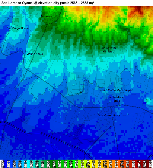
Below is the Elevation map of San Lorenzo Oyamel, which displays elevation range with different colors. Scale of the first map is from 2568 to 2838 m (8425 to 9311 ft) with average elevation of 2613.3 meters (=8574 ft) [note 1]
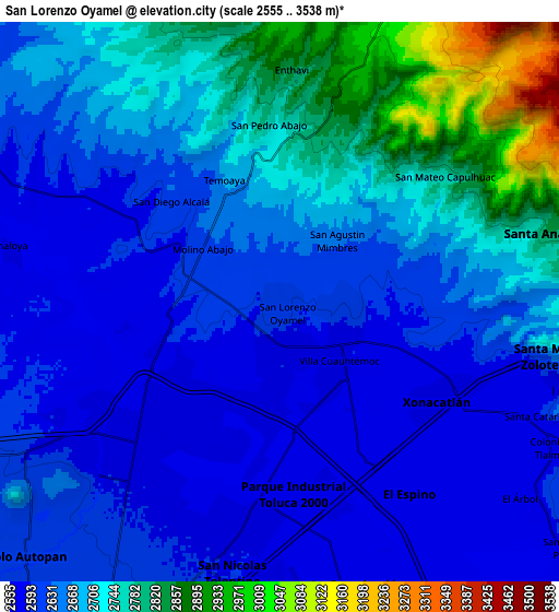
These maps also provides idea of topography and contour of this city, they are displayed at different zoom levels. More info about maps, scale and edge coordinates you can find below images.
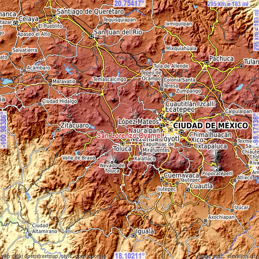
| \ | Map #1 | Map #2 | Topo.Map |
| Scale [m] | 2568..2838 m | 2555..3538 m | × |
| Scale [ft] | 8425..9311 ft | 8383..11608 ft | × |
| Average | 2613.3 m = 8574 ft | 2677.2 m = 8783 ft | × |
| Width | 9.22 km = 5.7 mi | 18.43 km = 11.5 mi | 294.9 km = 183.2 mi |
| Height | 9.22 km = 5.7 mi | 18.43 km = 11.5 mi | 294.9 km = 183.2 mi |
| ↑Max Latitude | 19.474986° | 19.516412° | 20.75417° |
| Latitude at center | 19.43355° | 19.43355° | 19.43355° |
| ↓Min Latitude | 19.392103° | 19.350646° | 18.10211° |
| ← Min Longitude | -99.621555° | -99.665501° | -100.98386° |
| Longitude center | -99.57761° | -99.57761° | -99.57761° |
| →Max Longitude | -99.533665° | -99.489719° | -98.17136° |
Nearby cities:
Cities around San Lorenzo Oyamel sort by population:
• Villa Cuauhtémoc elevation 2586 m
2.7 km,  133°
133°
• San Mateo Mozoquilpan 2607 m
2.4 km,  88°
88°
• Molino Abajo 2627 m
3.1 km,  304°
304°
• San Agustín Mimbres 2630 m
2.9 km,  49°
49°
• Temoaya 2671 m
4.1 km,  335°
335°
• Fraccionamiento Rinconada del Valle 2577 m
2.5 km,  171°
171°
• Ejido de Dolores 2591 m
3.7 km,  265°
265°
• San José Buenavista el Grande 2579 m
2.8 km,  188°
188°
• La Y 2576 m
4.1 km,  197°
197°
• Barrio de la Barranca 2603 m
2 km,  82°
82°
• La Magdalena Tenexpan 2681 m
3.5 km, 340°
• San Antonio del Puente 2579 m
4.5 km,  247°
247°
Multilingual:
 En español:
San Lorenzo Oyamel elevación 2605 m.
 En France:
San Lorenzo Oyamel élévation 2605 m.
 Auf Deutsch:
San Lorenzo Oyamel höhe über dem Meeresspiegel ist 2605 m.
 На русском:
San Lorenzo Oyamel высота над уровнем моря 2605 м
Sources and notes:
- [note 1] Map square and city borders are not equal. Map elevation data is calculated only from area inside that square.
- [src 1] Elevation data from geonames database provided with same terms of usage.
- [src 2] The elevation map of San Lorenzo Oyamel is generated using elevation data from NASA's 3 arcsec (90m) resolution SRTM data.
- [src 3] Base (background) map © OpenStreetMap contributors tiles are generated by Geofabrik and OpenTopoMap.
Copyright & License:
This San Lorenzo Oyamel Elevation Map is licensed under CC BY-SA. You may reuse any part from this page, if you give a proper credit by linking to this URL:
 More info on terms of use page.