Jicaltepec Cuexcontitlán elevation
Jicaltepec Cuexcontitlán (State of Mexico, Toluca), Mexico elevation is 2592 meters and Jicaltepec Cuexcontitlán elevation in feet is 8504 ft above sea level [src 1]. Jicaltepec Cuexcontitlán is a populated place (feature code) with elevation that is 1278 meters (4193 ft) bigger than average city elevation in Mexico.
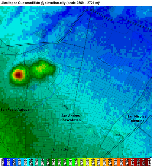
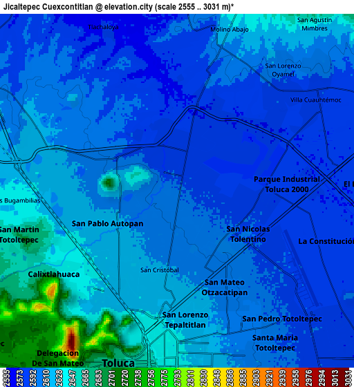
Below is the Elevation map of Jicaltepec Cuexcontitlán, which displays elevation range with different colors. Scale of the first map is from 2569 to 2721 m (8428 to 8927 ft) with average elevation of 2596 meters (=8517 ft) [note 1]
These maps also provides idea of topography and contour of this city, they are displayed at different zoom levels. More info about maps, scale and edge coordinates you can find below images.
| \ | Map #1 | Map #2 | Topo.Map |
| Scale [m] | 2569..2721 m | 2555..3031 m | × |
| Scale [ft] | 8428..8927 ft | 8383..9944 ft | × |
| Average | 2596 m = 8517 ft | 2609.1 m = 8560 ft | × |
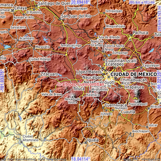
| Width | 9.22 km = 5.7 mi | 18.44 km = 11.5 mi | 295 km = 183.3 mi |
| Height | 9.22 km = 5.7 mi | 18.44 km = 11.5 mi | 295 km = 183.3 mi |
| ↑Max Latitude | 19.414512° | 19.455953° | 20.69418° |
| Latitude at center | 19.37306° | 19.37306° | 19.37306° |
| ↓Min Latitude | 19.331598° | 19.290125° | 18.04114° |
| ← Min Longitude | -99.671445° | -99.715391° | -101.03375° |
| Longitude center | -99.6275° | -99.6275° | -99.6275° |
| →Max Longitude | -99.583555° | -99.539609° | -98.22125° |
Nearby cities:
Cities around Jicaltepec Cuexcontitlán sort by population:
• San Pablo Autopan elevation 2613 m
3.6 km,  239°
239°
• San Andrés Cuexcontitlán 2593 m
1.7 km,  158°
158°
• Jicaltepec Autopan 2599 m
1.4 km,  263°
263°
• Barrio Santa Cruz 2618 m
4.4 km, 236°
• San Diego los Padres Cuexcontitlán Sección 5 B 2588 m
1.6 km,  78°
78°
• Fraccionamiento Real de San Pablo 2593 m
2.9 km,  309°
309°
• San Diego Linares 2651 m
1.8 km,  324°
324°
• Llano de la Y 2580 m
3.5 km,  19°
19°
• Galaxias Toluca 2592 m
3.6 km, 319°
• La Y 2576 m
4.8 km,  54°
54°
• Barrio del Cajón 2597 m
3.8 km,  302°
302°
• La Loma Cuexcontitlán 2651 m
2.4 km,  288°
288°
Multilingual:
 En español:
Jicaltepec Cuexcontitlán elevación 2592 m.
 En France:
Jicaltepec Cuexcontitlán élévation 2592 m.
 Auf Deutsch:
Jicaltepec Cuexcontitlán höhe über dem Meeresspiegel ist 2592 m.
 На русском:
Jicaltepec Cuexcontitlán высота над уровнем моря 2592 м
Sources and notes:
- [note 1] Map square and city borders are not equal. Map elevation data is calculated only from area inside that square.
- [src 1] Elevation data from geonames database provided with same terms of usage.
- [src 2] The elevation map of Jicaltepec Cuexcontitlán is generated using elevation data from NASA's 3 arcsec (90m) resolution SRTM data.
- [src 3] Base (background) map © OpenStreetMap contributors tiles are generated by Geofabrik and OpenTopoMap.
Copyright & License:
This Jicaltepec Cuexcontitlán Elevation Map is licensed under CC BY-SA. You may reuse any part from this page, if you give a proper credit by linking to this URL:
 More info on terms of use page.