La Providencia elevation
La Providencia (State of Mexico, Cuautitlán), Mexico elevation is 2250 meters and La Providencia elevation in feet is 7382 ft above sea level [src 1]. La Providencia is a populated place (feature code) with elevation that is 936 meters (3071 ft) bigger than average city elevation in Mexico.
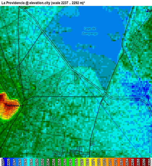
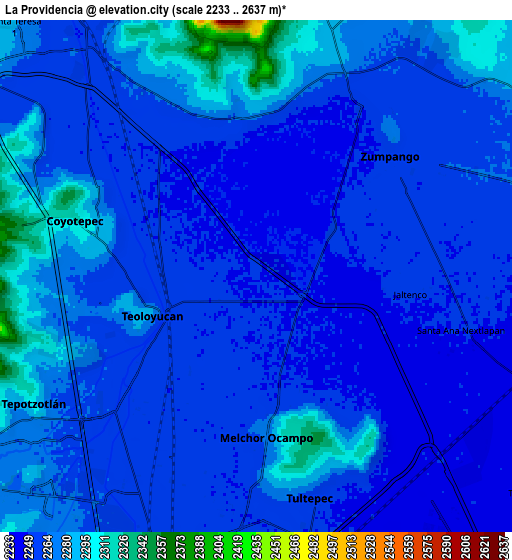
Below is the Elevation map of La Providencia, which displays elevation range with different colors. Scale of the first map is from 2237 to 2292 m (7339 to 7520 ft) with average elevation of 2249.5 meters (=7380 ft) [note 1]
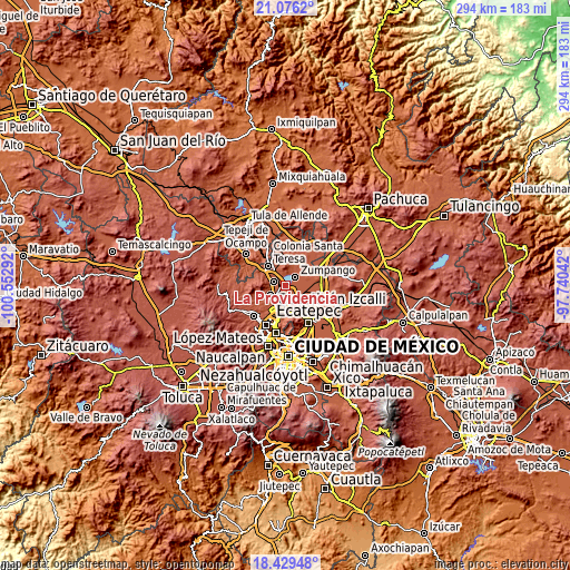
These maps also provides idea of topography and contour of this city, they are displayed at different zoom levels. More info about maps, scale and edge coordinates you can find below images.
| \ | Map #1 | Map #2 | Topo.Map |
| Scale [m] | 2237..2292 m | 2233..2637 m | × |
| Scale [ft] | 7339..7520 ft | 7326..8652 ft | × |
| Average | 2249.5 m = 7380 ft | 2264.1 m = 7428 ft | × |
| Width | 9.2 km = 5.7 mi | 18.39 km = 11.4 mi | 294.3 km = 182.9 mi |
| Height | 9.2 km = 5.7 mi | 18.39 km = 11.4 mi | 294.3 km = 182.9 mi |
| ↑Max Latitude | 19.799683° | 19.841025° | 21.0762° |
| Latitude at center | 19.75833° | 19.75833° | 19.75833° |
| ↓Min Latitude | 19.716967° | 19.675592° | 18.42948° |
| ← Min Longitude | -99.190615° | -99.234561° | -100.55292° |
| Longitude center | -99.14667° | -99.14667° | -99.14667° |
| →Max Longitude | -99.102725° | -99.058779° | -97.74042° |
Nearby cities:
Cities around La Providencia sort by population:
• Teoloyucan elevation 2268 m
3.9 km,  246°
246°
• Zumpango 2258 m
6.5 km,  49°
49°
• Melchor Ocampo 2262 m
6.3 km,  178°
178°
• San Juan Zitlaltepec 2284 m
6 km,  1°
1°
• Jaltenco 2253 m
5.6 km,  96°
96°
• San Bartolo 2252 m
3.3 km,  204°
204°
• San Francisco Tenopalco 2254 m
6 km,  147°
147°
• Santa María Huecatitla 2255 m
4.4 km,  212°
212°
• Barrio Tlatenco 2264 m
5.2 km, 245°
• La Planada 2251 m
4.6 km,  304°
304°
• San José del Puente 2261 m
6.7 km,  231°
231°
• El Llano Santa María 2254 m
6.9 km,  65°
65°
Multilingual:
 En español:
La Providencia elevación 2250 m.
 En France:
La Providencia élévation 2250 m.
 Auf Deutsch:
La Providencia höhe über dem Meeresspiegel ist 2250 m.

Sources and notes:
- [note 1] Map square and city borders are not equal. Map elevation data is calculated only from area inside that square.
- [src 1] Elevation data from geonames database provided with same terms of usage.
- [src 2] The elevation map of La Providencia is generated using elevation data from NASA's 3 arcsec (90m) resolution SRTM data.
- [src 3] Base (background) map © OpenStreetMap contributors tiles are generated by Geofabrik and OpenTopoMap.
Copyright & License:
This La Providencia Elevation Map is licensed under CC BY-SA. You may reuse any part from this page, if you give a proper credit by linking to this URL:
 More info on terms of use page.