Peña Flores (Palo Verde) elevation
Peña Flores (Palo Verde) (Morelos, Cuautla), Mexico elevation is 1352 meters and Peña Flores (Palo Verde) elevation in feet is 4436 ft above sea level [src 1]. Peña Flores (Palo Verde) is a populated place (feature code) with elevation that is 38 meters (125 ft) bigger than average city elevation in Mexico.
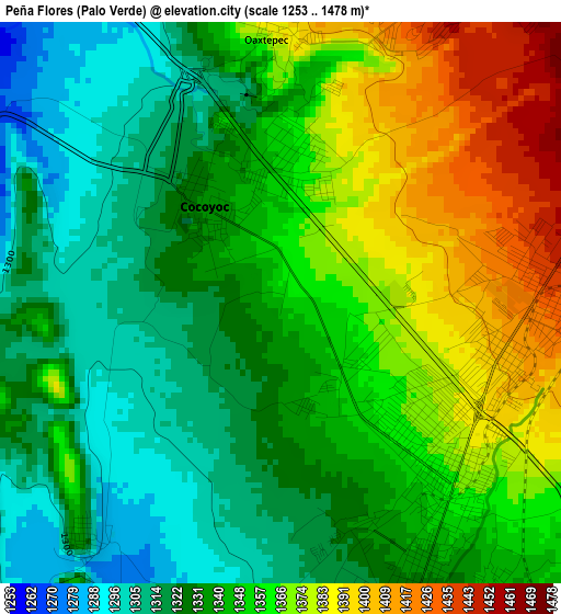
Below is the Elevation map of Peña Flores (Palo Verde), which displays elevation range with different colors. Scale of the first map is from 1253 to 1478 m (4111 to 4849 ft) with average elevation of 1346.2 meters (=4417 ft) [note 1]
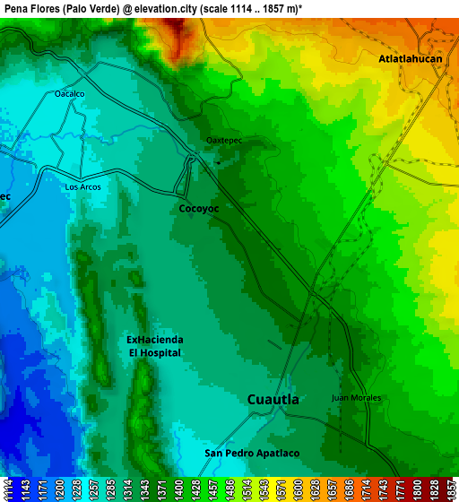
These maps also provides idea of topography and contour of this city, they are displayed at different zoom levels. More info about maps, scale and edge coordinates you can find below images.
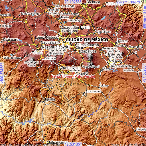
| \ | Map #1 | Map #2 | Topo.Map |
| Scale [m] | 1253..1478 m | 1114..1857 m | × |
| Scale [ft] | 4111..4849 ft | 3655..6093 ft | × |
| Average | 1346.2 m = 4417 ft | 1370.8 m = 4497 ft | × |
| Width | 9.25 km = 5.7 mi | 18.49 km = 11.5 mi | 295.9 km = 183.9 mi |
| Height | 9.25 km = 5.7 mi | 18.49 km = 11.5 mi | 295.9 km = 183.9 mi |
| ↑Max Latitude | 18.908799° | 18.950368° | 20.19253° |
| Latitude at center | 18.86722° | 18.86722° | 18.86722° |
| ↓Min Latitude | 18.825631° | 18.784031° | 17.53135° |
| ← Min Longitude | -99.012275° | -99.056221° | -100.37458° |
| Longitude center | -98.96833° | -98.96833° | -98.96833° |
| →Max Longitude | -98.924385° | -98.880439° | -97.56208° |
Nearby cities:
Cities around Peña Flores (Palo Verde) sort by population:
• Cuautla elevation 1333 m
7.2 km,  151°
151°
• Cocoyoc 1327 m
2.4 km,  322°
322°
• Oaxtepec 1461 m
5.8 km,  12°
12°
• Los Arcos 1256 m
6.3 km,  290°
290°
• Ex-Hacienda el Hospital 1280 m
5 km,  216°
216°
• Narciso Mendoza 1352 m
0.8 km,  349°
349°
• Puxtla 1275 m
6.5 km,  193°
193°
• Itzamatitlán 1252 m
7.4 km,  309°
309°
• Emiliano Zapata (Casahuates) 1518 m
7.1 km, 8°
• Yecapixteca 1501 m
7.1 km,  76°
76°
• Tierra Larga (Campo Nuevo) 1382 m
2.2 km,  98°
98°
• Colonia San Francisco 1523 m
7.5 km,  64°
64°
Multilingual:
 En español:
Peña Flores (Palo Verde) elevación 1352 m.
 En France:
Peña Flores (Palo Verde) élévation 1352 m.
 Auf Deutsch:
Peña Flores (Palo Verde) höhe über dem Meeresspiegel ist 1352 m.
 На русском:
Peña Flores (Palo Verde) высота над уровнем моря 1352 м
Sources and notes:
- [note 1] Map square and city borders are not equal. Map elevation data is calculated only from area inside that square.
- [src 1] Elevation data from geonames database provided with same terms of usage.
- [src 2] The elevation map of Peña Flores (Palo Verde) is generated using elevation data from NASA's 3 arcsec (90m) resolution SRTM data.
- [src 3] Base (background) map © OpenStreetMap contributors tiles are generated by Geofabrik and OpenTopoMap.
Copyright & License:
This Peña Flores (Palo Verde) Elevation Map is licensed under CC BY-SA. You may reuse any part from this page, if you give a proper credit by linking to this URL:
 More info on terms of use page.