Cuautla elevation
Cuautla (Morelos), Mexico elevation is 1333 meters and Cuautla elevation in feet is 4373 ft above sea level [src 1]. Cuautla is a seat of a second-order administrative division (feature code) with elevation that is 19 meters (62 ft) bigger than average city elevation in Mexico.
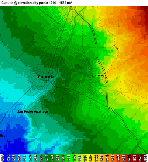
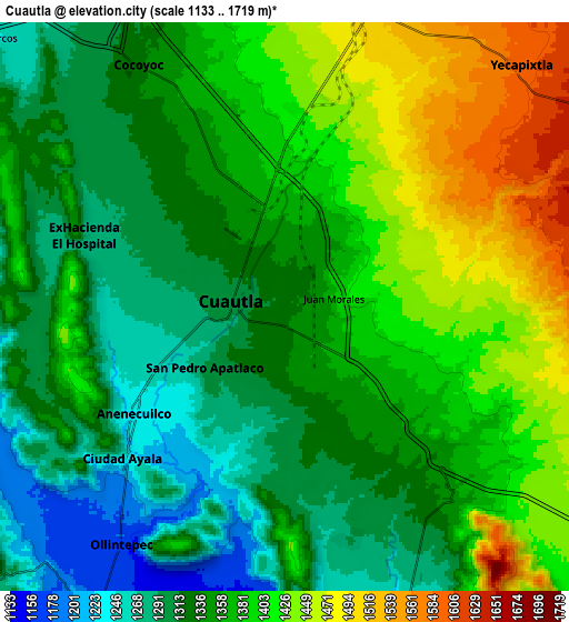
Below is the Elevation map of Cuautla, which displays elevation range with different colors. Scale of the first map is from 1214 to 1532 m (3983 to 5026 ft) with average elevation of 1341.8 meters (=4402 ft) [note 1]
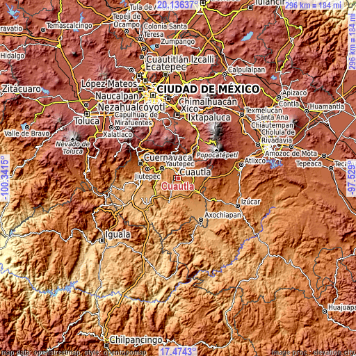
These maps also provides idea of topography and contour of this city, they are displayed at different zoom levels. More info about maps, scale and edge coordinates you can find below images.
| \ | Map #1 | Map #2 | Topo.Map |
| Scale [m] | 1214..1532 m | 1133..1719 m | × |
| Scale [ft] | 3983..5026 ft | 3717..5640 ft | × |
| Average | 1341.8 m = 4402 ft | 1364.5 m = 4477 ft | × |
| Width | 9.25 km = 5.7 mi | 18.5 km = 11.5 mi | 296 km = 183.9 mi |
| Height | 9.25 km = 5.7 mi | 18.5 km = 11.5 mi | 296 km = 183.9 mi |
| ↑Max Latitude | 18.852193° | 18.893776° | 20.13637° |
| Latitude at center | 18.8106° | 18.8106° | 18.8106° |
| ↓Min Latitude | 18.768997° | 18.727383° | 17.4743° |
| ← Min Longitude | -98.979195° | -99.023141° | -100.3415° |
| Longitude center | -98.93525° | -98.93525° | -98.93525° |
| →Max Longitude | -98.891305° | -98.847359° | -97.529° |
Nearby cities:
Cities around Cuautla sort by population:
• Juan Morales elevation 1367 m
1.4 km,  86°
86°
• San Pedro Apatlaco 1291 m
3.2 km,  232°
232°
• Anenecuilco 1267 m
6.8 km,  236°
236°
• Ciudad Ayala 1231 m
6.9 km, 225°
• Peña Flores (Palo Verde) 1352 m
7.2 km,  331°
331°
• Ex-Hacienda el Hospital 1280 m
6.9 km,  289°
289°
• Constancio Farfán (La Pascuala) 1213 m
7.9 km,  194°
194°
• Unidad Habitacional 10 de Abril 1293 m
6.6 km,  162°
162°
• Puxtla 1275 m
5 km,  269°
269°
• Colonia las Arboledas 1308 m
2.9 km, 189°
• Mixtlalcingo 1413 m
3.8 km,  102°
102°
• Tierra Larga (Campo Nuevo) 1382 m
6.1 km,  347°
347°
Multilingual:
 En español:
Cuautla elevación 1333 m.
 En France:
Cuautla élévation 1333 m.
 Auf Deutsch:
Cuautla höhe über dem Meeresspiegel ist 1333 m.

Sources and notes:
- [note 1] Map square and city borders are not equal. Map elevation data is calculated only from area inside that square.
- [src 1] Elevation data from geonames database provided with same terms of usage.
- [src 2] The elevation map of Cuautla is generated using elevation data from NASA's 3 arcsec (90m) resolution SRTM data.
- [src 3] Base (background) map © OpenStreetMap contributors tiles are generated by Geofabrik and OpenTopoMap.
Copyright & License:
This Cuautla Elevation Map is licensed under CC BY-SA. You may reuse any part from this page, if you give a proper credit by linking to this URL:
 More info on terms of use page.