Alianza Real elevation
Alianza Real (Nuevo León, El Carmen), Mexico elevation is 545 meters and Alianza Real elevation in feet is 1788 ft above sea level [src 1]. Alianza Real is a populated place (feature code) with elevation that is 769 meters (2523 ft) smaller than average city elevation in Mexico.
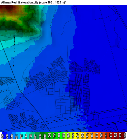
Below is the Elevation map of Alianza Real, which displays elevation range with different colors. Scale of the first map is from 486 to 1825 m (1594 to 5988 ft) with average elevation of 592.6 meters (=1944 ft) [note 1]
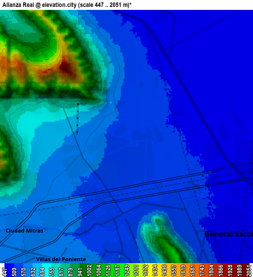
These maps also provides idea of topography and contour of this city, they are displayed at different zoom levels. More info about maps, scale and edge coordinates you can find below images.
| \ | Map #1 | Map #2 | Topo.Map |
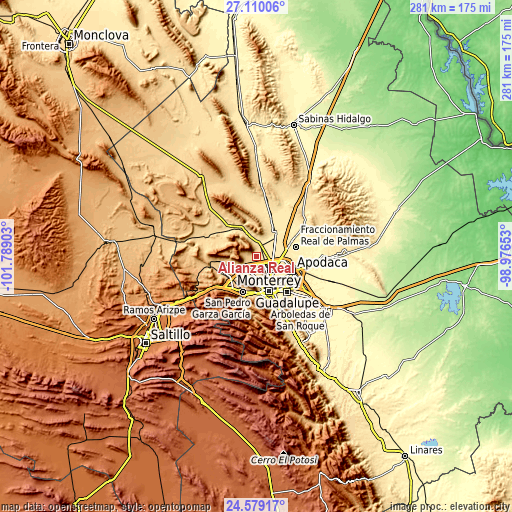
| Scale [m] | 486..1825 m | 447..2051 m | × |
| Scale [ft] | 1594..5988 ft | 1467..6729 ft | × |
| Average | 592.6 m = 1944 ft | 645 m = 2116 ft | × |
| Width | 8.79 km = 5.5 mi | 17.59 km = 10.9 mi | 281.4 km = 174.9 mi |
| Height | 8.79 km = 5.5 mi | 17.59 km = 10.9 mi | 281.4 km = 174.9 mi |
| ↑Max Latitude | 25.890931° | 25.930459° | 27.11006° |
| Latitude at center | 25.85139° | 25.85139° | 25.85139° |
| ↓Min Latitude | 25.811836° | 25.772268° | 24.57917° |
| ← Min Longitude | -100.426725° | -100.470671° | -101.78903° |
| Longitude center | -100.38278° | -100.38278° | -100.38278° |
| →Max Longitude | -100.338835° | -100.294889° | -98.97653° |
Nearby cities:
Cities around Alianza Real sort by population:
• Ciudad General Escobedo elevation 499 m
8.9 km,  132°
132°
• Parque Industrial Ciudad Mitras 593 m
9.5 km,  222°
222°
• Mitras Poniente 592 m
9.4 km,  207°
207°
• Carmen 505 m
9.6 km,  11°
11°
• Simeprodeso (Colectivo Nuevo) 476 m
9.1 km,  88°
88°
• Abasolo 511 m
10.6 km,  352°
352°
• Buena Vista 516 m
2.3 km, 87°
• Los Parques 619 m
11 km,  232°
232°
• Monclova Primer Sector 557 m
4.6 km, 206°
• Praderas de San Francisco 555 m
4.2 km, 208°
• Monclova Segundo Sector 554 m
4.3 km,  199°
199°
• Unión Agropecuarios Lázaro Cárdenas del Norte 541 m
2.1 km,  183°
183°
Multilingual:
 En español:
Alianza Real elevación 545 m.
 En France:
Alianza Real élévation 545 m.
 Auf Deutsch:
Alianza Real höhe über dem Meeresspiegel ist 545 m.

Sources and notes:
- [note 1] Map square and city borders are not equal. Map elevation data is calculated only from area inside that square.
- [src 1] Elevation data from geonames database provided with same terms of usage.
- [src 2] The elevation map of Alianza Real is generated using elevation data from NASA's 3 arcsec (90m) resolution SRTM data.
- [src 3] Base (background) map © OpenStreetMap contributors tiles are generated by Geofabrik and OpenTopoMap.
Copyright & License:
This Alianza Real Elevation Map is licensed under CC BY-SA. You may reuse any part from this page, if you give a proper credit by linking to this URL:
 More info on terms of use page.