Carmen elevation
Carmen (Nuevo León, El Carmen), Mexico elevation is 505 meters and Carmen elevation in feet is 1657 ft above sea level [src 1]. Carmen is a seat of a second-order administrative division (feature code) with elevation that is 809 meters (2654 ft) smaller than average city elevation in Mexico.
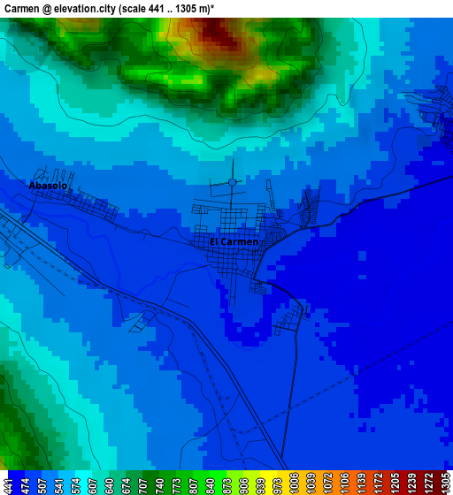
Below is the Elevation map of Carmen, which displays elevation range with different colors. Scale of the first map is from 441 to 1305 m (1447 to 4281 ft) with average elevation of 555.8 meters (=1823 ft) [note 1]
These maps also provides idea of topography and contour of this city, they are displayed at different zoom levels. More info about maps, scale and edge coordinates you can find below images.
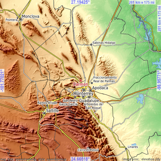
| \ | Map #1 | Map #2 | Topo.Map |
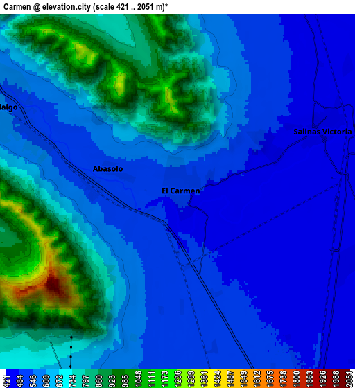
| Scale [m] | 441..1305 m | 421..2051 m | × |
| Scale [ft] | 1447..4281 ft | 1381..6729 ft | × |
| Average | 555.8 m = 1823 ft | 637.9 m = 2093 ft | × |
| Width | 8.79 km = 5.5 mi | 17.58 km = 10.9 mi | 281.2 km = 174.7 mi |
| Height | 8.79 km = 5.5 mi | 17.58 km = 10.9 mi | 281.2 km = 174.7 mi |
| ↑Max Latitude | 25.976012° | 26.015512° | 27.19425° |
| Latitude at center | 25.9365° | 25.9365° | 25.9365° |
| ↓Min Latitude | 25.896974° | 25.857435° | 24.66518° |
| ← Min Longitude | -100.407905° | -100.451851° | -101.77021° |
| Longitude center | -100.36396° | -100.36396° | -100.36396° |
| →Max Longitude | -100.320015° | -100.276069° | -98.95771° |
Nearby cities:
Cities around Carmen sort by population:
• Hidalgo elevation 550 m
9.5 km,  294°
294°
• Salinas Victoria 433 m
7.9 km,  67°
67°
• Emiliano Zapata 454 m
8.8 km,  109°
109°
• Las Torres 453 m
4.9 km, 69°
• Alianza Real 545 m
9.6 km,  191°
191°
• Ciudad Satélite del Norte 444 m
10.2 km,  103°
103°
• Simeprodeso (Colectivo Nuevo) 476 m
11.8 km,  142°
142°
• Abasolo 511 m
3.4 km, 288°
• Buena Vista 516 m
9.4 km,  177°
177°
• Praderas de San Francisco 555 m
13.7 km,  196°
196°
• Monclova Segundo Sector 554 m
13.9 km, 193°
• Unión Agropecuarios Lázaro Cárdenas del Norte 541 m
11.8 km, 189°
Multilingual:
 En español:
Carmen, El Carmen elevación 505 m.
 En France:
Carmen élévation 505 m.


Sources and notes:
- [note 1] Map square and city borders are not equal. Map elevation data is calculated only from area inside that square.
- [src 1] Elevation data from geonames database provided with same terms of usage.
- [src 2] The elevation map of Carmen is generated using elevation data from NASA's 3 arcsec (90m) resolution SRTM data.
- [src 3] Base (background) map © OpenStreetMap contributors tiles are generated by Geofabrik and OpenTopoMap.
Copyright & License:
This Carmen Elevation Map is licensed under CC BY-SA. You may reuse any part from this page, if you give a proper credit by linking to this URL:
 More info on terms of use page.