Las Torres elevation
Las Torres (Nuevo León, Salinas Victoria), Mexico elevation is 453 meters and Las Torres elevation in feet is 1486 ft above sea level [src 1]. Las Torres is a populated place (feature code) with elevation that is 861 meters (2825 ft) smaller than average city elevation in Mexico.
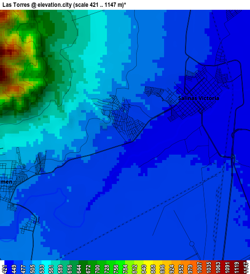
Below is the Elevation map of Las Torres, which displays elevation range with different colors. Scale of the first map is from 421 to 1147 m (1381 to 3763 ft) with average elevation of 503.8 meters (=1653 ft) [note 1]
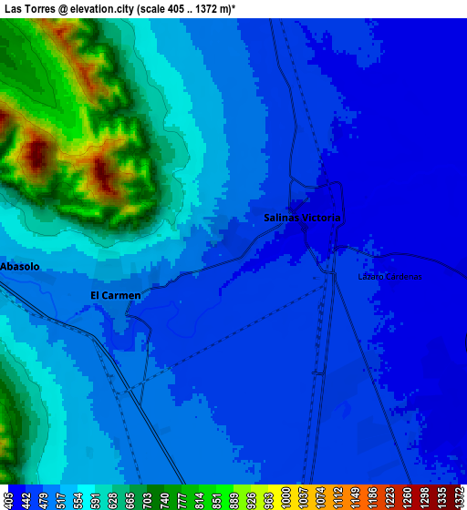
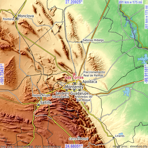
These maps also provides idea of topography and contour of this city, they are displayed at different zoom levels. More info about maps, scale and edge coordinates you can find below images.
| \ | Map #1 | Map #2 | Topo.Map |
| Scale [m] | 421..1147 m | 405..1372 m | × |
| Scale [ft] | 1381..3763 ft | 1329..4501 ft | × |
| Average | 503.8 m = 1653 ft | 535.8 m = 1758 ft | × |
| Width | 8.79 km = 5.5 mi | 17.57 km = 10.9 mi | 281.2 km = 174.7 mi |
| Height | 8.79 km = 5.5 mi | 17.57 km = 10.9 mi | 281.2 km = 174.7 mi |
| ↑Max Latitude | 25.991177° | 26.030671° | 27.20925° |
| Latitude at center | 25.95167° | 25.95167° | 25.95167° |
| ↓Min Latitude | 25.912149° | 25.872615° | 24.68051° |
| ← Min Longitude | -100.362005° | -100.405951° | -101.72431° |
| Longitude center | -100.31806° | -100.31806° | -100.31806° |
| →Max Longitude | -100.274115° | -100.230169° | -98.91181° |
Nearby cities:
Cities around Las Torres sort by population:
• Hidalgo elevation 550 m
13.4 km,  279°
279°
• Carmen 505 m
4.9 km,  249°
249°
• Salinas Victoria 433 m
3 km,  64°
64°
• Emiliano Zapata 454 m
5.9 km,  140°
140°
• Real del Sol 409 m
13.8 km,  96°
96°
• Villas de Alcalá 403 m
13.9 km,  106°
106°
• Alianza Real 545 m
12.9 km,  210°
210°
• Ciudad Satélite del Norte 444 m
6.7 km,  128°
128°
• Simeprodeso (Colectivo Nuevo) 476 m
11.3 km,  166°
166°
• Entronque Laredo-Salinas Victoria 451 m
12.9 km,  146°
146°
• Abasolo 511 m
7.8 km,  265°
265°
• Buena Vista 516 m
11.8 km,  200°
200°
Multilingual:
 En español:
Las Torres elevación 453 m.
 En France:
Las Torres élévation 453 m.
 Auf Deutsch:
Las Torres höhe über dem Meeresspiegel ist 453 m.

Sources and notes:
- [note 1] Map square and city borders are not equal. Map elevation data is calculated only from area inside that square.
- [src 1] Elevation data from geonames database provided with same terms of usage.
- [src 2] The elevation map of Las Torres is generated using elevation data from NASA's 3 arcsec (90m) resolution SRTM data.
- [src 3] Base (background) map © OpenStreetMap contributors tiles are generated by Geofabrik and OpenTopoMap.
Copyright & License:
This Las Torres Elevation Map is licensed under CC BY-SA. You may reuse any part from this page, if you give a proper credit by linking to this URL:
 More info on terms of use page.