Lo de Juárez elevation
Lo de Juárez (Guanajuato, Irapuato), Mexico elevation is 1768 meters and Lo de Juárez elevation in feet is 5801 ft above sea level [src 1]. Lo de Juárez is a populated place (feature code) with elevation that is 454 meters (1490 ft) bigger than average city elevation in Mexico.
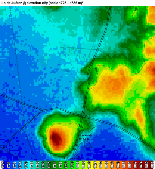
Below is the Elevation map of Lo de Juárez, which displays elevation range with different colors. Scale of the first map is from 1725 to 1886 m (5659 to 6188 ft) with average elevation of 1766.8 meters (=5797 ft) [note 1]
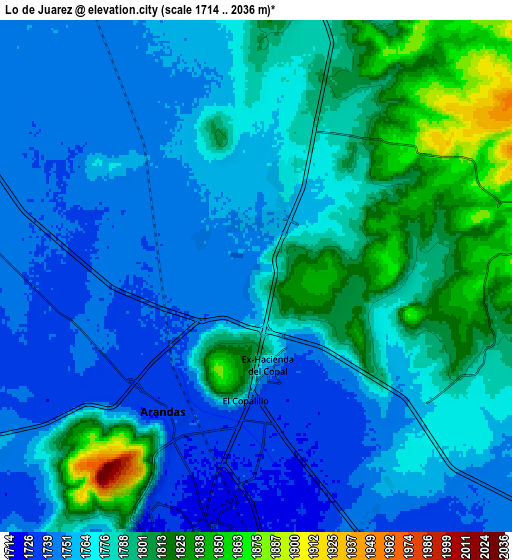
These maps also provides idea of topography and contour of this city, they are displayed at different zoom levels. More info about maps, scale and edge coordinates you can find below images.
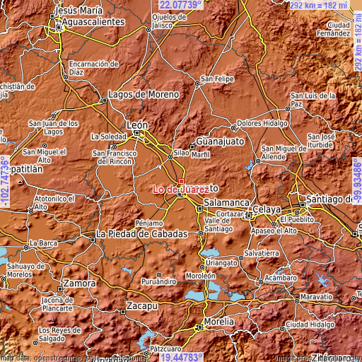
| \ | Map #1 | Map #2 | Topo.Map |
| Scale [m] | 1725..1886 m | 1714..2036 m | × |
| Scale [ft] | 5659..6188 ft | 5623..6680 ft | × |
| Average | 1766.8 m = 5797 ft | 1774.6 m = 5822 ft | × |
| Width | 9.14 km = 5.7 mi | 18.28 km = 11.4 mi | 292.4 km = 181.7 mi |
| Height | 9.14 km = 5.7 mi | 18.28 km = 11.4 mi | 292.4 km = 181.7 mi |
| ↑Max Latitude | 20.809414° | 20.850487° | 22.07739° |
| Latitude at center | 20.76833° | 20.76833° | 20.76833° |
| ↓Min Latitude | 20.727235° | 20.686128° | 19.44783° |
| ← Min Longitude | -101.385055° | -101.429001° | -102.74736° |
| Longitude center | -101.34111° | -101.34111° | -101.34111° |
| →Max Longitude | -101.297165° | -101.253219° | -99.93486° |
Nearby cities:
Cities around Lo de Juárez sort by population:
• Arandas elevation 1736 m
5.9 km,  214°
214°
• La Calera 1769 m
3.8 km,  14°
14°
• Aldama 1779 m
6 km,  27°
27°
• Valencianita 1801 m
4.7 km,  120°
120°
• Hacienda de Márquez 1748 m
2.4 km,  304°
304°
• Purísima del Progreso 1762 m
3 km,  22°
22°
• El Copalillo 1745 m
4.6 km,  185°
185°
• San Vicente 1783 m
6.7 km,  359°
359°
• Ex-Hacienda del Copal 1756 m
3.1 km,  168°
168°
• Serrano 1743 m
5.8 km,  281°
281°
• Taretán 1766 m
1.3 km, 27°
• Guadalupe de Paso Blanco 1739 m
6.6 km,  257°
257°
Multilingual:
 En español:
Lo de Juárez elevación 1768 m.
 En France:
Lo de Juárez élévation 1768 m.
 Auf Deutsch:
Lo de Juárez höhe über dem Meeresspiegel ist 1768 m.

Sources and notes:
- [note 1] Map square and city borders are not equal. Map elevation data is calculated only from area inside that square.
- [src 1] Elevation data from geonames database provided with same terms of usage.
- [src 2] The elevation map of Lo de Juárez is generated using elevation data from NASA's 3 arcsec (90m) resolution SRTM data.
- [src 3] Base (background) map © OpenStreetMap contributors tiles are generated by Geofabrik and OpenTopoMap.
Copyright & License:
This Lo de Juárez Elevation Map is licensed under CC BY-SA. You may reuse any part from this page, if you give a proper credit by linking to this URL:
 More info on terms of use page.