Vida Mejor I elevation
Vida Mejor I (Chiapas, Tapachula), Mexico elevation is 89 meters and Vida Mejor I elevation in feet is 292 ft above sea level [src 1]. Vida Mejor I is a populated place (feature code) with elevation that is 1225 meters (4019 ft) smaller than average city elevation in Mexico.
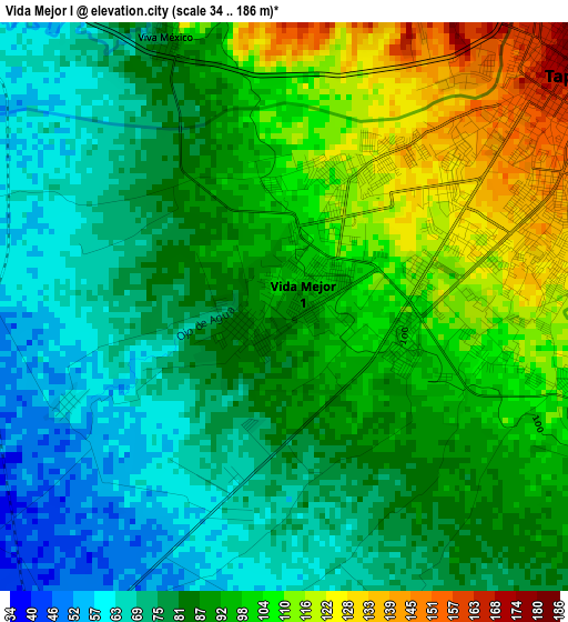
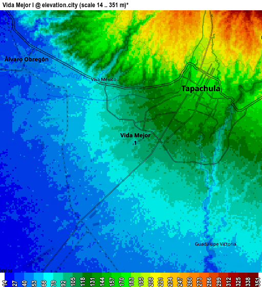
Below is the Elevation map of Vida Mejor I, which displays elevation range with different colors. Scale of the first map is from 34 to 186 m (112 to 610 ft) with average elevation of 88.9 meters (=292 ft) [note 1]
These maps also provides idea of topography and contour of this city, they are displayed at different zoom levels. More info about maps, scale and edge coordinates you can find below images.
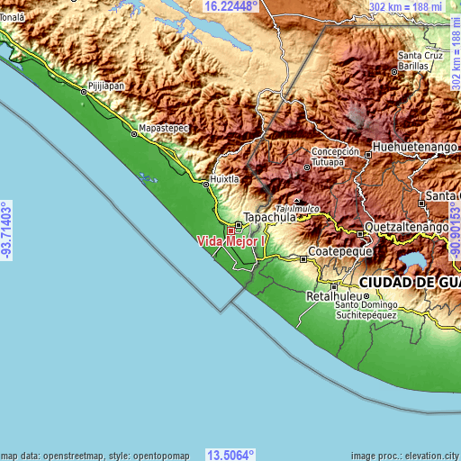
| \ | Map #1 | Map #2 | Topo.Map |
| Scale [m] | 34..186 m | 14..351 m | × |
| Scale [ft] | 112..610 ft | 46..1152 ft | × |
| Average | 88.9 m = 292 ft | 95 m = 312 ft | × |
| Width | 9.45 km = 5.9 mi | 18.89 km = 11.7 mi | 302.2 km = 187.8 mi |
| Height | 9.45 km = 5.9 mi | 18.89 km = 11.7 mi | 302.2 km = 187.8 mi |
| ↑Max Latitude | 14.912189° | 14.954651° | 16.22448° |
| Latitude at center | 14.86972° | 14.86972° | 14.86972° |
| ↓Min Latitude | 14.827242° | 14.784756° | 13.5064° |
| ← Min Longitude | -92.351725° | -92.395671° | -93.71403° |
| Longitude center | -92.30778° | -92.30778° | -92.30778° |
| →Max Longitude | -92.263835° | -92.219889° | -90.90153° |
Nearby cities:
Cities around Vida Mejor I sort by population:
• Tapachula elevation 170 m
6.6 km,  54°
54°
• Los Cafetales 94 m
0.7 km,  112°
112°
• Raymundo Enríquez 85 m
0.8 km,  249°
249°
• Viva México 88 m
4.9 km,  336°
336°
• Llano de la Lima 99 m
1.2 km, 110°
• El Sacrificio 144 m
8.6 km,  87°
87°
• Nuevo Pumpuapa (Cereso) 45 m
8.8 km,  315°
315°
• Cebadilla 1ra. Sección 114 m
3.1 km,  102°
102°
• Guadalupe Victoria 68 m
9.5 km,  140°
140°
• Los Palacios 89 m
5.5 km, 104°
• Omoa 86 m
9 km,  116°
116°
• Octavio Paz 104 m
4.9 km, 105°
Multilingual:
 En español:
Vida Mejor I elevación 89 m.
 En France:
Vida Mejor I élévation 89 m.
 Auf Deutsch:
Vida Mejor I höhe über dem Meeresspiegel ist 89 m.

Sources and notes:
- [note 1] Map square and city borders are not equal. Map elevation data is calculated only from area inside that square.
- [src 1] Elevation data from geonames database provided with same terms of usage.
- [src 2] The elevation map of Vida Mejor I is generated using elevation data from NASA's 3 arcsec (90m) resolution SRTM data.
- [src 3] Base (background) map © OpenStreetMap contributors tiles are generated by Geofabrik and OpenTopoMap.
Copyright & License:
This Vida Mejor I Elevation Map is licensed under CC BY-SA. You may reuse any part from this page, if you give a proper credit by linking to this URL:
 More info on terms of use page.