Manuel Ojinaga elevation
Manuel Ojinaga (Chihuahua, Ojinaga), Mexico elevation is 799 meters and Manuel Ojinaga elevation in feet is 2621 ft above sea level [src 1]. Manuel Ojinaga is a populated place (feature code) with elevation that is 515 meters (1690 ft) smaller than average city elevation in Mexico.
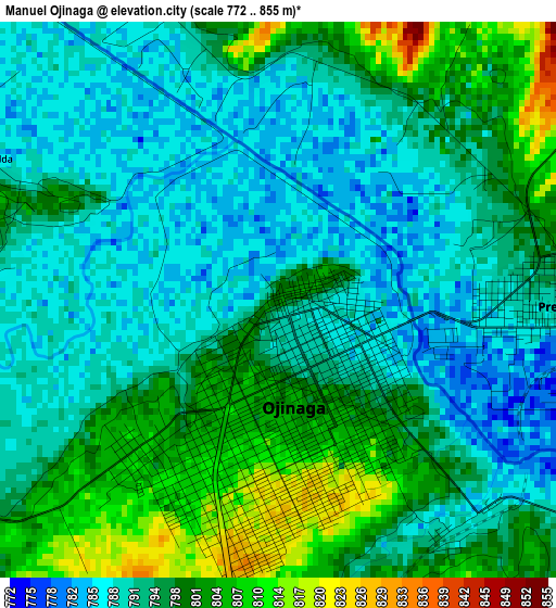
Below is the Elevation map of Manuel Ojinaga, which displays elevation range with different colors. Scale of the first map is from 772 to 855 m (2533 to 2805 ft) with average elevation of 794.9 meters (=2608 ft) [note 1]
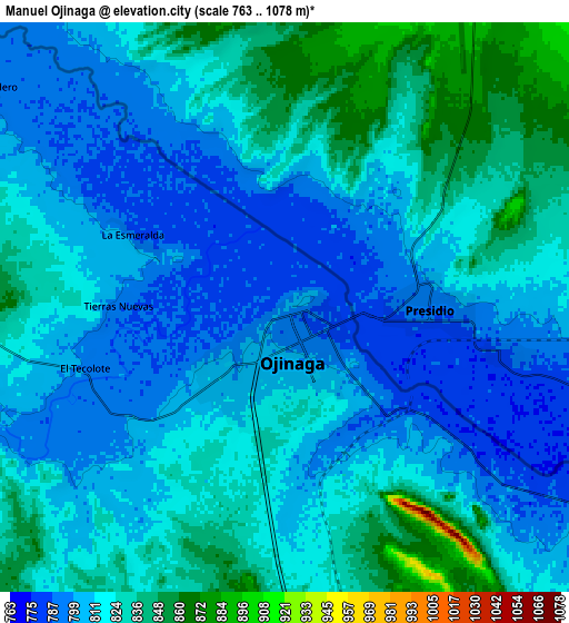
These maps also provides idea of topography and contour of this city, they are displayed at different zoom levels. More info about maps, scale and edge coordinates you can find below images.
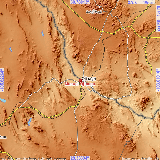
| \ | Map #1 | Map #2 | Topo.Map |
| Scale [m] | 772..855 m | 763..1078 m | × |
| Scale [ft] | 2533..2805 ft | 2503..3537 ft | × |
| Average | 794.9 m = 2608 ft | 815.9 m = 2677 ft | × |
| Width | 8.5 km = 5.3 mi | 17 km = 10.6 mi | 272 km = 169 mi |
| Height | 8.5 km = 5.3 mi | 17 km = 10.6 mi | 272 km = 169 mi |
| ↑Max Latitude | 29.602656° | 29.640858° | 30.78013° |
| Latitude at center | 29.56444° | 29.56444° | 29.56444° |
| ↓Min Latitude | 29.526209° | 29.487964° | 28.33394° |
| ← Min Longitude | -104.460335° | -104.504281° | -105.82264° |
| Longitude center | -104.41639° | -104.41639° | -104.41639° |
| →Max Longitude | -104.372445° | -104.328499° | -103.01014° |
Nearby cities:
Cities around Manuel Ojinaga sort by population:
• Jiménez elevation 1125 m
167 km,  214°
214°
• Meoqui 1147 m
177.1 km,  215°
215°
• Ojinaga 805 m
12.4 km,  271°
271°
• Aldama 1269 m
166.4 km,  240°
240°
• Lázaro Cárdenas 1202 m
175.6 km, 221°
• Ampliación Colonia Lázaro Cárdenas 1195 m
175.7 km, 221°
• Colonia Revolución 1182 m
177.8 km, 214°
• Julimes 1120 m
160.5 km, 217°
• Colonia Felipe Ángeles 1156 m
168.9 km, 219°
• Guadalupe Victoria 1124 m
168.6 km, 215°
• Coyame 1258 m
66.6 km,  260°
260°
• San Carlos 1067 m
70.9 km,  135°
135°
Multilingual:
 En español:
Manuel Ojinaga elevación 799 m.
 En France:
Manuel Ojinaga élévation 799 m.
 Auf Deutsch:
Manuel Ojinaga höhe über dem Meeresspiegel ist 799 m.

Sources and notes:
- [note 1] Map square and city borders are not equal. Map elevation data is calculated only from area inside that square.
- [src 1] Elevation data from geonames database provided with same terms of usage.
- [src 2] The elevation map of Manuel Ojinaga is generated using elevation data from NASA's 3 arcsec (90m) resolution SRTM data.
- [src 3] Base (background) map © OpenStreetMap contributors tiles are generated by Geofabrik and OpenTopoMap.
Copyright & License:
This Manuel Ojinaga Elevation Map is licensed under CC BY-SA. You may reuse any part from this page, if you give a proper credit by linking to this URL:
 More info on terms of use page.