Jiménez elevation
Jiménez (Chihuahua, Meoqui), Mexico elevation is 1125 meters and Jiménez elevation in feet is 3691 ft above sea level [src 1]. Jiménez is a populated place (feature code) with elevation that is 189 meters (620 ft) smaller than average city elevation in Mexico.
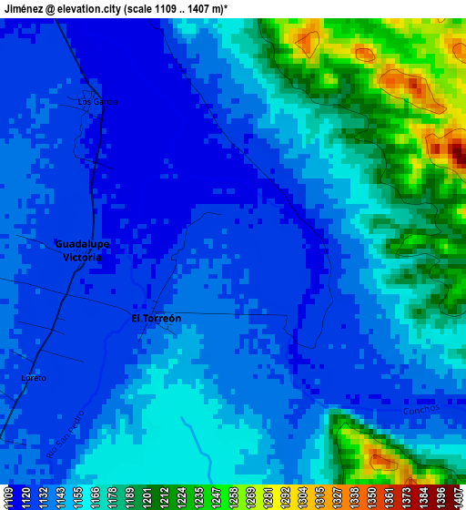
Below is the Elevation map of Jiménez, which displays elevation range with different colors. Scale of the first map is from 1109 to 1407 m (3638 to 4616 ft) with average elevation of 1154.8 meters (=3789 ft) [note 1]
These maps also provides idea of topography and contour of this city, they are displayed at different zoom levels. More info about maps, scale and edge coordinates you can find below images.
| \ | Map #1 | Map #2 | Topo.Map |
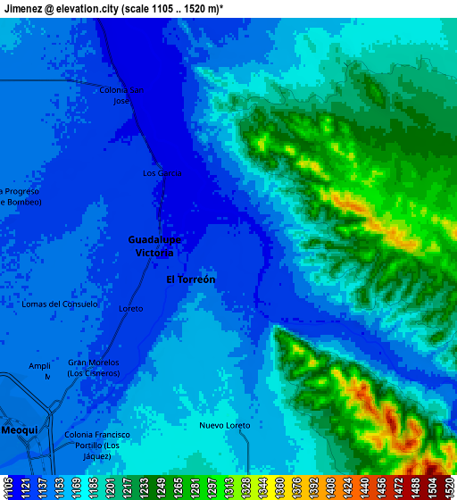
| Scale [m] | 1109..1407 m | 1105..1520 m | × |
| Scale [ft] | 3638..4616 ft | 3625..4987 ft | × |
| Average | 1154.8 m = 3789 ft | 1176.3 m = 3859 ft | × |
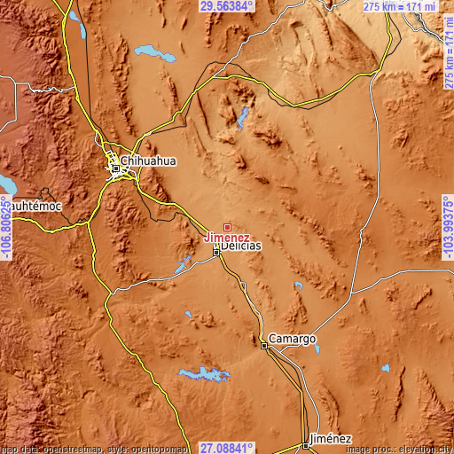
| Width | 8.6 km = 5.3 mi | 17.2 km = 10.7 mi | 275.2 km = 171 mi |
| Height | 8.6 km = 5.3 mi | 17.2 km = 10.7 mi | 275.3 km = 171.1 mi |
| ↑Max Latitude | 28.372004° | 28.410663° | 29.56384° |
| Latitude at center | 28.33333° | 28.33333° | 28.33333° |
| ↓Min Latitude | 28.294642° | 28.25594° | 27.08841° |
| ← Min Longitude | -105.443945° | -105.487891° | -106.80625° |
| Longitude center | -105.4° | -105.4° | -105.4° |
| →Max Longitude | -105.356055° | -105.312109° | -103.99375° |
Nearby cities:
Cities around Jiménez sort by population:
• Ciudad Delicias elevation 1172 m
17.3 km,  203°
203°
• Meoqui 1147 m
10.4 km,  229°
229°
• Colonia Revolución 1182 m
11 km, 202°
• Miguel Hidalgo 1215 m
20 km,  178°
178°
• Congregación Ortíz 1150 m
14.6 km, 232°
• Estación Consuelo 1191 m
19.1 km,  269°
269°
• Julimes 1120 m
10.4 km,  345°
345°
• Orranteño 1171 m
17.8 km,  159°
159°
• Colonia Terrazas 1158 m
12.4 km,  211°
211°
• Colonia Abraham González (La Quemada) 1210 m
14.1 km, 182°
• Colonia Felipe Ángeles 1156 m
12.4 km,  297°
297°
• Guadalupe Victoria 1124 m
2.7 km, 269°
Multilingual:
 En español:
Jiménez elevación 1125 m.
 En France:
Jiménez élévation 1125 m.
 Auf Deutsch:
Jiménez höhe über dem Meeresspiegel ist 1125 m.

Sources and notes:
- [note 1] Map square and city borders are not equal. Map elevation data is calculated only from area inside that square.
- [src 1] Elevation data from geonames database provided with same terms of usage.
- [src 2] The elevation map of Jiménez is generated using elevation data from NASA's 3 arcsec (90m) resolution SRTM data.
- [src 3] Base (background) map © OpenStreetMap contributors tiles are generated by Geofabrik and OpenTopoMap.
Copyright & License:
This Jiménez Elevation Map is licensed under CC BY-SA. You may reuse any part from this page, if you give a proper credit by linking to this URL:
 More info on terms of use page.