Aldama elevation
Aldama (Chihuahua), Mexico elevation is 1269 meters and Aldama elevation in feet is 4163 ft above sea level [src 1]. Aldama is a seat of a second-order administrative division (feature code) with elevation that is 45 meters (148 ft) smaller than average city elevation in Mexico.
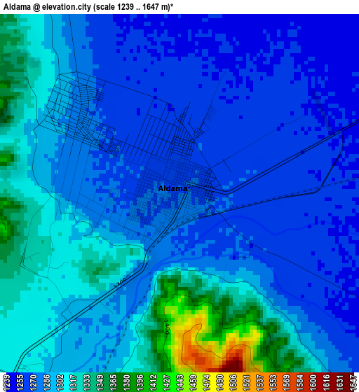
Below is the Elevation map of Aldama, which displays elevation range with different colors. Scale of the first map is from 1239 to 1647 m (4065 to 5404 ft) with average elevation of 1291.8 meters (=4238 ft) [note 1]
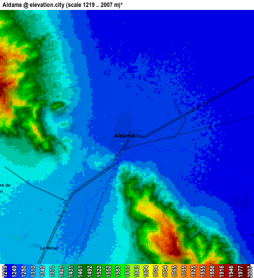
These maps also provides idea of topography and contour of this city, they are displayed at different zoom levels. More info about maps, scale and edge coordinates you can find below images.
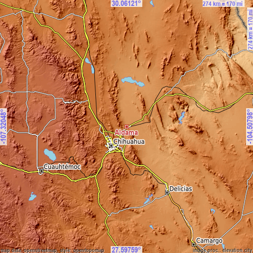
| \ | Map #1 | Map #2 | Topo.Map |
| Scale [m] | 1239..1647 m | 1219..2007 m | × |
| Scale [ft] | 4065..5404 ft | 3999..6585 ft | × |
| Average | 1291.8 m = 4238 ft | 1337.5 m = 4388 ft | × |
| Width | 8.56 km = 5.3 mi | 17.12 km = 10.6 mi | 273.9 km = 170.2 mi |
| Height | 8.56 km = 5.3 mi | 17.12 km = 10.6 mi | 273.9 km = 170.2 mi |
| ↑Max Latitude | 28.875179° | 28.913654° | 30.06121° |
| Latitude at center | 28.83669° | 28.83669° | 28.83669° |
| ↓Min Latitude | 28.798187° | 28.75967° | 27.59759° |
| ← Min Longitude | -105.958175° | -106.002121° | -107.32048° |
| Longitude center | -105.91423° | -105.91423° | -105.91423° |
| →Max Longitude | -105.870285° | -105.826339° | -104.50798° |
Nearby cities:
Cities around Aldama sort by population:
• Chihuahua elevation 1437 m
28.1 km,  217°
217°
• Lázaro Cárdenas 1202 m
57.2 km,  150°
150°
• Ampliación Colonia Lázaro Cárdenas 1195 m
58.2 km, 150°
• Santa Eulalia 1690 m
27.1 km,  174°
174°
• Ninguno [CERESO] 1467 m
25.4 km,  185°
185°
• Estación Consuelo 1191 m
64.3 km, 150°
• Julimes 1120 m
66.1 km,  134°
134°
• El Sauz 1558 m
40.6 km,  305°
305°
• Santa Isabel 1623 m
70.9 km, 219°
• Colonia Felipe Ángeles 1156 m
63.7 km,  141°
141°
• Guadalupe Victoria 1124 m
73.4 km, 139°
• San Andrés 1764 m
65.9 km,  240°
240°
Multilingual:
 En español:
Aldama elevación 1269 m.
 En France:
Aldama élévation 1269 m.


Sources and notes:
- [note 1] Map square and city borders are not equal. Map elevation data is calculated only from area inside that square.
- [src 1] Elevation data from geonames database provided with same terms of usage.
- [src 2] The elevation map of Aldama is generated using elevation data from NASA's 3 arcsec (90m) resolution SRTM data.
- [src 3] Base (background) map © OpenStreetMap contributors tiles are generated by Geofabrik and OpenTopoMap.
Copyright & License:
This Aldama Elevation Map is licensed under CC BY-SA. You may reuse any part from this page, if you give a proper credit by linking to this URL:
 More info on terms of use page.