La D elevation
La D (Querétaro, Pedro Escobedo), Mexico elevation is 1962 meters and La D elevation in feet is 6437 ft above sea level [src 1]. La D is a populated place (feature code) with elevation that is 648 meters (2126 ft) bigger than average city elevation in Mexico.
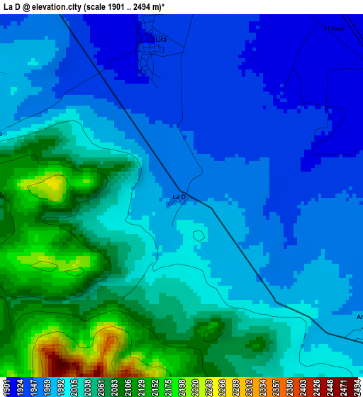
Below is the Elevation map of La D, which displays elevation range with different colors. Scale of the first map is from 1901 to 2494 m (6237 to 8182 ft) with average elevation of 2009.1 meters (=6592 ft) [note 1]
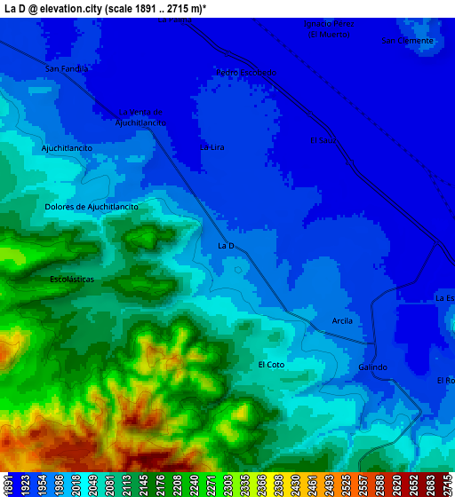
These maps also provides idea of topography and contour of this city, they are displayed at different zoom levels. More info about maps, scale and edge coordinates you can find below images.
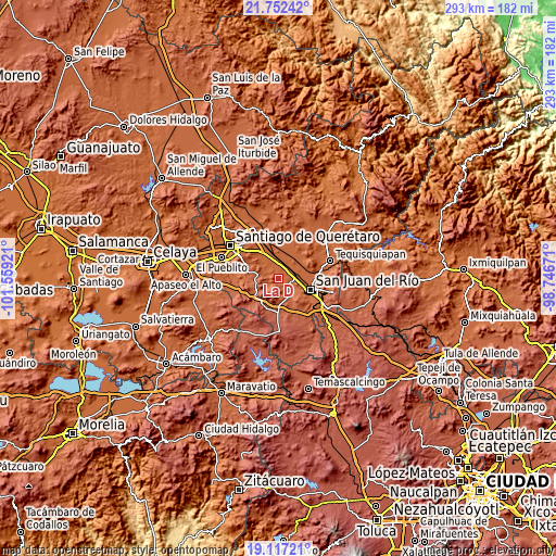
| \ | Map #1 | Map #2 | Topo.Map |
| Scale [m] | 1901..2494 m | 1891..2715 m | × |
| Scale [ft] | 6237..8182 ft | 6204..8907 ft | × |
| Average | 2009.1 m = 6592 ft | 2040 m = 6693 ft | × |
| Width | 9.16 km = 5.7 mi | 18.31 km = 11.4 mi | 293 km = 182.1 mi |
| Height | 9.16 km = 5.7 mi | 18.31 km = 11.4 mi | 293 km = 182.1 mi |
| ↑Max Latitude | 20.481633° | 20.522795° | 21.75242° |
| Latitude at center | 20.44046° | 20.44046° | 20.44046° |
| ↓Min Latitude | 20.399276° | 20.358081° | 19.11721° |
| ← Min Longitude | -100.196905° | -100.240851° | -101.55921° |
| Longitude center | -100.15296° | -100.15296° | -100.15296° |
| →Max Longitude | -100.109015° | -100.065069° | -98.74671° |
Nearby cities:
Cities around La D sort by population:
• Pedro Escobedo elevation 1921 m
6.7 km,  9°
9°
• El Saúz 1908 m
5.7 km,  43°
43°
• La Lira 1921 m
4 km,  347°
347°
• La Estancia 1938 m
9.3 km,  103°
103°
• Arcila 1974 m
5.6 km,  126°
126°
• Ajuchitlancito 1979 m
7.6 km,  301°
301°
• Galindo 1948 m
7.4 km, 130°
• Escolasticas 2119 m
6.3 km,  257°
257°
• La Palma 1910 m
9.3 km, 346°
• Ignacio Pérez 1928 m
10.1 km,  25°
25°
• El Coto 2044 m
5.4 km,  159°
159°
• Laguna de Vaquerías 2201 m
9.8 km,  169°
169°
Multilingual:
 En español:
La ”D”, La D elevación 1962 m.
 En France:
La D élévation 1962 m.


Sources and notes:
- [note 1] Map square and city borders are not equal. Map elevation data is calculated only from area inside that square.
- [src 1] Elevation data from geonames database provided with same terms of usage.
- [src 2] The elevation map of La D is generated using elevation data from NASA's 3 arcsec (90m) resolution SRTM data.
- [src 3] Base (background) map © OpenStreetMap contributors tiles are generated by Geofabrik and OpenTopoMap.
Copyright & License:
This La D Elevation Map is licensed under CC BY-SA. You may reuse any part from this page, if you give a proper credit by linking to this URL:
 More info on terms of use page.