Pedro Escobedo elevation
Pedro Escobedo (Querétaro), Mexico elevation is 1921 meters and Pedro Escobedo elevation in feet is 6302 ft above sea level [src 1]. Pedro Escobedo is a seat of a second-order administrative division (feature code) with elevation that is 607 meters (1991 ft) bigger than average city elevation in Mexico.
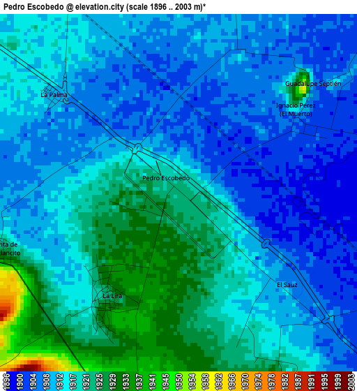
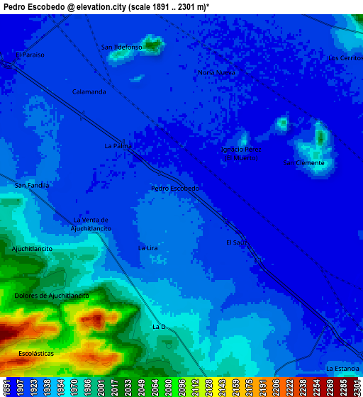
Below is the Elevation map of Pedro Escobedo, which displays elevation range with different colors. Scale of the first map is from 1896 to 2003 m (6220 to 6572 ft) with average elevation of 1914.5 meters (=6281 ft) [note 1]
These maps also provides idea of topography and contour of this city, they are displayed at different zoom levels. More info about maps, scale and edge coordinates you can find below images.
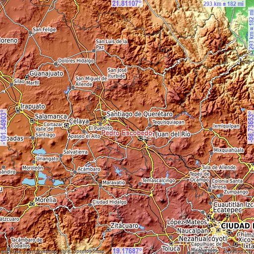
| \ | Map #1 | Map #2 | Topo.Map |
| Scale [m] | 1896..2003 m | 1891..2301 m | × |
| Scale [ft] | 6220..6572 ft | 6204..7549 ft | × |
| Average | 1914.5 m = 6281 ft | 1938.8 m = 6361 ft | × |
| Width | 9.15 km = 5.7 mi | 18.31 km = 11.4 mi | 292.9 km = 182 mi |
| Height | 9.15 km = 5.7 mi | 18.31 km = 11.4 mi | 292.9 km = 182 mi |
| ↑Max Latitude | 20.540787° | 20.581933° | 21.81107° |
| Latitude at center | 20.49963° | 20.49963° | 20.49963° |
| ↓Min Latitude | 20.458462° | 20.417283° | 19.17687° |
| ← Min Longitude | -100.186725° | -100.230671° | -101.54903° |
| Longitude center | -100.14278° | -100.14278° | -100.14278° |
| →Max Longitude | -100.098835° | -100.054889° | -98.73653° |
Nearby cities:
Cities around Pedro Escobedo sort by population:
• El Saúz elevation 1908 m
3.7 km,  130°
130°
• La Lira 1921 m
3.3 km,  215°
215°
• San Clemente 1921 m
6.3 km,  74°
74°
• La D 1962 m
6.7 km,  189°
189°
• Ajuchitlancito 1979 m
8 km,  250°
250°
• Epigmenio González 1929 m
6.2 km,  337°
337°
• Guadalupe Septién 1921 m
4.3 km,  44°
44°
• La Palma 1910 m
4.1 km,  307°
307°
• Ignacio Pérez 1928 m
4.1 km,  52°
52°
• Calamanda 1915 m
6.9 km,  319°
319°
• Noria Nueva 1909 m
6.6 km,  16°
16°
• San Vicente el Alto 1922 m
8 km, 343°
Multilingual:
 En español:
Pedro Escobedo elevación 1921 m.
 En France:
Pedro Escobedo élévation 1921 m.
 Auf Deutsch:
Pedro Escobedo höhe über dem Meeresspiegel ist 1921 m.

Sources and notes:
- [note 1] Map square and city borders are not equal. Map elevation data is calculated only from area inside that square.
- [src 1] Elevation data from geonames database provided with same terms of usage.
- [src 2] The elevation map of Pedro Escobedo is generated using elevation data from NASA's 3 arcsec (90m) resolution SRTM data.
- [src 3] Base (background) map © OpenStreetMap contributors tiles are generated by Geofabrik and OpenTopoMap.
Copyright & License:
This Pedro Escobedo Elevation Map is licensed under CC BY-SA. You may reuse any part from this page, if you give a proper credit by linking to this URL:
 More info on terms of use page.