El Paraíso elevation
El Paraíso (Guerrero, Atoyac de Álvarez), Mexico elevation is 792 meters and El Paraíso elevation in feet is 2598 ft above sea level [src 1]. El Paraíso is a populated place (feature code) with elevation that is 522 meters (1713 ft) smaller than average city elevation in Mexico.
Below is the Elevation map of El Paraíso, which displays elevation range with different colors. Scale of the first map is from 534 to 1581 m (1752 to 5187 ft) with average elevation of 965 meters (=3166 ft) [note 1]
These maps also provides idea of topography and contour of this city, they are displayed at different zoom levels. More info about maps, scale and edge coordinates you can find below images.
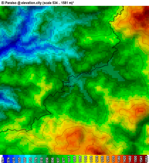
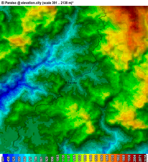
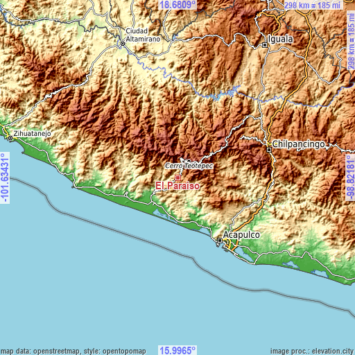
| \ | Map #1 | Map #2 | Topo.Map |
| Scale [m] | 534..1581 m | 391..2138 m | × |
| Scale [ft] | 1752..5187 ft | 1283..7014 ft | × |
| Average | 965 m = 3166 ft | 1073 m = 3520 ft | × |
| Width | 9.33 km = 5.8 mi | 18.66 km = 11.6 mi | 298.5 km = 185.5 mi |
| Height | 9.33 km = 5.8 mi | 18.66 km = 11.6 mi | 298.5 km = 185.5 mi |
| ↑Max Latitude | 17.385553° | 17.427485° | 18.6809° |
| Latitude at center | 17.34361° | 17.34361° | 17.34361° |
| ↓Min Latitude | 17.301658° | 17.259696° | 15.9965° |
| ← Min Longitude | -100.272005° | -100.315951° | -101.63431° |
| Longitude center | -100.22806° | -100.22806° | -100.22806° |
| →Max Longitude | -100.184115° | -100.140169° | -98.82181° |
Nearby cities:
Cities around El Paraíso sort by population:
• Atoyac de Álvarez elevation 59 m
26.6 km,  235°
235°
• Tepetixtla 408 m
18.5 km,  140°
140°
• El Ticui 55 m
27 km, 238°
• Zacualpan 19 m
30.2 km,  200°
200°
• Cacalutla 37 m
27.6 km,  208°
208°
• Corral Falso 26 m
31.1 km,  232°
232°
• Arenal de Álvarez (Arenal de Paco) 17 m
34.1 km,  224°
224°
• Cayaco 16 m
33.2 km,  187°
187°
• Pueblo Viejo 1825 m
24.6 km,  28°
28°
• Las Compuertas 900 m
28.5 km,  125°
125°
• Alcholoa 40 m
28.7 km, 221°
• San Cristóbal 882 m
31.6 km,  103°
103°
Multilingual:
 En español:
El Paraíso elevación 792 m.
 En France:
El Paraíso élévation 792 m.
 Auf Deutsch:
El Paraíso höhe über dem Meeresspiegel ist 792 m.

Sources and notes:
- [note 1] Map square and city borders are not equal. Map elevation data is calculated only from area inside that square.
- [src 1] Elevation data from geonames database provided with same terms of usage.
- [src 2] The elevation map of El Paraíso is generated using elevation data from NASA's 3 arcsec (90m) resolution SRTM data.
- [src 3] Base (background) map © OpenStreetMap contributors tiles are generated by Geofabrik and OpenTopoMap.
Copyright & License:
This El Paraíso Elevation Map is licensed under CC BY-SA. You may reuse any part from this page, if you give a proper credit by linking to this URL:
 More info on terms of use page.