Centro de Arriba elevation
Centro de Arriba (Aguascalientes), Mexico elevation is 1863 meters and Centro de Arriba elevation in feet is 6112 ft above sea level [src 1]. Centro de Arriba is a populated place (feature code) with elevation that is 549 meters (1801 ft) bigger than average city elevation in Mexico.
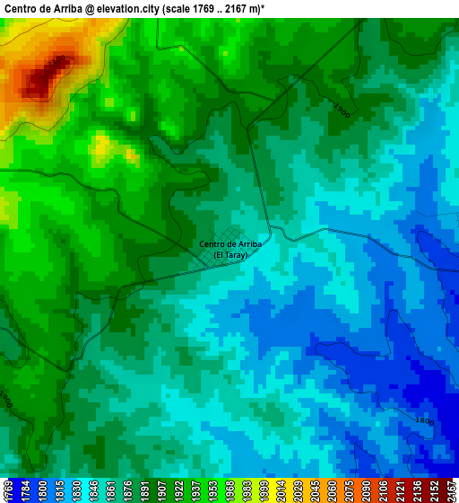
Below is the Elevation map of Centro de Arriba, which displays elevation range with different colors. Scale of the first map is from 1769 to 2167 m (5804 to 7110 ft) with average elevation of 1879.8 meters (=6167 ft) [note 1]
These maps also provides idea of topography and contour of this city, they are displayed at different zoom levels. More info about maps, scale and edge coordinates you can find below images.
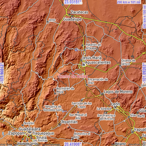
| \ | Map #1 | Topo.Map |
| Scale [m] | 1769..2167 m | × |
| Scale [ft] | 5804..7110 ft | × |
| Average | 1879.8 m = 6167 ft | × |
| Width | 9.08 km = 5.6 mi | 290.5 km = 180.5 mi |
| Height | 9.08 km = 5.6 mi | 290.5 km = 180.5 mi |
| ↑Max Latitude | 21.772046° | 23.03151° |
| Latitude at center | 21.73123° | 21.73123° |
| ↓Min Latitude | 21.690402° | 20.41908° |
| ← Min Longitude | -102.542825° | -103.90513° |
| Longitude center | -102.49888° | -102.49888° |
| →Max Longitude | -102.454935° | -101.09263° |
Nearby cities:
Cities around Centro de Arriba sort by population:
• Villa Hidalgo elevation 1942 m
11.1 km,  236°
236°
• Mechoacanejo 1862 m
23.5 km,  205°
205°
• Belén del Refugio 1726 m
23.3 km,  163°
163°
• San Antonio de Peñuelas 1834 m
21.5 km,  107°
107°
• Malpaso 1717 m
22.2 km,  309°
309°
• Peñuelas (El Cienegal) 1863 m
23.1 km,  92°
92°
• General Ignacio Zaragoza 1998 m
17.1 km,  11°
11°
• El Refugio de Peñuelas 1864 m
21.7 km, 94°
• Montoro 1859 m
20.5 km,  82°
82°
• La Loma de los Negritos 1870 m
21.8 km,  44°
44°
• Tepusco 1876 m
16.9 km,  219°
219°
• Los Caños 1907 m
6.5 km,  30°
30°
Multilingual:
 En español:
Centro de Arriba, El Taray elevación 1863 m.
 En France:
Centro de Arriba élévation 1863 m.
 Auf Deutsch:
Centro de Arriba höhe über dem Meeresspiegel ist 1863 m.

Sources and notes:
- [note 1] Map square and city borders are not equal. Map elevation data is calculated only from area inside that square.
- [src 1] Elevation data from geonames database provided with same terms of usage.
- [src 2] The elevation map of Centro de Arriba is generated using elevation data from NASA's 3 arcsec (90m) resolution SRTM data.
- [src 3] Base (background) map © OpenStreetMap contributors tiles are generated by Geofabrik and OpenTopoMap.
Copyright & License:
This Centro de Arriba Elevation Map is licensed under CC BY-SA. You may reuse any part from this page, if you give a proper credit by linking to this URL:
 More info on terms of use page.