Villa Hidalgo elevation
Villa Hidalgo (Jalisco), Mexico elevation is 1942 meters and Villa Hidalgo elevation in feet is 6371 ft above sea level [src 1]. Villa Hidalgo is a seat of a second-order administrative division (feature code) with elevation that is 628 meters (2060 ft) bigger than average city elevation in Mexico.
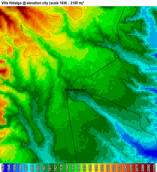
Below is the Elevation map of Villa Hidalgo, which displays elevation range with different colors. Scale of the first map is from 1836 to 2100 m (6024 to 6890 ft) with average elevation of 1940.9 meters (=6368 ft) [note 1]
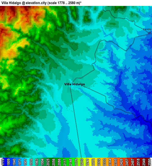
These maps also provides idea of topography and contour of this city, they are displayed at different zoom levels. More info about maps, scale and edge coordinates you can find below images.
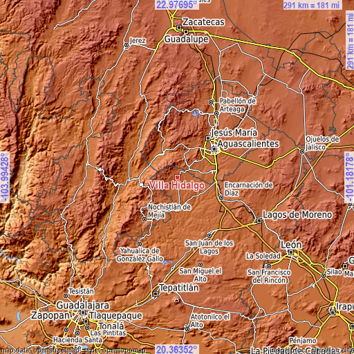
| \ | Map #1 | Map #2 | Topo.Map |
| Scale [m] | 1836..2100 m | 1778..2580 m | × |
| Scale [ft] | 6024..6890 ft | 5833..8465 ft | × |
| Average | 1940.9 m = 6368 ft | 1974.9 m = 6479 ft | × |
| Width | 9.08 km = 5.6 mi | 18.16 km = 11.3 mi | 290.6 km = 180.6 mi |
| Height | 9.08 km = 5.6 mi | 18.16 km = 11.3 mi | 290.6 km = 180.6 mi |
| ↑Max Latitude | 21.716992° | 21.757812° | 22.97695° |
| Latitude at center | 21.67616° | 21.67616° | 21.67616° |
| ↓Min Latitude | 21.635316° | 21.594461° | 20.36352° |
| ← Min Longitude | -102.631975° | -102.675921° | -103.99428° |
| Longitude center | -102.58803° | -102.58803° | -102.58803° |
| →Max Longitude | -102.544085° | -102.500139° | -101.18178° |
Nearby cities:
Cities around Villa Hidalgo sort by population:
• Calvillo elevation 1629 m
23.2 km,  324°
324°
• Mechoacanejo 1862 m
15.1 km,  183°
183°
• Belén del Refugio 1726 m
22.7 km,  135°
135°
• El Cuervero (Cuerveros) 1678 m
22.8 km,  334°
334°
• Tenayuca 1855 m
20.5 km,  200°
200°
• Malpaso 1717 m
21.8 km,  338°
338°
• Tepusco 1876 m
7.2 km,  191°
191°
• La Panadera 1656 m
23.8 km, 331°
• Los Caños 1907 m
17.1 km,  46°
46°
• Mesa Grande 1774 m
19.9 km, 316°
• Jaltiche de Arriba 1598 m
23.5 km,  298°
298°
• Centro de Arriba 1863 m
11.1 km,  56°
56°
Multilingual:
 En español:
Villa Hidalgo elevación 1942 m.
 En France:
Villa Hidalgo élévation 1942 m.
 Auf Deutsch:
Villa Hidalgo höhe über dem Meeresspiegel ist 1942 m.

Sources and notes:
- [note 1] Map square and city borders are not equal. Map elevation data is calculated only from area inside that square.
- [src 1] Elevation data from geonames database provided with same terms of usage.
- [src 2] The elevation map of Villa Hidalgo is generated using elevation data from NASA's 3 arcsec (90m) resolution SRTM data.
- [src 3] Base (background) map © OpenStreetMap contributors tiles are generated by Geofabrik and OpenTopoMap.
Copyright & License:
This Villa Hidalgo Elevation Map is licensed under CC BY-SA. You may reuse any part from this page, if you give a proper credit by linking to this URL:
 More info on terms of use page.