Agua Prieta elevation
Agua Prieta (Sonora, Agua Prieta Municipality), Mexico elevation is 1219 meters and Agua Prieta elevation in feet is 3999 ft above sea level [src 1]. Agua Prieta is a seat of a second-order administrative division (feature code) with elevation that is 95 meters (312 ft) smaller than average city elevation in Mexico.
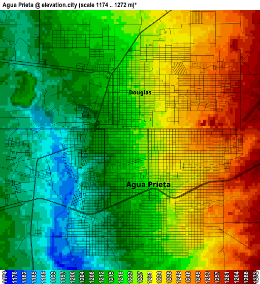
Below is the Elevation map of Agua Prieta, which displays elevation range with different colors. Scale of the first map is from 1174 to 1272 m (3852 to 4173 ft) with average elevation of 1221.2 meters (=4007 ft) [note 1]
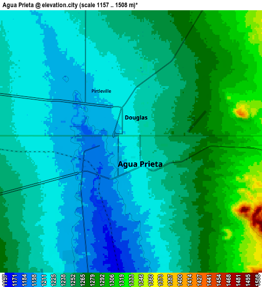
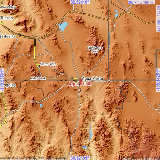
These maps also provides idea of topography and contour of this city, they are displayed at different zoom levels. More info about maps, scale and edge coordinates you can find below images.
| \ | Map #1 | Map #2 | Topo.Map |
| Scale [m] | 1174..1272 m | 1157..1508 m | × |
| Scale [ft] | 3852..4173 ft | 3796..4948 ft | × |
| Average | 1221.2 m = 4007 ft | 1244 m = 4081 ft | × |
| Width | 8.35 km = 5.2 mi | 16.7 km = 10.4 mi | 267.1 km = 166 mi |
| Height | 8.35 km = 5.2 mi | 16.69 km = 10.4 mi | 267.1 km = 166 mi |
| ↑Max Latitude | 31.36824° | 31.405754° | 32.52418° |
| Latitude at center | 31.33071° | 31.33071° | 31.33071° |
| ↓Min Latitude | 31.293165° | 31.255606° | 30.12191° |
| ← Min Longitude | -109.592705° | -109.636651° | -110.95501° |
| Longitude center | -109.54876° | -109.54876° | -109.54876° |
| →Max Longitude | -109.504815° | -109.460869° | -108.14251° |
Nearby cities:
Cities around Agua Prieta sort by population:
• Cananea elevation 1599 m
80.3 km,  241°
241°
• Nacozari Viejo 1352 m
103.9 km,  185°
185°
• Nacozari de García 1106 m
107.1 km, 187°
• Esqueda 1204 m
67.6 km,  183°
183°
• Naco 1423 m
37.8 km,  269°
269°
• Arizpe 837 m
125.3 km,  208°
208°
• Bacerac 1040 m
123.4 km,  151°
151°
• Bacoachi 1053 m
87.4 km, 207°
• Monte Verde 1415 m
91.8 km,  120°
120°
• Santa Cruz 1361 m
100.1 km,  263°
263°
• Fronteras 1135 m
48.2 km, 181°
• Bavispe 1016 m
111.1 km, 148°
Multilingual:
 En español:
Agua Prieta elevación 1219 m.
 En France:
Agua Prieta élévation 1219 m.
 Auf Deutsch:
Agua Prieta höhe über dem Meeresspiegel ist 1219 m.

Sources and notes:
- [note 1] Map square and city borders are not equal. Map elevation data is calculated only from area inside that square.
- [src 1] Elevation data from geonames database provided with same terms of usage.
- [src 2] The elevation map of Agua Prieta is generated using elevation data from NASA's 3 arcsec (90m) resolution SRTM data.
- [src 3] Base (background) map © OpenStreetMap contributors tiles are generated by Geofabrik and OpenTopoMap.
Copyright & License:
This Agua Prieta Elevation Map is licensed under CC BY-SA. You may reuse any part from this page, if you give a proper credit by linking to this URL:
 More info on terms of use page.