Ajijic elevation
Ajijic (Jalisco, Chapala), Mexico elevation is 1577 meters and Ajijic elevation in feet is 5174 ft above sea level [src 1]. Ajijic is a populated place (feature code) with elevation that is 263 meters (863 ft) bigger than average city elevation in Mexico.
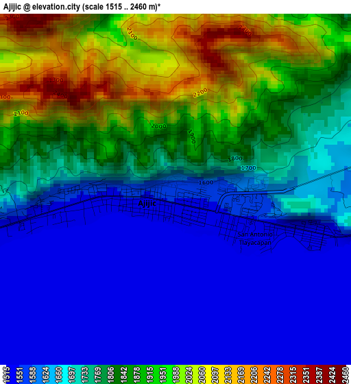
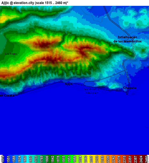
Below is the Elevation map of Ajijic, which displays elevation range with different colors. Scale of the first map is from 1515 to 2460 m (4970 to 8071 ft) with average elevation of 1752.7 meters (=5750 ft) [note 1]
These maps also provides idea of topography and contour of this city, they are displayed at different zoom levels. More info about maps, scale and edge coordinates you can find below images.
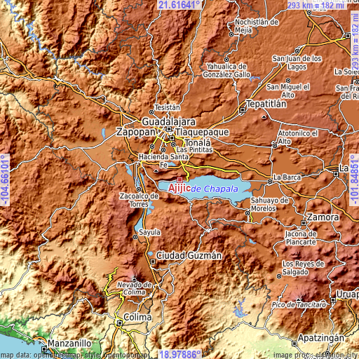
| \ | Map #1 | Map #2 | Topo.Map |
| Scale [m] | 1515..2460 m | 1515..2460 m | × |
| Scale [ft] | 4970..8071 ft | 4970..8071 ft | × |
| Average | 1752.7 m = 5750 ft | 1676.2 m = 5499 ft | × |
| Width | 9.17 km = 5.7 mi | 18.33 km = 11.4 mi | 293.3 km = 182.2 mi |
| Height | 9.17 km = 5.7 mi | 18.33 km = 11.4 mi | 293.3 km = 182.2 mi |
| ↑Max Latitude | 20.344459° | 20.385658° | 21.61641° |
| Latitude at center | 20.30325° | 20.30325° | 20.30325° |
| ↓Min Latitude | 20.26203° | 20.220798° | 18.97886° |
| ← Min Longitude | -103.298705° | -103.342651° | -104.66101° |
| Longitude center | -103.25476° | -103.25476° | -103.25476° |
| →Max Longitude | -103.210815° | -103.166869° | -101.84851° |
Nearby cities:
Cities around Ajijic sort by population:
• Chapala elevation 1539 m
6.7 km,  96°
96°
• San Juan Cosalá 1536 m
9.2 km,  259°
259°
• Ixtlahuacán de los Membrillos 1601 m
8.1 km,  51°
51°
• San Luis Soyatlán 1540 m
12.9 km,  205°
205°
• Los Cedros 1575 m
9.9 km,  13°
13°
• San Cristóbal Zapotitlán 1538 m
14.8 km,  233°
233°
• Buenavista 1562 m
9.8 km,  24°
24°
• Santa Cruz de la Soledad 1543 m
10.2 km,  81°
81°
• Potrerillos 1844 m
13.4 km,  286°
286°
• San Nicolás de Ibarra 1535 m
13.5 km, 77°
• El Rodeo 1523 m
14.1 km,  33°
33°
• Santa Rosa 1550 m
12.5 km, 9°
Multilingual:
 En español:
Ajijic elevación 1577 m.
 En France:
Ajijic élévation 1577 m.


Sources and notes:
- [note 1] Map square and city borders are not equal. Map elevation data is calculated only from area inside that square.
- [src 1] Elevation data from geonames database provided with same terms of usage.
- [src 2] The elevation map of Ajijic is generated using elevation data from NASA's 3 arcsec (90m) resolution SRTM data.
- [src 3] Base (background) map © OpenStreetMap contributors tiles are generated by Geofabrik and OpenTopoMap.
Copyright & License:
This Ajijic Elevation Map is licensed under CC BY-SA. You may reuse any part from this page, if you give a proper credit by linking to this URL:
 More info on terms of use page.