Aratichanguío elevation
Aratichanguío (Guerrero, Zirándaro), Mexico elevation is 216 meters and Aratichanguío elevation in feet is 709 ft above sea level [src 1]. Aratichanguío is a populated place (feature code) with elevation that is 1098 meters (3602 ft) smaller than average city elevation in Mexico.
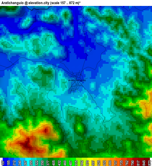
Below is the Elevation map of Aratichanguío, which displays elevation range with different colors. Scale of the first map is from 157 to 872 m (515 to 2861 ft) with average elevation of 326 meters (=1070 ft) [note 1]
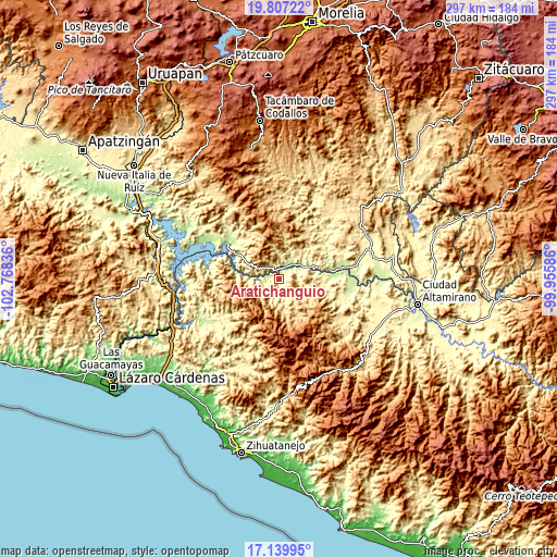
These maps also provides idea of topography and contour of this city, they are displayed at different zoom levels. More info about maps, scale and edge coordinates you can find below images.
| \ | Map #1 | Topo.Map |
| Scale [m] | 157..872 m | × |
| Scale [ft] | 515..2861 ft | × |
| Average | 326 m = 1070 ft | × |
| Width | 9.27 km = 5.8 mi | 296.6 km = 184.3 mi |
| Height | 9.27 km = 5.8 mi | 296.6 km = 184.3 mi |
| ↑Max Latitude | 18.520444° | 19.80722° |
| Latitude at center | 18.47877° | 18.47877° |
| ↓Min Latitude | 18.437085° | 17.13995° |
| ← Min Longitude | -101.406055° | -102.76836° |
| Longitude center | -101.36211° | -101.36211° |
| →Max Longitude | -101.318165° | -99.95586° |
Nearby cities:
Cities around Aratichanguío sort by population:
• Huetamo de Núñez elevation 304 m
51.8 km,  71°
71°
• Churumuco de Morelos 201 m
36.4 km,  304°
304°
• Zirándaro de los Chávez 209 m
40.4 km,  90°
90°
• Infiernillo (Morelos de Infiernillo) 80 m
60.9 km,  249°
249°
• Paso de Arena 348 m
57.8 km,  109°
109°
• Purechucho 284 m
51.2 km,  77°
77°
• Guayameo 642 m
22.1 km,  151°
151°
• Placeres del Oro 383 m
55.6 km,  119°
119°
• Santa Teresa 357 m
59.1 km,  104°
104°
• Coahuayutla de Guerrero 313 m
43.4 km, 245°
• Poturo 535 m
46.8 km,  325°
325°
• Patambó 412 m
58.8 km, 118°
Multilingual:
 En español:
Aratichanguío elevación 216 m.
 En France:
Aratichanguío élévation 216 m.
 Auf Deutsch:
Aratichanguío höhe über dem Meeresspiegel ist 216 m.

Sources and notes:
- [note 1] Map square and city borders are not equal. Map elevation data is calculated only from area inside that square.
- [src 1] Elevation data from geonames database provided with same terms of usage.
- [src 2] The elevation map of Aratichanguío is generated using elevation data from NASA's 3 arcsec (90m) resolution SRTM data.
- [src 3] Base (background) map © OpenStreetMap contributors tiles are generated by Geofabrik and OpenTopoMap.
Copyright & License:
This Aratichanguío Elevation Map is licensed under CC BY-SA. You may reuse any part from this page, if you give a proper credit by linking to this URL:
 More info on terms of use page.