La Purísima elevation
La Purísima (Jalisco, Zapotlanejo), Mexico elevation is 1625 meters and La Purísima elevation in feet is 5331 ft above sea level [src 1]. La Purísima is a populated place (feature code) with elevation that is 311 meters (1020 ft) bigger than average city elevation in Mexico.
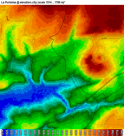
Below is the Elevation map of La Purísima, which displays elevation range with different colors. Scale of the first map is from 1514 to 1789 m (4967 to 5869 ft) with average elevation of 1654.7 meters (=5429 ft) [note 1]
These maps also provides idea of topography and contour of this city, they are displayed at different zoom levels. More info about maps, scale and edge coordinates you can find below images.
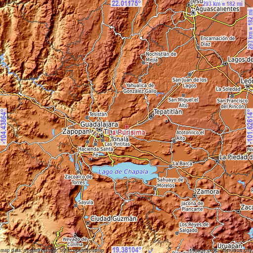
| \ | Map #1 | Topo.Map |
| Scale [m] | 1514..1789 m | × |
| Scale [ft] | 4967..5869 ft | × |
| Average | 1654.7 m = 5429 ft | × |
| Width | 9.14 km = 5.7 mi | 292.5 km = 181.8 mi |
| Height | 9.14 km = 5.7 mi | 292.5 km = 181.8 mi |
| ↑Max Latitude | 20.743202° | 22.01175° |
| Latitude at center | 20.7021° | 20.7021° |
| ↓Min Latitude | 20.660987° | 19.38104° |
| ← Min Longitude | -103.076335° | -104.43864° |
| Longitude center | -103.03239° | -103.03239° |
| →Max Longitude | -102.988445° | -101.62614° |
Nearby cities:
Cities around La Purísima sort by population:
• Zapotlanejo elevation 1524 m
9.6 km,  202°
202°
• Acatic 1684 m
15.3 km,  55°
55°
• La Laja 1457 m
16.5 km,  214°
214°
• El Refugio 1777 m
14.3 km,  79°
79°
• Mismaloya (Fraccionamiento Pedregal de Santa Martha) 1567 m
17.9 km,  233°
233°
• Matatlán 1563 m
12.3 km,  273°
273°
• San Antonio de los Vázquez 1693 m
17.5 km,  317°
317°
• Tierras Coloradas 1767 m
18.1 km, 80°
• San José de las Flores 1722 m
9.1 km,  130°
130°
• La Mezquitera 1463 m
18 km, 207°
• La Paz 1499 m
18.1 km,  186°
186°
• San Joaquín Zorrillos 1677 m
9.2 km,  168°
168°
Multilingual:
 En español:
La Purísima elevación 1625 m.
 En France:
La Purísima élévation 1625 m.
 Auf Deutsch:
La Purísima höhe über dem Meeresspiegel ist 1625 m.

Sources and notes:
- [note 1] Map square and city borders are not equal. Map elevation data is calculated only from area inside that square.
- [src 1] Elevation data from geonames database provided with same terms of usage.
- [src 2] The elevation map of La Purísima is generated using elevation data from NASA's 3 arcsec (90m) resolution SRTM data.
- [src 3] Base (background) map © OpenStreetMap contributors tiles are generated by Geofabrik and OpenTopoMap.
Copyright & License:
This La Purísima Elevation Map is licensed under CC BY-SA. You may reuse any part from this page, if you give a proper credit by linking to this URL:
 More info on terms of use page.