Juriquilla elevation
Juriquilla (Querétaro), Mexico elevation is 1907 meters and Juriquilla elevation in feet is 6257 ft above sea level [src 1]. Juriquilla is a populated place (feature code) with elevation that is 593 meters (1946 ft) bigger than average city elevation in Mexico.
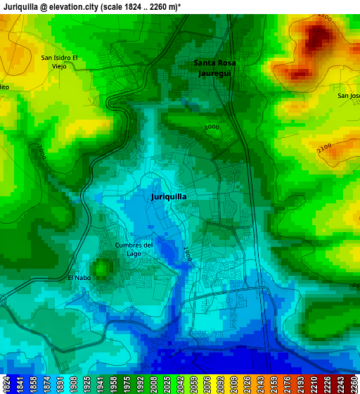
Below is the Elevation map of Juriquilla, which displays elevation range with different colors. Scale of the first map is from 1824 to 2260 m (5984 to 7415 ft) with average elevation of 1969.5 meters (=6462 ft) [note 1]
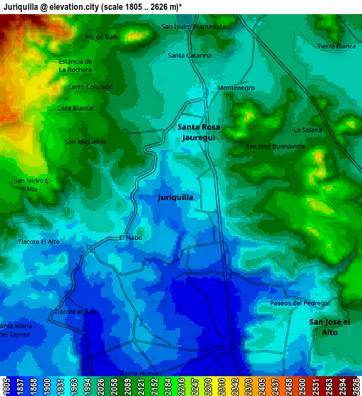
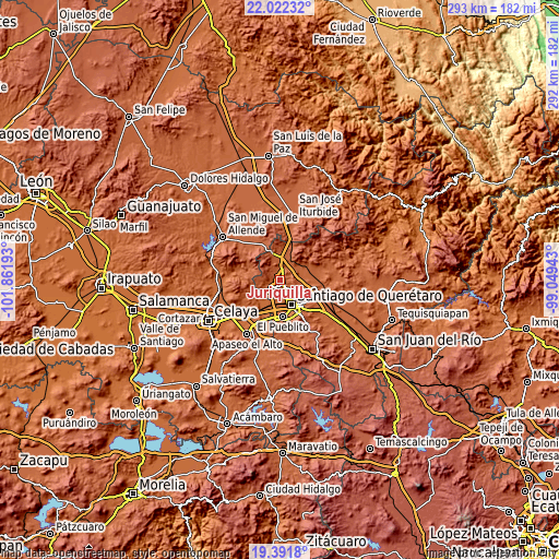
These maps also provides idea of topography and contour of this city, they are displayed at different zoom levels. More info about maps, scale and edge coordinates you can find below images.
| \ | Map #1 | Map #2 | Topo.Map |
| Scale [m] | 1824..2260 m | 1805..2626 m | × |
| Scale [ft] | 5984..7415 ft | 5922..8615 ft | × |
| Average | 1969.5 m = 6462 ft | 2008.4 m = 6589 ft | × |
| Width | 9.14 km = 5.7 mi | 18.28 km = 11.4 mi | 292.5 km = 181.8 mi |
| Height | 9.14 km = 5.7 mi | 18.28 km = 11.4 mi | 292.5 km = 181.8 mi |
| ↑Max Latitude | 20.753869° | 20.794958° | 22.02232° |
| Latitude at center | 20.71277° | 20.71277° | 20.71277° |
| ↓Min Latitude | 20.67166° | 20.630538° | 19.3918° |
| ← Min Longitude | -100.499625° | -100.543571° | -101.86193° |
| Longitude center | -100.45568° | -100.45568° | -100.45568° |
| →Max Longitude | -100.411735° | -100.367789° | -99.04943° |
Nearby cities:
Cities around Juriquilla sort by population:
• Santa Rosa Jauregui elevation 1963 m
3.3 km,  13°
13°
• El Salitre 1846 m
6.2 km,  146°
146°
• Tlacote el Bajo 1854 m
7.9 km,  223°
223°
• La Solana 2057 m
7 km,  65°
65°
• Montenegro 1979 m
6.3 km,  26°
26°
• San Miguelito 2073 m
5.6 km,  298°
298°
• El Nabo 1905 m
3.3 km,  230°
230°
• Paseos del Pedregal 1921 m
8.1 km,  132°
132°
• Santa Catarina 1981 m
7.1 km,  2°
2°
• San José Buenavista 2054 m
5.3 km,  62°
62°
• Sergio Villaseñor 1969 m
8.4 km, 154°
• Mompaní 1938 m
5.8 km,  246°
246°
Multilingual:
 En español:
Juriquilla elevación 1907 m.
 En France:
Juriquilla élévation 1907 m.
 Auf Deutsch:
Juriquilla höhe über dem Meeresspiegel ist 1907 m.

Sources and notes:
- [note 1] Map square and city borders are not equal. Map elevation data is calculated only from area inside that square.
- [src 1] Elevation data from geonames database provided with same terms of usage.
- [src 2] The elevation map of Juriquilla is generated using elevation data from NASA's 3 arcsec (90m) resolution SRTM data.
- [src 3] Base (background) map © OpenStreetMap contributors tiles are generated by Geofabrik and OpenTopoMap.
Copyright & License:
This Juriquilla Elevation Map is licensed under CC BY-SA. You may reuse any part from this page, if you give a proper credit by linking to this URL:
 More info on terms of use page.