Neutla elevation
Neutla (Guanajuato, Comonfort), Mexico elevation is 1826 meters and Neutla elevation in feet is 5991 ft above sea level [src 1]. Neutla is a populated place (feature code) with elevation that is 512 meters (1680 ft) bigger than average city elevation in Mexico.
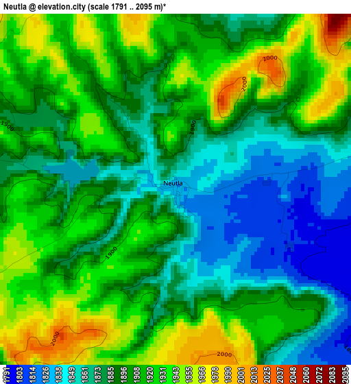
Below is the Elevation map of Neutla, which displays elevation range with different colors. Scale of the first map is from 1791 to 2095 m (5876 to 6873 ft) with average elevation of 1900.2 meters (=6234 ft) [note 1]
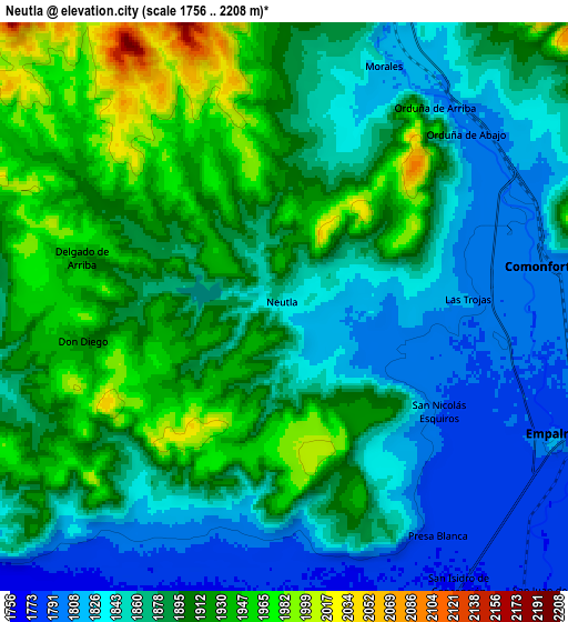
These maps also provides idea of topography and contour of this city, they are displayed at different zoom levels. More info about maps, scale and edge coordinates you can find below images.
| \ | Map #1 | Map #2 | Topo.Map |
| Scale [m] | 1791..2095 m | 1756..2208 m | × |
| Scale [ft] | 5876..6873 ft | 5761..7244 ft | × |
| Average | 1900.2 m = 6234 ft | 1881.7 m = 6174 ft | × |
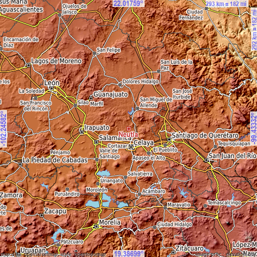
| Width | 9.14 km = 5.7 mi | 18.28 km = 11.4 mi | 292.5 km = 181.8 mi |
| Height | 9.14 km = 5.7 mi | 18.28 km = 11.4 mi | 292.5 km = 181.8 mi |
| ↑Max Latitude | 20.749101° | 20.79019° | 22.01759° |
| Latitude at center | 20.708° | 20.708° | 20.708° |
| ↓Min Latitude | 20.666888° | 20.625765° | 19.38699° |
| ← Min Longitude | -100.883515° | -100.927461° | -102.24582° |
| Longitude center | -100.83957° | -100.83957° | -100.83957° |
| →Max Longitude | -100.795625° | -100.751679° | -99.43332° |
Nearby cities:
Cities around Neutla sort by population:
• Comonfort elevation 1800 m
8.5 km,  78°
78°
• Rincón del Centeno 1845 m
7.1 km,  222°
222°
• San Elías 1780 m
8.1 km,  181°
181°
• Delgado de Arriba 1918 m
6.6 km,  283°
283°
• Santa Teresa 1789 m
8 km,  193°
193°
• Orduña de Abajo 1803 m
8.1 km,  46°
46°
• Morales 1832 m
8.4 km,  21°
21°
• Palmillas de San Juan 1987 m
7.2 km,  339°
339°
• Las Trojas 1804 m
6.1 km,  86°
86°
• Orduña de Arriba 1809 m
8.1 km,  37°
37°
• Delgado de Abajo 1902 m
5.7 km, 280°
• Don Diego 1918 m
6.6 km,  260°
260°
Multilingual:
 En español:
Neutla elevación 1826 m.
 En France:
Neutla élévation 1826 m.


Sources and notes:
- [note 1] Map square and city borders are not equal. Map elevation data is calculated only from area inside that square.
- [src 1] Elevation data from geonames database provided with same terms of usage.
- [src 2] The elevation map of Neutla is generated using elevation data from NASA's 3 arcsec (90m) resolution SRTM data.
- [src 3] Base (background) map © OpenStreetMap contributors tiles are generated by Geofabrik and OpenTopoMap.
Copyright & License:
This Neutla Elevation Map is licensed under CC BY-SA. You may reuse any part from this page, if you give a proper credit by linking to this URL:
 More info on terms of use page.