Tepuxtepec elevation
Tepuxtepec (Michoacán, Contepec), Mexico elevation is 2369 meters and Tepuxtepec elevation in feet is 7772 ft above sea level [src 1]. Tepuxtepec is a populated place (feature code) with elevation that is 1055 meters (3461 ft) bigger than average city elevation in Mexico.
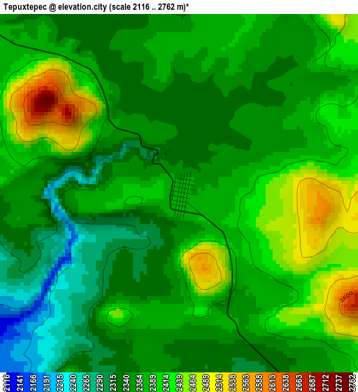
Below is the Elevation map of Tepuxtepec, which displays elevation range with different colors. Scale of the first map is from 2116 to 2762 m (6942 to 9062 ft) with average elevation of 2374 meters (=7789 ft) [note 1]
These maps also provides idea of topography and contour of this city, they are displayed at different zoom levels. More info about maps, scale and edge coordinates you can find below images.
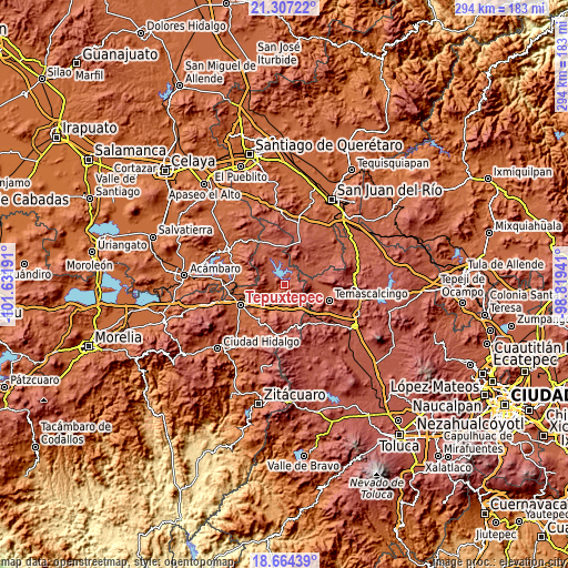
| \ | Map #1 | Topo.Map |
| Scale [m] | 2116..2762 m | × |
| Scale [ft] | 6942..9062 ft | × |
| Average | 2374 m = 7789 ft | × |
| Width | 9.18 km = 5.7 mi | 293.9 km = 182.6 mi |
| Height | 9.18 km = 5.7 mi | 293.9 km = 182.6 mi |
| ↑Max Latitude | 20.032642° | 21.30722° |
| Latitude at center | 19.99135° | 19.99135° |
| ↓Min Latitude | 19.950047° | 18.66439° |
| ← Min Longitude | -100.269605° | -101.63191° |
| Longitude center | -100.22566° | -100.22566° |
| →Max Longitude | -100.181715° | -98.81941° |
Nearby cities:
Cities around Tepuxtepec sort by population:
• Contepec elevation 2492 m
7.7 km,  122°
122°
• Buenavista 2257 m
8.7 km,  182°
182°
• Chitejé de Garabato 2456 m
12.8 km,  17°
17°
• Venta de Bravo 2296 m
15.2 km,  158°
158°
• San Antonio Solís 2374 m
14.6 km,  86°
86°
• Tepetongo 2331 m
13.3 km,  133°
133°
• Atotonilco 2322 m
5.6 km, 177°
• El Césped 2310 m
15.1 km,  143°
143°
• Dolores 2434 m
12.7 km,  307°
307°
• La Higuerilla (Los Lirios) 2139 m
9.3 km,  214°
214°
• Agua Caliente 2306 m
11.6 km,  151°
151°
• San Antonio Molinos 2366 m
9.4 km,  6°
6°
Multilingual:
 En español:
Tepuxtepec, Salto de Tepuxtepec elevación 2369 m.
 En France:
Tepuxtepec élévation 2369 m.
 Auf Deutsch:
Tepuxtepec höhe über dem Meeresspiegel ist 2369 m.

Sources and notes:
- [note 1] Map square and city borders are not equal. Map elevation data is calculated only from area inside that square.
- [src 1] Elevation data from geonames database provided with same terms of usage.
- [src 2] The elevation map of Tepuxtepec is generated using elevation data from NASA's 3 arcsec (90m) resolution SRTM data.
- [src 3] Base (background) map © OpenStreetMap contributors tiles are generated by Geofabrik and OpenTopoMap.
Copyright & License:
This Tepuxtepec Elevation Map is licensed under CC BY-SA. You may reuse any part from this page, if you give a proper credit by linking to this URL:
 More info on terms of use page.