Contepec elevation
Contepec (State of Mexico, Ayapango), Mexico elevation is 2492 meters and Contepec elevation in feet is 8176 ft above sea level [src 1]. Contepec is a seat of a second-order administrative division (feature code) with elevation that is 1178 meters (3865 ft) bigger than average city elevation in Mexico.
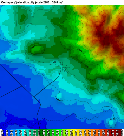
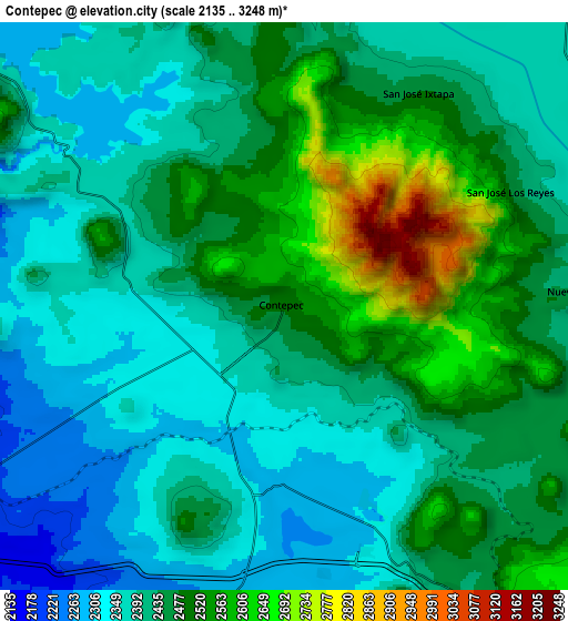
Below is the Elevation map of Contepec, which displays elevation range with different colors. Scale of the first map is from 2269 to 3248 m (7444 to 10656 ft) with average elevation of 2541.6 meters (=8339 ft) [note 1]
These maps also provides idea of topography and contour of this city, they are displayed at different zoom levels. More info about maps, scale and edge coordinates you can find below images.
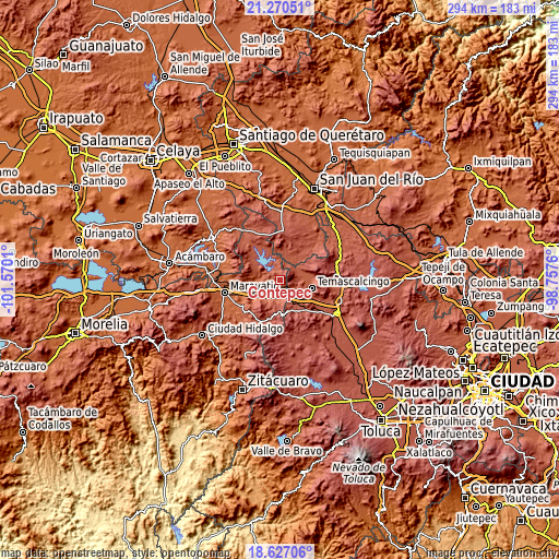
| \ | Map #1 | Map #2 | Topo.Map |
| Scale [m] | 2269..3248 m | 2135..3248 m | × |
| Scale [ft] | 7444..10656 ft | 7005..10656 ft | × |
| Average | 2541.6 m = 8339 ft | 2443.3 m = 8016 ft | × |
| Width | 9.19 km = 5.7 mi | 18.37 km = 11.4 mi | 293.9 km = 182.6 mi |
| Height | 9.19 km = 5.7 mi | 18.37 km = 11.4 mi | 293.9 km = 182.6 mi |
| ↑Max Latitude | 19.995622° | 20.036912° | 21.27051° |
| Latitude at center | 19.95432° | 19.95432° | 19.95432° |
| ↓Min Latitude | 19.913008° | 19.871684° | 18.62706° |
| ← Min Longitude | -100.207795° | -100.251741° | -101.5701° |
| Longitude center | -100.16385° | -100.16385° | -100.16385° |
| →Max Longitude | -100.119905° | -100.075959° | -98.7576° |
Nearby cities:
Cities around Contepec sort by population:
• Buenavista elevation 2257 m
8.3 km,  236°
236°
• Tepuxtepec 2369 m
7.7 km,  302°
302°
• Venta de Bravo 2296 m
10.1 km,  185°
185°
• San Antonio Solís 2374 m
9.6 km,  58°
58°
• Tepetongo 2331 m
6 km,  147°
147°
• Atotonilco 2322 m
6.4 km,  256°
256°
• Zaragoza (Puerto de Medina) 2437 m
10.2 km, 151°
• El Césped 2310 m
8.4 km,  162°
162°
• San Jose Solís 2387 m
13 km,  67°
67°
• La Higuerilla (Los Lirios) 2139 m
12.3 km,  253°
253°
• San Francisco Solis 2402 m
12.7 km,  102°
102°
• Agua Caliente 2306 m
6.1 km, 187°
Multilingual:
 En español:
Contepec elevación 2492 m.
 En France:
Contepec élévation 2492 m.
 Auf Deutsch:
Contepec höhe über dem Meeresspiegel ist 2492 m.

Sources and notes:
- [note 1] Map square and city borders are not equal. Map elevation data is calculated only from area inside that square.
- [src 1] Elevation data from geonames database provided with same terms of usage.
- [src 2] The elevation map of Contepec is generated using elevation data from NASA's 3 arcsec (90m) resolution SRTM data.
- [src 3] Base (background) map © OpenStreetMap contributors tiles are generated by Geofabrik and OpenTopoMap.
Copyright & License:
This Contepec Elevation Map is licensed under CC BY-SA. You may reuse any part from this page, if you give a proper credit by linking to this URL:
 More info on terms of use page.