Santa Cruz elevation
Santa Cruz (Querétaro, El Marqués), Mexico elevation is 1950 meters and Santa Cruz elevation in feet is 6398 ft above sea level [src 1]. Santa Cruz is a populated place (feature code) with elevation that is 636 meters (2087 ft) bigger than average city elevation in Mexico.
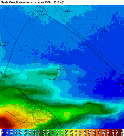
Below is the Elevation map of Santa Cruz, which displays elevation range with different colors. Scale of the first map is from 1906 to 2316 m (6253 to 7598 ft) with average elevation of 1978.1 meters (=6490 ft) [note 1]
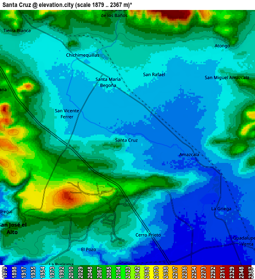
These maps also provides idea of topography and contour of this city, they are displayed at different zoom levels. More info about maps, scale and edge coordinates you can find below images.
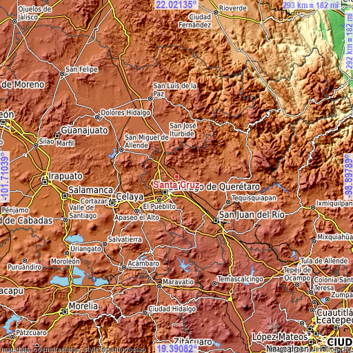
| \ | Map #1 | Map #2 | Topo.Map |
| Scale [m] | 1906..2316 m | 1879..2367 m | × |
| Scale [ft] | 6253..7598 ft | 6165..7766 ft | × |
| Average | 1978.1 m = 6490 ft | 1993.9 m = 6542 ft | × |
| Width | 9.14 km = 5.7 mi | 18.28 km = 11.4 mi | 292.5 km = 181.8 mi |
| Height | 9.14 km = 5.7 mi | 18.28 km = 11.4 mi | 292.5 km = 181.8 mi |
| ↑Max Latitude | 20.75289° | 20.793978° | 22.02135° |
| Latitude at center | 20.71179° | 20.71179° | 20.71179° |
| ↓Min Latitude | 20.670679° | 20.629557° | 19.39082° |
| ← Min Longitude | -100.348085° | -100.392031° | -101.71039° |
| Longitude center | -100.30414° | -100.30414° | -100.30414° |
| →Max Longitude | -100.260195° | -100.216249° | -98.89789° |
Nearby cities:
Cities around Santa Cruz sort by population:
• La Pradera elevation 2037 m
7.1 km,  213°
213°
• Amazcala 1920 m
4.2 km,  102°
102°
• Saldarriaga 1895 m
9.4 km,  172°
172°
• La Griega 1912 m
8.4 km,  127°
127°
• Chichimequillas 1966 m
6.8 km,  330°
330°
• San Vicente Ferrer 1951 m
4.7 km,  291°
291°
• Santa María Begoña 1959 m
4.1 km,  340°
340°
• San Rafael 1960 m
4.9 km,  22°
22°
• Los Baños 2024 m
8.8 km,  353°
353°
• Ninguno [CERESO] 2180 m
7.2 km,  233°
233°
• El Pozo 1939 m
8.8 km,  200°
200°
• San Miguel Amazcala 1985 m
8.3 km,  58°
58°
Multilingual:
 En español:
Santa Cruz elevación 1950 m.
 En France:
Santa Cruz élévation 1950 m.
 Auf Deutsch:
Santa Cruz höhe über dem Meeresspiegel ist 1950 m.

Sources and notes:
- [note 1] Map square and city borders are not equal. Map elevation data is calculated only from area inside that square.
- [src 1] Elevation data from geonames database provided with same terms of usage.
- [src 2] The elevation map of Santa Cruz is generated using elevation data from NASA's 3 arcsec (90m) resolution SRTM data.
- [src 3] Base (background) map © OpenStreetMap contributors tiles are generated by Geofabrik and OpenTopoMap.
Copyright & License:
This Santa Cruz Elevation Map is licensed under CC BY-SA. You may reuse any part from this page, if you give a proper credit by linking to this URL:
 More info on terms of use page.