Villachuato elevation
Villachuato (State of Mexico, Polotitlán), Mexico elevation is 1695 meters and Villachuato elevation in feet is 5561 ft above sea level [src 1]. Villachuato is a populated place (feature code) with elevation that is 381 meters (1250 ft) bigger than average city elevation in Mexico.
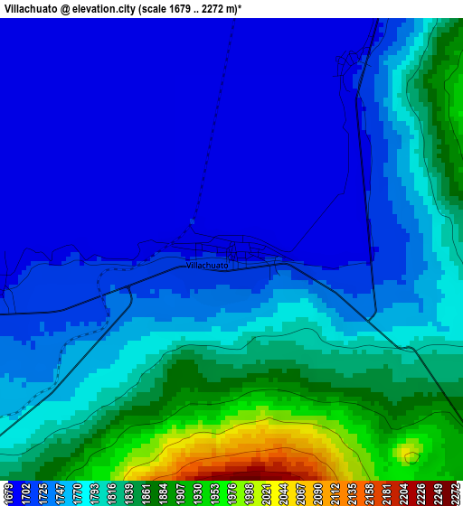
Below is the Elevation map of Villachuato, which displays elevation range with different colors. Scale of the first map is from 1679 to 2272 m (5509 to 7454 ft) with average elevation of 1771.5 meters (=5812 ft) [note 1]
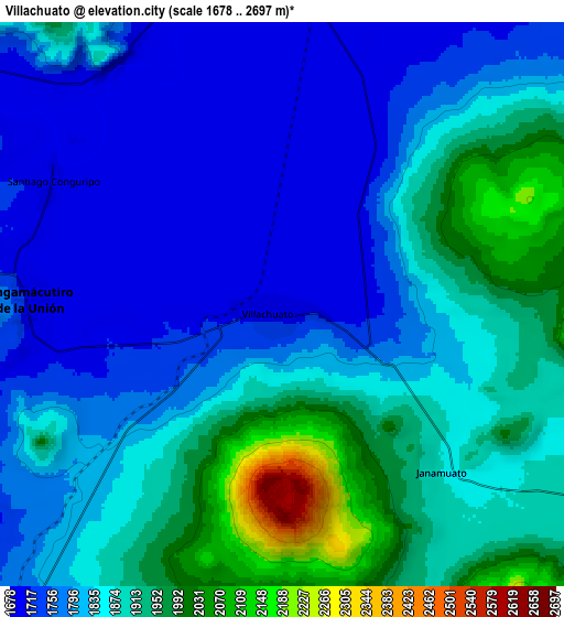
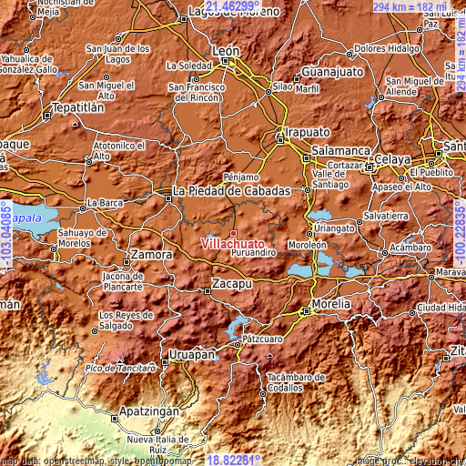
These maps also provides idea of topography and contour of this city, they are displayed at different zoom levels. More info about maps, scale and edge coordinates you can find below images.
| \ | Map #1 | Map #2 | Topo.Map |
| Scale [m] | 1679..2272 m | 1678..2697 m | × |
| Scale [ft] | 5509..7454 ft | 5505..8848 ft | × |
| Average | 1771.5 m = 5812 ft | 1839.2 m = 6034 ft | × |
| Width | 9.17 km = 5.7 mi | 18.35 km = 11.4 mi | 293.6 km = 182.4 mi |
| Height | 9.17 km = 5.7 mi | 18.35 km = 11.4 mi | 293.6 km = 182.4 mi |
| ↑Max Latitude | 20.189731° | 20.23097° | 21.46299° |
| Latitude at center | 20.14848° | 20.14848° | 20.14848° |
| ↓Min Latitude | 20.107219° | 20.065946° | 18.82281° |
| ← Min Longitude | -101.678545° | -101.722491° | -103.04085° |
| Longitude center | -101.6346° | -101.6346° | -101.6346° |
| →Max Longitude | -101.590655° | -101.546709° | -100.22835° |
Nearby cities:
Cities around Villachuato sort by population:
• Puruándiro elevation 1891 m
14.1 km,  118°
118°
• Angamacutiro de la Unión 1705 m
8 km,  271°
271°
• Galeana 1939 m
14.2 km,  152°
152°
• San Martín 1690 m
7.9 km,  17°
17°
• Janamuato 1874 m
7.5 km,  136°
136°
• Tres Mezquites 1690 m
12.6 km,  3°
3°
• Manuel Villalongín 1716 m
15 km,  48°
48°
• El Maluco 1698 m
4.3 km,  263°
263°
• La Calle 1702 m
15.3 km,  359°
359°
• Potreros 1703 m
12 km,  348°
348°
• Janambo 1823 m
13 km,  60°
60°
• Agua Caliente 1731 m
14 km,  228°
228°
Multilingual:
 En español:
Villachuato elevación 1695 m.
 En France:
Villachuato élévation 1695 m.
 Auf Deutsch:
Villachuato höhe über dem Meeresspiegel ist 1695 m.

Sources and notes:
- [note 1] Map square and city borders are not equal. Map elevation data is calculated only from area inside that square.
- [src 1] Elevation data from geonames database provided with same terms of usage.
- [src 2] The elevation map of Villachuato is generated using elevation data from NASA's 3 arcsec (90m) resolution SRTM data.
- [src 3] Base (background) map © OpenStreetMap contributors tiles are generated by Geofabrik and OpenTopoMap.
Copyright & License:
This Villachuato Elevation Map is licensed under CC BY-SA. You may reuse any part from this page, if you give a proper credit by linking to this URL:
 More info on terms of use page.