San Isidro el Berro elevation
San Isidro el Berro (Veracruz, Mariano Escobedo), Mexico elevation is 2594 meters and San Isidro el Berro elevation in feet is 8510 ft above sea level [src 1]. San Isidro el Berro is a populated place (feature code) with elevation that is 1280 meters (4199 ft) bigger than average city elevation in Mexico.
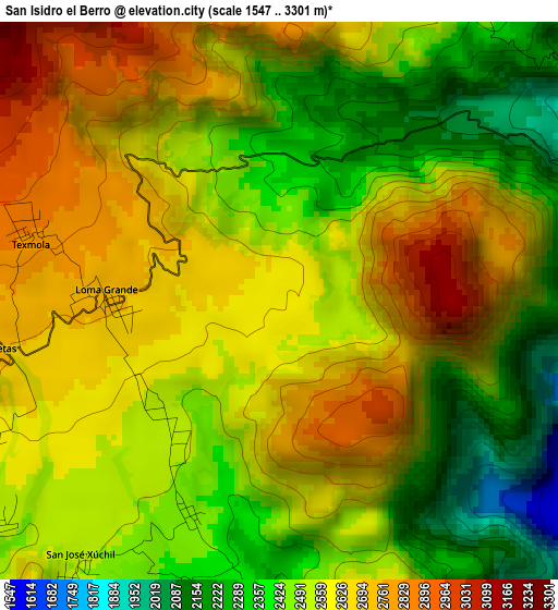
Below is the Elevation map of San Isidro el Berro, which displays elevation range with different colors. Scale of the first map is from 1547 to 3301 m (5075 to 10830 ft) with average elevation of 2540.7 meters (=8336 ft) [note 1]
These maps also provides idea of topography and contour of this city, they are displayed at different zoom levels. More info about maps, scale and edge coordinates you can find below images.
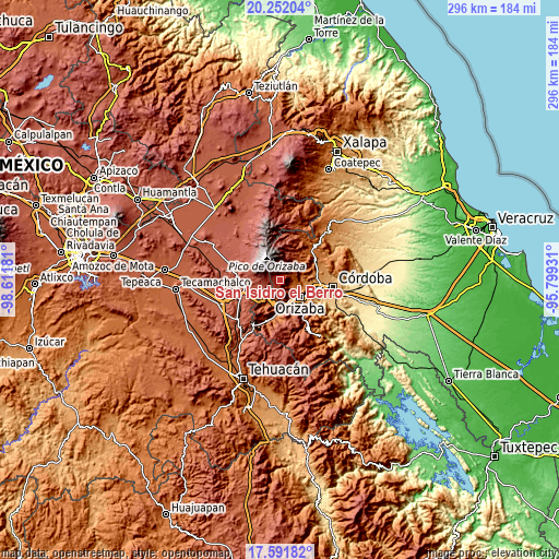
| \ | Map #1 | Topo.Map |
| Scale [m] | 1547..3301 m | × |
| Scale [ft] | 5075..10830 ft | × |
| Average | 2540.7 m = 8336 ft | × |
| Width | 9.24 km = 5.7 mi | 295.8 km = 183.8 mi |
| Height | 9.24 km = 5.7 mi | 295.8 km = 183.8 mi |
| ↑Max Latitude | 18.968784° | 20.25204° |
| Latitude at center | 18.92722° | 18.92722° |
| ↓Min Latitude | 18.885646° | 17.59182° |
| ← Min Longitude | -97.249505° | -98.61181° |
| Longitude center | -97.20556° | -97.20556° |
| →Max Longitude | -97.161615° | -95.79931° |
Nearby cities:
Cities around San Isidro el Berro sort by population:
• Ixhuatlancillo elevation 1439 m
6.8 km,  118°
118°
• La Perla 1624 m
7.6 km,  89°
89°
• Mariano Escobedo 1533 m
8.1 km,  100°
100°
• San Isidro 1417 m
9.3 km, 115°
• Loma Grande 2666 m
2.7 km,  258°
258°
• San José Súchil 2492 m
5.5 km,  217°
217°
• Texmola 2850 m
4.3 km,  289°
289°
• Chilapa 2245 m
8.7 km,  38°
38°
• Santa Cruz Texmalaquilla 3119 m
8.8 km,  281°
281°
• Barrio de San Miguel 1577 m
8.5 km, 86°
• Metlac Hernández (Metlac Primero) 1898 m
8.6 km,  49°
49°
• Paso Carretas 2738 m
4.9 km, 260°
Multilingual:
 En español:
San Isidro el Berro elevación 2594 m.
 En France:
San Isidro el Berro élévation 2594 m.
 Auf Deutsch:
San Isidro el Berro höhe über dem Meeresspiegel ist 2594 m.
 На русском:
San Isidro el Berro высота над уровнем моря 2594 м
Sources and notes:
- [note 1] Map square and city borders are not equal. Map elevation data is calculated only from area inside that square.
- [src 1] Elevation data from geonames database provided with same terms of usage.
- [src 2] The elevation map of San Isidro el Berro is generated using elevation data from NASA's 3 arcsec (90m) resolution SRTM data.
- [src 3] Base (background) map © OpenStreetMap contributors tiles are generated by Geofabrik and OpenTopoMap.
Copyright & License:
This San Isidro el Berro Elevation Map is licensed under CC BY-SA. You may reuse any part from this page, if you give a proper credit by linking to this URL:
 More info on terms of use page.