Agua Buena elevation
Agua Buena (San Luis Potosí, Tamasopo), Mexico elevation is 366 meters and Agua Buena elevation in feet is 1201 ft above sea level [src 1]. Agua Buena is a populated place (feature code) with elevation that is 948 meters (3110 ft) smaller than average city elevation in Mexico.
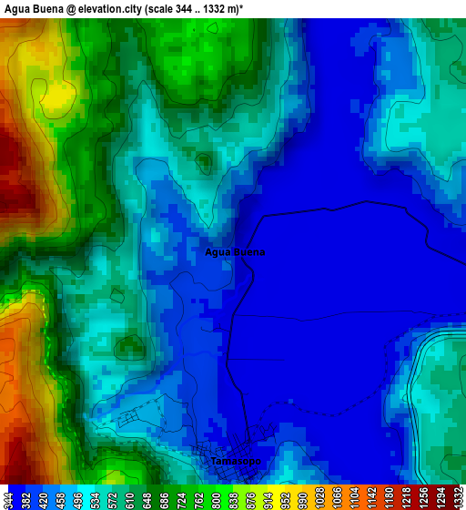
Below is the Elevation map of Agua Buena, which displays elevation range with different colors. Scale of the first map is from 344 to 1332 m (1129 to 4370 ft) with average elevation of 550.3 meters (=1805 ft) [note 1]
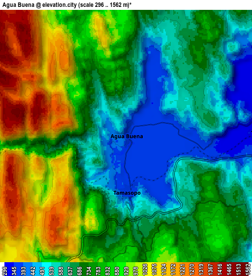
These maps also provides idea of topography and contour of this city, they are displayed at different zoom levels. More info about maps, scale and edge coordinates you can find below images.
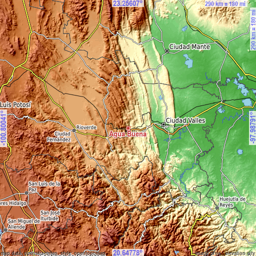
| \ | Map #1 | Map #2 | Topo.Map |
| Scale [m] | 344..1332 m | 296..1562 m | × |
| Scale [ft] | 1129..4370 ft | 971..5125 ft | × |
| Average | 550.3 m = 1805 ft | 773.8 m = 2539 ft | × |
| Width | 9.06 km = 5.6 mi | 18.13 km = 11.3 mi | 290 km = 180.2 mi |
| Height | 9.06 km = 5.6 mi | 18.13 km = 11.3 mi | 290 km = 180.2 mi |
| ↑Max Latitude | 21.998662° | 22.039402° | 23.25607° |
| Latitude at center | 21.95791° | 21.95791° | 21.95791° |
| ↓Min Latitude | 21.917147° | 21.876372° | 20.64778° |
| ← Min Longitude | -99.438105° | -99.482051° | -100.80041° |
| Longitude center | -99.39416° | -99.39416° | -99.39416° |
| →Max Longitude | -99.350215° | -99.306269° | -97.98791° |
Nearby cities:
Cities around Agua Buena sort by population:
• Cárdenas elevation 1220 m
26.1 km,  280°
280°
• Rayón 973 m
28.6 km,  243°
243°
• Tamasopo 361 m
3.7 km,  179°
179°
• Tambaca 327 m
9.6 km,  88°
88°
• Rascón 295 m
14.2 km,  84°
84°
• Damian Carmona 360 m
18.7 km,  34°
34°
• La Lima 142 m
30.2 km,  96°
96°
• Higinio Olivo 1185 m
19.3 km, 277°
• Alaquines 1284 m
28.6 km,  311°
311°
• Ojo de Agua 149 m
28.9 km, 89°
• Martinez 1318 m
26.8 km,  297°
297°
• Nuevo Crucitas 229 m
25.7 km,  49°
49°
Multilingual:
 En español:
Agua Buena elevación 366 m.
 En France:
Agua Buena élévation 366 m.
 Auf Deutsch:
Agua Buena höhe über dem Meeresspiegel ist 366 m.

Sources and notes:
- [note 1] Map square and city borders are not equal. Map elevation data is calculated only from area inside that square.
- [src 1] Elevation data from geonames database provided with same terms of usage.
- [src 2] The elevation map of Agua Buena is generated using elevation data from NASA's 3 arcsec (90m) resolution SRTM data.
- [src 3] Base (background) map © OpenStreetMap contributors tiles are generated by Geofabrik and OpenTopoMap.
Copyright & License:
This Agua Buena Elevation Map is licensed under CC BY-SA. You may reuse any part from this page, if you give a proper credit by linking to this URL:
 More info on terms of use page.