Aldama elevation
Aldama (Tamaulipas), Mexico elevation is 133 meters and Aldama elevation in feet is 436 ft above sea level [src 1]. Aldama is a seat of a second-order administrative division (feature code) with elevation that is 1181 meters (3875 ft) smaller than average city elevation in Mexico.
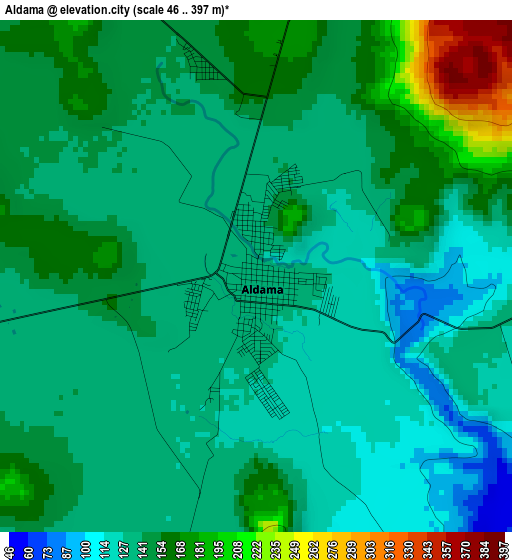
Below is the Elevation map of Aldama, which displays elevation range with different colors. Scale of the first map is from 46 to 397 m (151 to 1302 ft) with average elevation of 143.2 meters (=470 ft) [note 1]
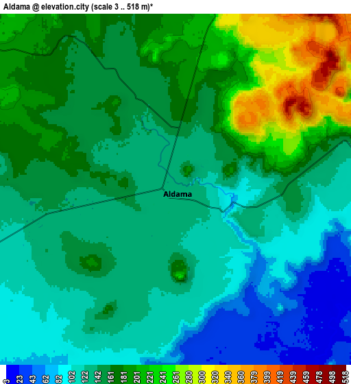
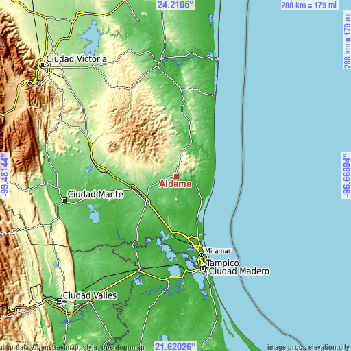
These maps also provides idea of topography and contour of this city, they are displayed at different zoom levels. More info about maps, scale and edge coordinates you can find below images.
| \ | Map #1 | Map #2 | Topo.Map |
| Scale [m] | 46..397 m | 3..518 m | × |
| Scale [ft] | 151..1302 ft | 10..1699 ft | × |
| Average | 143.2 m = 470 ft | 152.2 m = 499 ft | × |
| Width | 9 km = 5.6 mi | 18 km = 11.2 mi | 288 km = 179 mi |
| Height | 9 km = 5.6 mi | 18 km = 11.2 mi | 288 km = 179 mi |
| ↑Max Latitude | 22.962039° | 23.002496° | 24.2105° |
| Latitude at center | 22.92157° | 22.92157° | 22.92157° |
| ↓Min Latitude | 22.881089° | 22.840595° | 21.62026° |
| ← Min Longitude | -98.119135° | -98.163081° | -99.48144° |
| Longitude center | -98.07519° | -98.07519° | -98.07519° |
| →Max Longitude | -98.031245° | -97.987299° | -96.66894° |
Nearby cities:
Cities around Aldama sort by population:
• Ursulo Galván elevation 80 m
33.2 km,  229°
229°
• González 91 m
37.5 km,  253°
253°
• Cuauhtémoc 16 m
42.7 km,  190°
190°
• Graciano Sánchez 40 m
57.4 km,  238°
238°
• Carrillo Puerto 15 m
55.7 km,  168°
168°
• Esteros 26 m
44.9 km, 186°
• Ricardo Flores Magón 8 m
55.1 km,  161°
161°
• Maclovio Herrera 57 m
46.8 km,  181°
181°
• La Colonia 19 m
54 km, 173°
• Lomas del Real 16 m
48.1 km, 157°
• Nuevo Cereso Regional de Altamira 29 m
51.7 km, 172°
• Unidos Avanzamos 17 m
55.3 km, 168°
Multilingual:
 En español:
Aldama elevación 133 m.
 En France:
Aldama élévation 133 m.


Sources and notes:
- [note 1] Map square and city borders are not equal. Map elevation data is calculated only from area inside that square.
- [src 1] Elevation data from geonames database provided with same terms of usage.
- [src 2] The elevation map of Aldama is generated using elevation data from NASA's 3 arcsec (90m) resolution SRTM data.
- [src 3] Base (background) map © OpenStreetMap contributors tiles are generated by Geofabrik and OpenTopoMap.
Copyright & License:
This Aldama Elevation Map is licensed under CC BY-SA. You may reuse any part from this page, if you give a proper credit by linking to this URL:
 More info on terms of use page.