Ursulo Galván elevation
Ursulo Galván (Tamaulipas, González), Mexico elevation is 80 meters and Ursulo Galván elevation in feet is 262 ft above sea level [src 1]. Ursulo Galván is a populated place (feature code) with elevation that is 1234 meters (4049 ft) smaller than average city elevation in Mexico.
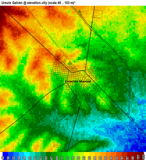
Below is the Elevation map of Ursulo Galván, which displays elevation range with different colors. Scale of the first map is from 48 to 103 m (157 to 338 ft) with average elevation of 74 meters (=243 ft) [note 1]
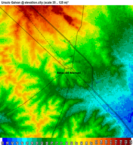
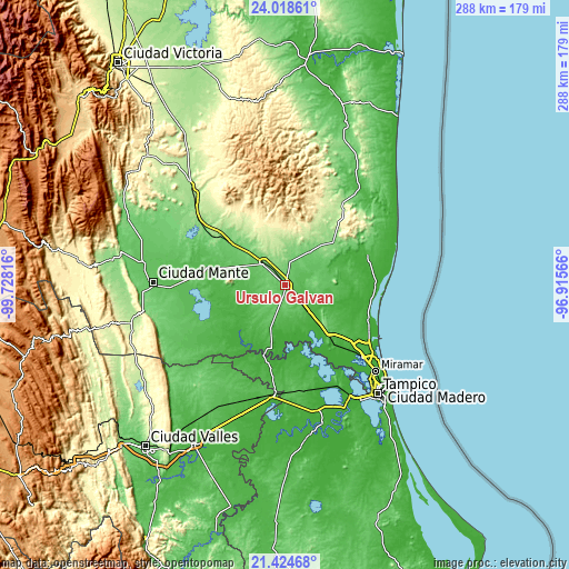
These maps also provides idea of topography and contour of this city, they are displayed at different zoom levels. More info about maps, scale and edge coordinates you can find below images.
| \ | Map #1 | Map #2 | Topo.Map |
| Scale [m] | 48..103 m | 35..125 m | × |
| Scale [ft] | 157..338 ft | 115..410 ft | × |
| Average | 74 m = 243 ft | 76.8 m = 252 ft | × |
| Width | 9.01 km = 5.6 mi | 18.03 km = 11.2 mi | 288.4 km = 179.2 mi |
| Height | 9.01 km = 5.6 mi | 18.03 km = 11.2 mi | 288.4 km = 179.2 mi |
| ↑Max Latitude | 22.768317° | 22.808832° | 24.01861° |
| Latitude at center | 22.72779° | 22.72779° | 22.72779° |
| ↓Min Latitude | 22.687251° | 22.6467° | 21.42468° |
| ← Min Longitude | -98.365855° | -98.409801° | -99.72816° |
| Longitude center | -98.32191° | -98.32191° | -98.32191° |
| →Max Longitude | -98.277965° | -98.234019° | -96.91566° |
Nearby cities:
Cities around Ursulo Galván sort by population:
• Aldama elevation 133 m
33.2 km,  49°
49°
• González 91 m
15.5 km,  315°
315°
• Cuauhtémoc 16 m
26.9 km,  139°
139°
• Graciano Sánchez 40 m
25.2 km,  251°
251°
• Guayalejo 38 m
41.7 km,  203°
203°
• Nueva Apolonia 32 m
40.8 km,  231°
231°
• Esteros 26 m
30.6 km, 138°
• Los Aztecas 30 m
39.2 km, 229°
• Nuevo Tantoán 31 m
42 km,  217°
217°
• López Rayón 30 m
29.2 km,  208°
208°
• Maclovio Herrera 57 m
35 km, 136°
• San Antonio Rayón 23 m
35.5 km, 195°
Multilingual:
 En español:
Ursulo Galván elevación 80 m.
 En France:
Ursulo Galván élévation 80 m.
 Auf Deutsch:
Ursulo Galván höhe über dem Meeresspiegel ist 80 m.

Sources and notes:
- [note 1] Map square and city borders are not equal. Map elevation data is calculated only from area inside that square.
- [src 1] Elevation data from geonames database provided with same terms of usage.
- [src 2] The elevation map of Ursulo Galván is generated using elevation data from NASA's 3 arcsec (90m) resolution SRTM data.
- [src 3] Base (background) map © OpenStreetMap contributors tiles are generated by Geofabrik and OpenTopoMap.
Copyright & License:
This Ursulo Galván Elevation Map is licensed under CC BY-SA. You may reuse any part from this page, if you give a proper credit by linking to this URL:
 More info on terms of use page.