Ayotzintepec elevation
Ayotzintepec (Oaxaca), Mexico elevation is 124 meters and Ayotzintepec elevation in feet is 407 ft above sea level [src 1]. Ayotzintepec is a populated place (feature code) with elevation that is 1190 meters (3904 ft) smaller than average city elevation in Mexico.
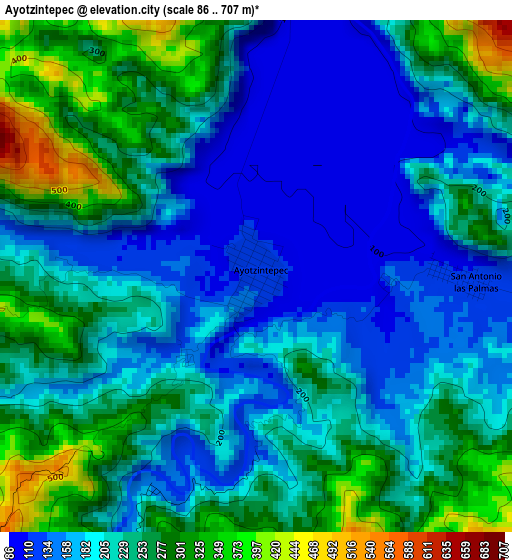
Below is the Elevation map of Ayotzintepec, which displays elevation range with different colors. Scale of the first map is from 86 to 707 m (282 to 2320 ft) with average elevation of 219.8 meters (=721 ft) [note 1]
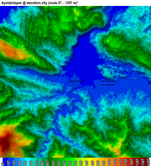
These maps also provides idea of topography and contour of this city, they are displayed at different zoom levels. More info about maps, scale and edge coordinates you can find below images.
| \ | Map #1 | Map #2 | Topo.Map |
| Scale [m] | 86..707 m | 57..1357 m | × |
| Scale [ft] | 282..2320 ft | 187..4452 ft | × |
| Average | 219.8 m = 721 ft | 380.1 m = 1247 ft | × |
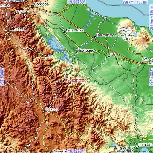
| Width | 9.31 km = 5.8 mi | 18.62 km = 11.6 mi | 297.9 km = 185.1 mi |
| Height | 9.31 km = 5.8 mi | 18.62 km = 11.6 mi | 298 km = 185.2 mi |
| ↑Max Latitude | 17.714477° | 17.756333° | 19.00739° |
| Latitude at center | 17.67261° | 17.67261° | 17.67261° |
| ↓Min Latitude | 17.630734° | 17.588848° | 16.32784° |
| ← Min Longitude | -96.172495° | -96.216441° | -97.5348° |
| Longitude center | -96.12855° | -96.12855° | -96.12855° |
| →Max Longitude | -96.084605° | -96.040659° | -94.7223° |
Nearby cities:
Cities around Ayotzintepec sort by population:
• Valle Nacional elevation 86 m
21.6 km,  302°
302°
• Río Chiquito 82 m
21.1 km,  106°
106°
• San José Río Manzo 89 m
26.3 km,  90°
90°
• San Pedro Ozumacín 398 m
10.3 km,  273°
273°
• San Antonio las Palmas 119 m
4 km, 91°
• Pueblo Viejo 77 m
27.2 km,  16°
16°
• Santa María Jacatepec 57 m
22.7 km,  337°
337°
• Vega del Sol 63 m
17.9 km,  328°
328°
• Arroyo de Banco 168 m
27.4 km, 301°
• Santa Fe y la Mar 122 m
22.4 km, 297°
• San Juan Petlapa 675 m
24.7 km,  156°
156°
• Santiago Camotlán 1413 m
26 km,  193°
193°
Multilingual:
 En español:
Ayotzintepec elevación 124 m.
 En France:
Ayotzintepec élévation 124 m.
 Auf Deutsch:
Ayotzintepec höhe über dem Meeresspiegel ist 124 m.

Sources and notes:
- [note 1] Map square and city borders are not equal. Map elevation data is calculated only from area inside that square.
- [src 1] Elevation data from geonames database provided with same terms of usage.
- [src 2] The elevation map of Ayotzintepec is generated using elevation data from NASA's 3 arcsec (90m) resolution SRTM data.
- [src 3] Base (background) map © OpenStreetMap contributors tiles are generated by Geofabrik and OpenTopoMap.
Copyright & License:
This Ayotzintepec Elevation Map is licensed under CC BY-SA. You may reuse any part from this page, if you give a proper credit by linking to this URL:
 More info on terms of use page.