Buenavista de Cuéllar elevation
Buenavista de Cuéllar (Guerrero), Mexico elevation is 1255 meters and Buenavista de Cuéllar elevation in feet is 4117 ft above sea level [src 1]. Buenavista de Cuéllar is a seat of a second-order administrative division (feature code) with elevation that is 59 meters (194 ft) smaller than average city elevation in Mexico.
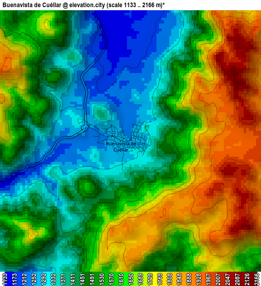
Below is the Elevation map of Buenavista de Cuéllar, which displays elevation range with different colors. Scale of the first map is from 1133 to 2166 m (3717 to 7106 ft) with average elevation of 1558.8 meters (=5114 ft) [note 1]
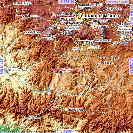
These maps also provides idea of topography and contour of this city, they are displayed at different zoom levels. More info about maps, scale and edge coordinates you can find below images.
| \ | Map #1 | Map #2 | Topo.Map |
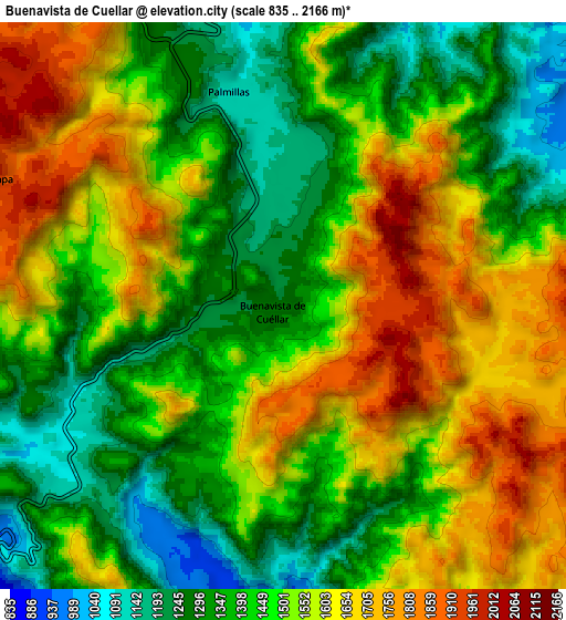
| Scale [m] | 1133..2166 m | 835..2166 m | × |
| Scale [ft] | 3717..7106 ft | 2740..7106 ft | × |
| Average | 1558.8 m = 5114 ft | 1493.8 m = 4901 ft | × |
| Width | 9.27 km = 5.8 mi | 18.54 km = 11.5 mi | 296.6 km = 184.3 mi |
| Height | 9.27 km = 5.8 mi | 18.54 km = 11.5 mi | 296.6 km = 184.3 mi |
| ↑Max Latitude | 18.501259° | 18.542928° | 19.78819° |
| Latitude at center | 18.45958° | 18.45958° | 18.45958° |
| ↓Min Latitude | 18.417891° | 18.376191° | 17.12061° |
| ← Min Longitude | -99.452625° | -99.496571° | -100.81493° |
| Longitude center | -99.40868° | -99.40868° | -99.40868° |
| →Max Longitude | -99.364735° | -99.320789° | -98.00243° |
Nearby cities:
Cities around Buenavista de Cuéllar sort by population:
• Tlamacazapa elevation 1952 m
10.5 km,  292°
292°
• Amacuzac 922 m
16 km,  14°
14°
• Tilzapotla 1016 m
14.5 km,  76°
76°
• Tlaxmalac 893 m
11 km,  182°
182°
• Tuxpan 762 m
14.4 km,  211°
211°
• Huajintlán 930 m
16.7 km,  354°
354°
• Casahuatlán 985 m
12.7 km, 8°
• El Estudiante 871 m
17.6 km,  41°
41°
• Santa Fe Tepetlapa 1056 m
10.1 km, 350°
• San Vicente Palapa 856 m
15 km, 180°
• Palmillas 1112 m
7.2 km, 345°
• Coahuixtla 929 m
13.4 km,  17°
17°
Multilingual:
 En español:
Buenavista de Cuéllar elevación 1255 m.
 En France:
Buenavista de Cuéllar élévation 1255 m.
 Auf Deutsch:
Buenavista de Cuéllar höhe über dem Meeresspiegel ist 1255 m.
 На русском:
Buenavista de Cuéllar высота над уровнем моря 1255 м
Sources and notes:
- [note 1] Map square and city borders are not equal. Map elevation data is calculated only from area inside that square.
- [src 1] Elevation data from geonames database provided with same terms of usage.
- [src 2] The elevation map of Buenavista de Cuéllar is generated using elevation data from NASA's 3 arcsec (90m) resolution SRTM data.
- [src 3] Base (background) map © OpenStreetMap contributors tiles are generated by Geofabrik and OpenTopoMap.
Copyright & License:
This Buenavista de Cuéllar Elevation Map is licensed under CC BY-SA. You may reuse any part from this page, if you give a proper credit by linking to this URL:
 More info on terms of use page.