Contla elevation
Contla (Tlaxcala, Contla de Juan Cuamatzi), Mexico elevation is 2327 meters and Contla elevation in feet is 7635 ft above sea level [src 1]. Contla is a seat of a second-order administrative division (feature code) with elevation that is 1013 meters (3323 ft) bigger than average city elevation in Mexico.
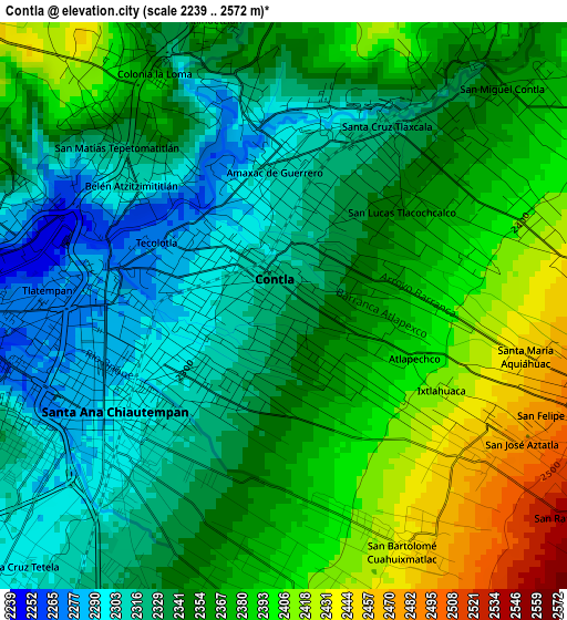
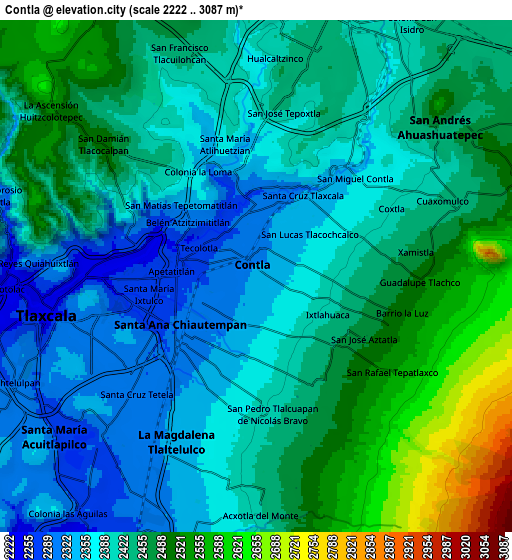
Below is the Elevation map of Contla, which displays elevation range with different colors. Scale of the first map is from 2239 to 2572 m (7346 to 8438 ft) with average elevation of 2354.8 meters (=7726 ft) [note 1]
These maps also provides idea of topography and contour of this city, they are displayed at different zoom levels. More info about maps, scale and edge coordinates you can find below images.
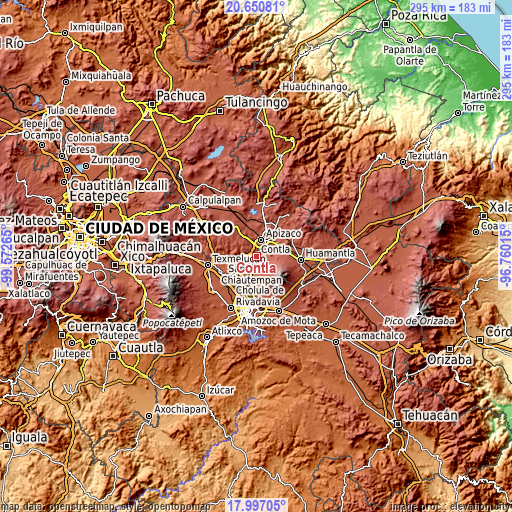
| \ | Map #1 | Map #2 | Topo.Map |
| Scale [m] | 2239..2572 m | 2222..3087 m | × |
| Scale [ft] | 7346..8438 ft | 7290..10128 ft | × |
| Average | 2354.8 m = 7726 ft | 2430.6 m = 7974 ft | × |
| Width | 9.22 km = 5.7 mi | 18.44 km = 11.5 mi | 295.1 km = 183.4 mi |
| Height | 9.22 km = 5.7 mi | 18.44 km = 11.5 mi | 295.1 km = 183.4 mi |
| ↑Max Latitude | 19.370783° | 19.412235° | 20.65081° |
| Latitude at center | 19.32932° | 19.32932° | 19.32932° |
| ↓Min Latitude | 19.287847° | 19.246363° | 17.99705° |
| ← Min Longitude | -98.210345° | -98.254291° | -99.57265° |
| Longitude center | -98.1664° | -98.1664° | -98.1664° |
| →Max Longitude | -98.122455° | -98.078509° | -96.76015° |
Nearby cities:
Cities around Contla sort by population:
• Tlaxcala elevation 2277 m
3.7 km,  251°
251°
• Santa Ana Chiautempan 2301 m
3.4 km,  221°
221°
• Amaxac de Guerrero 2303 m
2 km,  347°
347°
• Apetatitlán Antonio Carbajal 2291 m
1.5 km,  299°
299°
• Santa Cruz Tlaxcala 2325 m
3.3 km,  30°
30°
• San Bartolomé Cuahuixmatlac 2440 m
4.4 km,  154°
154°
• Belén Atzitzimititlán 2310 m
3.2 km,  308°
308°
• Tlatempan 2275 m
3.9 km,  273°
273°
• San Pedro Xochiteotla 2458 m
3.8 km,  129°
129°
• San Matías Tepetomatitlán 2339 m
4.1 km, 312°
• San Lucas Tlacochcalco 2358 m
2.6 km,  54°
54°
• Jesús Huitznahuac 2404 m
4.3 km,  69°
69°
Multilingual:
 En español:
Contla elevación 2327 m.
 En France:
Contla élévation 2327 m.


Sources and notes:
- [note 1] Map square and city borders are not equal. Map elevation data is calculated only from area inside that square.
- [src 1] Elevation data from geonames database provided with same terms of usage.
- [src 2] The elevation map of Contla is generated using elevation data from NASA's 3 arcsec (90m) resolution SRTM data.
- [src 3] Base (background) map © OpenStreetMap contributors tiles are generated by Geofabrik and OpenTopoMap.
Copyright & License:
This Contla Elevation Map is licensed under CC BY-SA. You may reuse any part from this page, if you give a proper credit by linking to this URL:
 More info on terms of use page.