San Bartolomé Cuahuixmatlac elevation
San Bartolomé Cuahuixmatlac (Tlaxcala, Chiautempan), Mexico elevation is 2440 meters and San Bartolomé Cuahuixmatlac elevation in feet is 8005 ft above sea level [src 1]. San Bartolomé Cuahuixmatlac is a populated place (feature code) with elevation that is 1126 meters (3694 ft) bigger than average city elevation in Mexico.
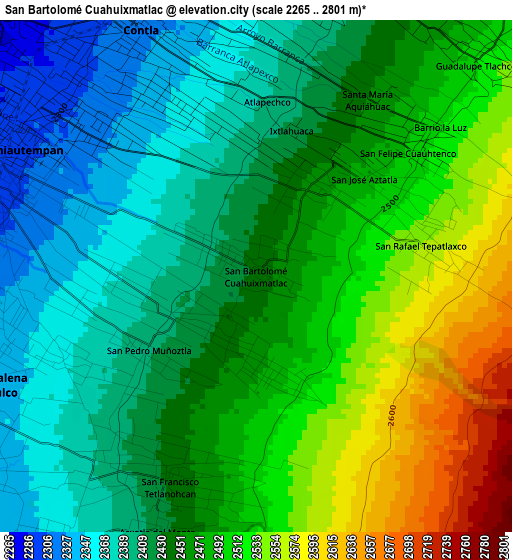
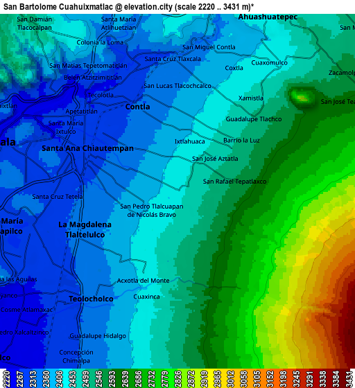
Below is the Elevation map of San Bartolomé Cuahuixmatlac, which displays elevation range with different colors. Scale of the first map is from 2265 to 2801 m (7431 to 9190 ft) with average elevation of 2456 meters (=8058 ft) [note 1]
These maps also provides idea of topography and contour of this city, they are displayed at different zoom levels. More info about maps, scale and edge coordinates you can find below images.
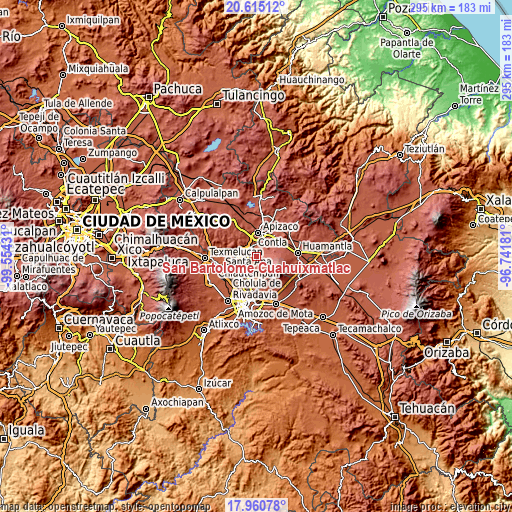
| \ | Map #1 | Map #2 | Topo.Map |
| Scale [m] | 2265..2801 m | 2220..3431 m | × |
| Scale [ft] | 7431..9190 ft | 7283..11257 ft | × |
| Average | 2456 m = 8058 ft | 2503.8 m = 8215 ft | × |
| Width | 9.22 km = 5.7 mi | 18.45 km = 11.5 mi | 295.1 km = 183.4 mi |
| Height | 9.22 km = 5.7 mi | 18.45 km = 11.5 mi | 295.2 km = 183.4 mi |
| ↑Max Latitude | 19.334802° | 19.376264° | 20.61512° |
| Latitude at center | 19.29333° | 19.29333° | 19.29333° |
| ↓Min Latitude | 19.251847° | 19.210354° | 17.96078° |
| ← Min Longitude | -98.192005° | -98.235951° | -99.55431° |
| Longitude center | -98.14806° | -98.14806° | -98.14806° |
| →Max Longitude | -98.104115° | -98.060169° | -96.74181° |
Nearby cities:
Cities around San Bartolomé Cuahuixmatlac sort by population:
• Santa Ana Chiautempan elevation 2301 m
4.4 km,  289°
289°
• Contla 2327 m
4.4 km,  334°
334°
• La Magdalena Tlaltelulco 2326 m
5.2 km,  257°
257°
• San Francisco Tetlanohcan 2434 m
4 km,  204°
204°
• Tetlanohcán 2431 m
4.1 km, 204°
• San Pedro Muñoztla 2405 m
2.4 km,  236°
236°
• Guadalupe Tlachco 2509 m
5.6 km,  45°
45°
• San José Aztatla 2488 m
2.9 km, 50°
• San Pedro Xochiteotla 2458 m
1.9 km,  31°
31°
• San Lucas Tlacochcalco 2358 m
5.5 km,  1°
1°
• Acxotla del Monte 2408 m
5 km, 204°
• San Rafael Tepatlaxco 2550 m
3 km,  79°
79°
Multilingual:
 En español:
San Bartolomé Cuahuixmatlac elevación 2440 m.
 En France:
San Bartolomé Cuahuixmatlac élévation 2440 m.
 Auf Deutsch:
San Bartolomé Cuahuixmatlac höhe über dem Meeresspiegel ist 2440 m.
 На русском:
San Bartolomé Cuahuixmatlac высота над уровнем моря 2440 м
Sources and notes:
- [note 1] Map square and city borders are not equal. Map elevation data is calculated only from area inside that square.
- [src 1] Elevation data from geonames database provided with same terms of usage.
- [src 2] The elevation map of San Bartolomé Cuahuixmatlac is generated using elevation data from NASA's 3 arcsec (90m) resolution SRTM data.
- [src 3] Base (background) map © OpenStreetMap contributors tiles are generated by Geofabrik and OpenTopoMap.
Copyright & License:
This San Bartolomé Cuahuixmatlac Elevation Map is licensed under CC BY-SA. You may reuse any part from this page, if you give a proper credit by linking to this URL:
 More info on terms of use page.