Huejotzingo elevation
Huejotzingo (Puebla), Mexico elevation is 2275 meters and Huejotzingo elevation in feet is 7464 ft above sea level [src 1]. Huejotzingo is a seat of a second-order administrative division (feature code) with elevation that is 961 meters (3153 ft) bigger than average city elevation in Mexico.
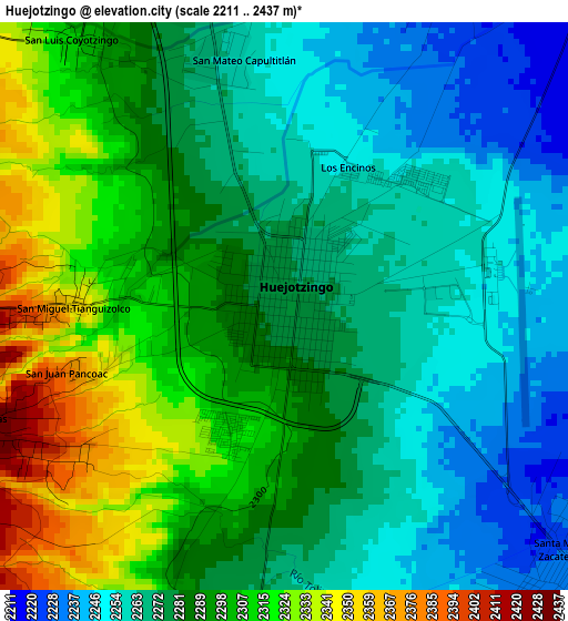
Below is the Elevation map of Huejotzingo, which displays elevation range with different colors. Scale of the first map is from 2211 to 2437 m (7254 to 7995 ft) with average elevation of 2284.5 meters (=7495 ft) [note 1]
These maps also provides idea of topography and contour of this city, they are displayed at different zoom levels. More info about maps, scale and edge coordinates you can find below images.
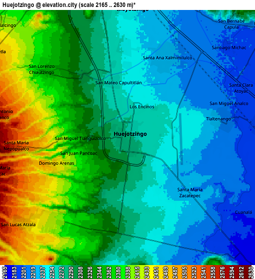
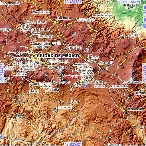
| \ | Map #1 | Map #2 | Topo.Map |
| Scale [m] | 2211..2437 m | 2165..2630 m | × |
| Scale [ft] | 7254..7995 ft | 7103..8629 ft | × |
| Average | 2284.5 m = 7495 ft | 2304.1 m = 7559 ft | × |
| Width | 9.23 km = 5.7 mi | 18.46 km = 11.5 mi | 295.4 km = 183.6 mi |
| Height | 9.23 km = 5.7 mi | 18.46 km = 11.5 mi | 295.4 km = 183.6 mi |
| ↑Max Latitude | 19.200426° | 19.241922° | 20.48183° |
| Latitude at center | 19.15892° | 19.15892° | 19.15892° |
| ↓Min Latitude | 19.117404° | 19.075877° | 17.82532° |
| ← Min Longitude | -98.452185° | -98.496131° | -99.81449° |
| Longitude center | -98.40824° | -98.40824° | -98.40824° |
| →Max Longitude | -98.364295° | -98.320349° | -97.00199° |
Nearby cities:
Cities around Huejotzingo sort by population:
• Santa Ana Xalmimilulco elevation 2224 m
6.6 km,  24°
24°
• Santa María Zacatepec 2223 m
6 km,  131°
131°
• San Lorenzo Chiautzingo 2372 m
8 km,  309°
309°
• San Andrés Calpan 2427 m
8.3 km,  222°
222°
• Tlaltenango 2210 m
7.2 km,  78°
78°
• Domingo Arenas 2447 m
5.5 km,  247°
247°
• San Miguel Tianguizolco 2358 m
3.4 km,  269°
269°
• San Mateo Capultitlán 2258 m
4.1 km,  349°
349°
• San Luis Coyotzingo 2299 m
5.3 km,  325°
325°
• San Miguel Analco 2200 m
7.6 km,  71°
71°
• San Juan Pancoac 2380 m
3.7 km, 252°
• Los Encinos 2255 m
2.5 km, 24°
Multilingual:
 En español:
Huejotzingo elevación 2275 m.
 En France:
Huejotzingo élévation 2275 m.
 Auf Deutsch:
Huejotzingo höhe über dem Meeresspiegel ist 2275 m.

Sources and notes:
- [note 1] Map square and city borders are not equal. Map elevation data is calculated only from area inside that square.
- [src 1] Elevation data from geonames database provided with same terms of usage.
- [src 2] The elevation map of Huejotzingo is generated using elevation data from NASA's 3 arcsec (90m) resolution SRTM data.
- [src 3] Base (background) map © OpenStreetMap contributors tiles are generated by Geofabrik and OpenTopoMap.
Copyright & License:
This Huejotzingo Elevation Map is licensed under CC BY-SA. You may reuse any part from this page, if you give a proper credit by linking to this URL:
 More info on terms of use page.