La Joya elevation
La Joya (Morelos, Coatlán del Río), Mexico elevation is 1010 meters and La Joya elevation in feet is 3314 ft above sea level [src 1]. La Joya is a populated place (feature code) with elevation that is 304 meters (997 ft) smaller than average city elevation in Mexico.
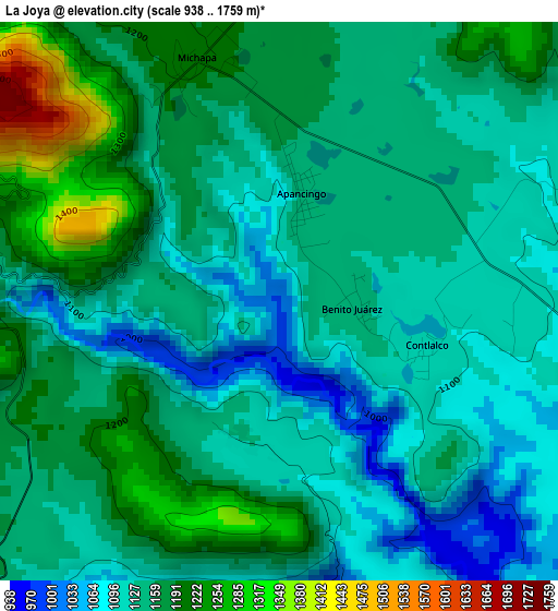
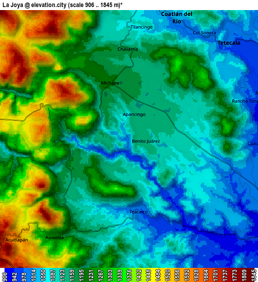
Below is the Elevation map of La Joya, which displays elevation range with different colors. Scale of the first map is from 938 to 1759 m (3077 to 5771 ft) with average elevation of 1149.7 meters (=3772 ft) [note 1]
These maps also provides idea of topography and contour of this city, they are displayed at different zoom levels. More info about maps, scale and edge coordinates you can find below images.
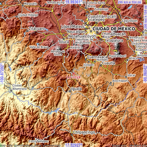
| \ | Map #1 | Map #2 | Topo.Map |
| Scale [m] | 938..1759 m | 906..1845 m | × |
| Scale [ft] | 3077..5771 ft | 2972..6053 ft | × |
| Average | 1149.7 m = 3772 ft | 1194 m = 3917 ft | × |
| Width | 9.26 km = 5.8 mi | 18.52 km = 11.5 mi | 296.2 km = 184 mi |
| Height | 9.26 km = 5.8 mi | 18.52 km = 11.5 mi | 296.3 km = 184.1 mi |
| ↑Max Latitude | 18.708299° | 18.749917° | 19.99361° |
| Latitude at center | 18.66667° | 18.66667° | 18.66667° |
| ↓Min Latitude | 18.625031° | 18.583382° | 17.32927° |
| ← Min Longitude | -99.510615° | -99.554561° | -100.87292° |
| Longitude center | -99.46667° | -99.46667° | -99.46667° |
| →Max Longitude | -99.422725° | -99.378779° | -98.06042° |
Nearby cities:
Cities around La Joya sort by population:
• Amacuzac elevation 922 m
12.7 km,  126°
126°
• Tetecala 986 m
9.9 km,  44°
44°
• Acuitlapan 1579 m
10.8 km,  227°
227°
• Cuauchichinola 945 m
9.6 km,  91°
91°
• Coatlán del Río 1022 m
9.3 km,  22°
22°
• Huajintlán 930 m
7.8 km,  145°
145°
• Axixintla 1222 m
9 km,  217°
217°
• San Andrés Nicolás Bravo 1193 m
11.2 km,  0°
0°
• Cocoyotla 1049 m
9.9 km,  9°
9°
• Chontalcoatlán 1259 m
11.4 km,  263°
263°
• Michapa 1202 m
4.2 km,  341°
341°
• Chavarría 1162 m
6.6 km,  358°
358°
Multilingual:
 En español:
La Joya elevación 1010 m.
 En France:
La Joya élévation 1010 m.
 Auf Deutsch:
La Joya höhe über dem Meeresspiegel ist 1010 m.

Sources and notes:
- [note 1] Map square and city borders are not equal. Map elevation data is calculated only from area inside that square.
- [src 1] Elevation data from geonames database provided with same terms of usage.
- [src 2] The elevation map of La Joya is generated using elevation data from NASA's 3 arcsec (90m) resolution SRTM data.
- [src 3] Base (background) map © OpenStreetMap contributors tiles are generated by Geofabrik and OpenTopoMap.
Copyright & License:
This La Joya Elevation Map is licensed under CC BY-SA. You may reuse any part from this page, if you give a proper credit by linking to this URL:
 More info on terms of use page.