La Laja elevation
La Laja (Querétaro, Tequisquiapan), Mexico elevation is 1961 meters and La Laja elevation in feet is 6434 ft above sea level [src 1]. La Laja is a populated place (feature code) with elevation that is 647 meters (2123 ft) bigger than average city elevation in Mexico.
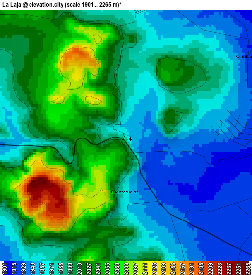
Below is the Elevation map of La Laja, which displays elevation range with different colors. Scale of the first map is from 1901 to 2265 m (6237 to 7431 ft) with average elevation of 1996.6 meters (=6551 ft) [note 1]
These maps also provides idea of topography and contour of this city, they are displayed at different zoom levels. More info about maps, scale and edge coordinates you can find below images.
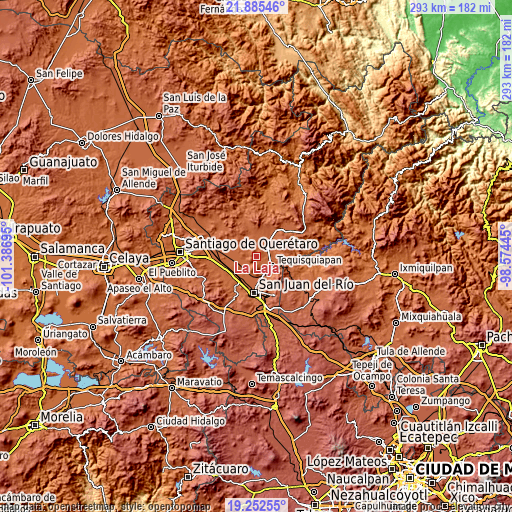
| \ | Map #1 | Topo.Map |
| Scale [m] | 1901..2265 m | × |
| Scale [ft] | 6237..7431 ft | × |
| Average | 1996.6 m = 6551 ft | × |
| Width | 9.15 km = 5.7 mi | 292.8 km = 181.9 mi |
| Height | 9.15 km = 5.7 mi | 292.8 km = 181.9 mi |
| ↑Max Latitude | 20.615817° | 21.88546° |
| Latitude at center | 20.57468° | 20.57468° |
| ↓Min Latitude | 20.533532° | 19.25255° |
| ← Min Longitude | -100.024645° | -101.38695° |
| Longitude center | -99.9807° | -99.9807° |
| →Max Longitude | -99.936755° | -98.57445° |
Nearby cities:
Cities around La Laja sort by population:
• Tequisquiapan elevation 1881 m
10.9 km,  122°
122°
• La Valla 1922 m
9.6 km,  209°
209°
• La Fuente 1918 m
6.3 km,  246°
246°
• Fuentezuelas 1969 m
2.1 km,  183°
183°
• Bordo Blanco 1898 m
10.3 km,  148°
148°
• El Tejocote 2020 m
7.5 km,  311°
311°
• Los Cerritos 1917 m
8.7 km,  260°
260°
• San José de la Laja 1976 m
4.9 km,  6°
6°
• La Tortuga 1926 m
6 km,  98°
98°
• La Trinidad 1965 m
6.8 km,  164°
164°
• Santa Rosa de Lima 1944 m
10.1 km,  1°
1°
• Santillán 1922 m
5.2 km,  55°
55°
Multilingual:
 En español:
La Laja elevación 1961 m.
 En France:
La Laja élévation 1961 m.
 Auf Deutsch:
La Laja höhe über dem Meeresspiegel ist 1961 m.

Sources and notes:
- [note 1] Map square and city borders are not equal. Map elevation data is calculated only from area inside that square.
- [src 1] Elevation data from geonames database provided with same terms of usage.
- [src 2] The elevation map of La Laja is generated using elevation data from NASA's 3 arcsec (90m) resolution SRTM data.
- [src 3] Base (background) map © OpenStreetMap contributors tiles are generated by Geofabrik and OpenTopoMap.
Copyright & License:
This La Laja Elevation Map is licensed under CC BY-SA. You may reuse any part from this page, if you give a proper credit by linking to this URL:
 More info on terms of use page.