La Tigrilla elevation
La Tigrilla (Chiapas, La Concordia), Mexico elevation is 599 meters and La Tigrilla elevation in feet is 1965 ft above sea level [src 1]. La Tigrilla is a populated place (feature code) with elevation that is 715 meters (2346 ft) smaller than average city elevation in Mexico.
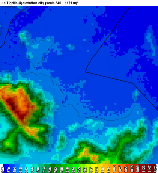
Below is the Elevation map of La Tigrilla, which displays elevation range with different colors. Scale of the first map is from 546 to 1171 m (1791 to 3842 ft) with average elevation of 636.1 meters (=2087 ft) [note 1]
These maps also provides idea of topography and contour of this city, they are displayed at different zoom levels. More info about maps, scale and edge coordinates you can find below images.
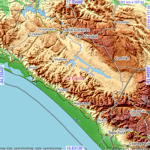
| \ | Map #1 | Topo.Map |
| Scale [m] | 546..1171 m | × |
| Scale [ft] | 1791..3842 ft | × |
| Average | 636.1 m = 2087 ft | × |
| Width | 9.39 km = 5.8 mi | 300.6 km = 186.8 mi |
| Height | 9.39 km = 5.8 mi | 300.6 km = 186.8 mi |
| ↑Max Latitude | 16.029931° | 17.33486° |
| Latitude at center | 15.98769° | 15.98769° |
| ↓Min Latitude | 15.94544° | 14.63138° |
| ← Min Longitude | -92.896145° | -94.25845° |
| Longitude center | -92.8522° | -92.8522° |
| →Max Longitude | -92.808255° | -91.44595° |
Nearby cities:
Cities around La Tigrilla sort by population:
• Jaltenango de la Paz elevation 641 m
18.7 km,  132°
132°
• Nuevo Vicente Guerrero 605 m
14.3 km,  293°
293°
• Benito Juárez 568 m
7.1 km,  30°
30°
• El Ámbar (El Ámbar de Echeverría) 561 m
12.3 km,  9°
9°
• Querétaro 683 m
19.5 km,  148°
148°
• Diamante de Echeverría 577 m
14.1 km,  348°
348°
• Dolores Jaltenango 636 m
12.9 km,  141°
141°
• Independencia 566 m
11 km, 7°
• Plan de Agua Prieta 559 m
17.2 km,  22°
22°
• Reforma 581 m
21.4 km,  110°
110°
• El Ramal (Porvenir) 675 m
16.8 km,  216°
216°
• Nueva Libertad 556 m
12.4 km, 22°
Multilingual:
 En español:
Colonia la Tigrilla elevación 599 m.
 En France:
La Tigrilla élévation 599 m.
 Auf Deutsch:
La Tigrilla höhe über dem Meeresspiegel ist 599 m.

Sources and notes:
- [note 1] Map square and city borders are not equal. Map elevation data is calculated only from area inside that square.
- [src 1] Elevation data from geonames database provided with same terms of usage.
- [src 2] The elevation map of La Tigrilla is generated using elevation data from NASA's 3 arcsec (90m) resolution SRTM data.
- [src 3] Base (background) map © OpenStreetMap contributors tiles are generated by Geofabrik and OpenTopoMap.
Copyright & License:
This La Tigrilla Elevation Map is licensed under CC BY-SA. You may reuse any part from this page, if you give a proper credit by linking to this URL:
 More info on terms of use page.