Los Altos elevation
Los Altos (Veracruz, Tantima), Mexico elevation is 20 meters and Los Altos elevation in feet is 66 ft above sea level [src 1]. Los Altos is a populated place (feature code) with elevation that is 1294 meters (4245 ft) smaller than average city elevation in Mexico.
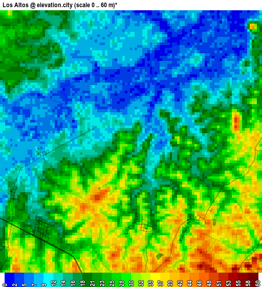
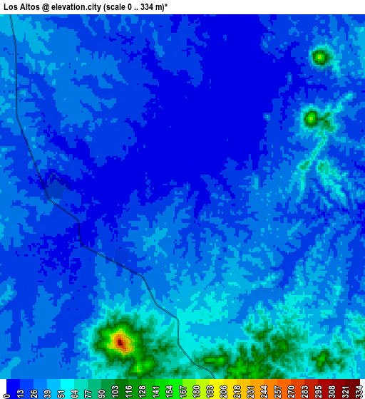
Below is the Elevation map of Los Altos, which displays elevation range with different colors. Scale of the first map is from 0 to 60 m (0 to 197 ft) with average elevation of 19.4 meters (=64 ft) [note 1]
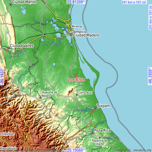
These maps also provides idea of topography and contour of this city, they are displayed at different zoom levels. More info about maps, scale and edge coordinates you can find below images.
| \ | Map #1 | Map #2 | Topo.Map |
| Scale [m] | 0..60 m | 0..334 m | × |
| Scale [ft] | 0..197 ft | 0..1096 ft | × |
| Average | 19.4 m = 64 ft | 31.7 m = 104 ft | × |
| Width | 9.09 km = 5.6 mi | 18.18 km = 11.3 mi | 290.9 km = 180.8 mi |
| Height | 9.09 km = 5.6 mi | 18.18 km = 11.3 mi | 290.9 km = 180.8 mi |
| ↑Max Latitude | 21.550639° | 21.591506° | 22.81209° |
| Latitude at center | 21.50976° | 21.50976° | 21.50976° |
| ↓Min Latitude | 21.46887° | 21.427968° | 20.19566° |
| ← Min Longitude | -97.800995° | -97.844941° | -99.1633° |
| Longitude center | -97.75705° | -97.75705° | -97.75705° |
| →Max Longitude | -97.713105° | -97.669159° | -96.3508° |
Nearby cities:
Cities around Los Altos sort by population:
• Naranjos elevation 62 m
19.1 km,  157°
157°
• Chinampa de Gorostiza 106 m
16.9 km,  172°
172°
• Tamalín 147 m
19.8 km,  196°
196°
• Citlaltépec 231 m
23.7 km,  212°
212°
• Ozuluama de Mascareñas 169 m
19.3 km,  330°
330°
• Colonia las Flores 59 m
17.7 km, 158°
• Amatlán 176 m
19.4 km,  179°
179°
• Cucharas 4 m
15.4 km,  40°
40°
• Tantima 199 m
21.3 km, 201°
• Las Sabinas 227 m
24.9 km, 211°
• Saladero 2 m
24 km,  113°
113°
• Gutiérrez Zamora 86 m
16.3 km, 195°
Multilingual:
 En español:
Los Altos elevación 20 m.
 En France:
Los Altos élévation 20 m.
 Auf Deutsch:
Los Altos höhe über dem Meeresspiegel ist 20 m.

Sources and notes:
- [note 1] Map square and city borders are not equal. Map elevation data is calculated only from area inside that square.
- [src 1] Elevation data from geonames database provided with same terms of usage.
- [src 2] The elevation map of Los Altos is generated using elevation data from NASA's 3 arcsec (90m) resolution SRTM data.
- [src 3] Base (background) map © OpenStreetMap contributors tiles are generated by Geofabrik and OpenTopoMap.
Copyright & License:
This Los Altos Elevation Map is licensed under CC BY-SA. You may reuse any part from this page, if you give a proper credit by linking to this URL:
 More info on terms of use page.