Tamalín elevation
Tamalín (Veracruz), Mexico elevation is 147 meters and Tamalín elevation in feet is 482 ft above sea level [src 1]. Tamalín is a seat of a second-order administrative division (feature code) with elevation that is 1167 meters (3829 ft) smaller than average city elevation in Mexico.
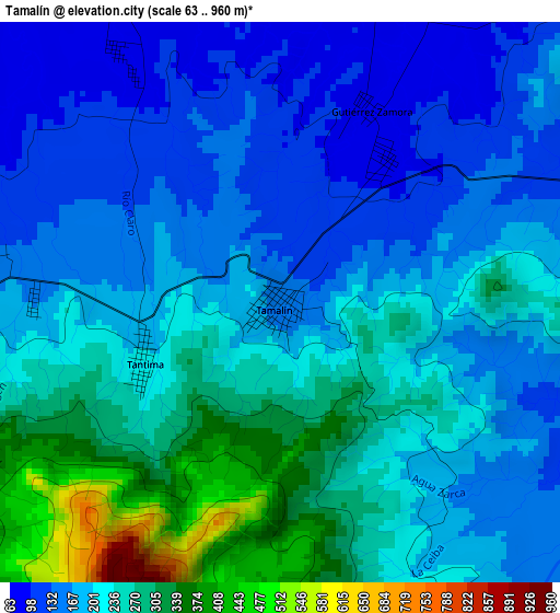
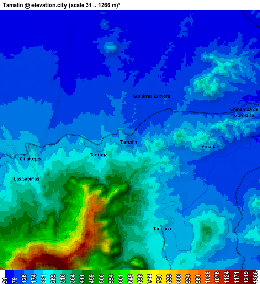
Below is the Elevation map of Tamalín, which displays elevation range with different colors. Scale of the first map is from 63 to 960 m (207 to 3150 ft) with average elevation of 212.1 meters (=696 ft) [note 1]
These maps also provides idea of topography and contour of this city, they are displayed at different zoom levels. More info about maps, scale and edge coordinates you can find below images.
| \ | Map #1 | Map #2 | Topo.Map |
| Scale [m] | 63..960 m | 31..1266 m | × |
| Scale [ft] | 207..3150 ft | 102..4154 ft | × |
| Average | 212.1 m = 696 ft | 222.5 m = 730 ft | × |
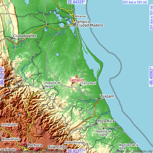
| Width | 9.1 km = 5.7 mi | 18.21 km = 11.3 mi | 291.3 km = 181 mi |
| Height | 9.1 km = 5.7 mi | 18.21 km = 11.3 mi | 291.3 km = 181 mi |
| ↑Max Latitude | 21.380287° | 21.421202° | 22.64325° |
| Latitude at center | 21.33936° | 21.33936° | 21.33936° |
| ↓Min Latitude | 21.298422° | 21.257472° | 20.02377° |
| ← Min Longitude | -97.855825° | -97.899771° | -99.21813° |
| Longitude center | -97.81188° | -97.81188° | -97.81188° |
| →Max Longitude | -97.767935° | -97.723989° | -96.40563° |
Nearby cities:
Cities around Tamalín sort by population:
• Naranjos elevation 62 m
13 km,  84°
84°
• Chinampa de Gorostiza 106 m
8.3 km,  74°
74°
• Citlaltépec 231 m
7 km,  260°
260°
• Colonia las Flores 59 m
12.6 km, 78°
• Chontla 262 m
12.6 km,  247°
247°
• Amatlán 176 m
5.7 km,  94°
94°
• San Francisco 147 m
15.7 km, 248°
• Tancoco 251 m
6.3 km,  160°
160°
• Zacamixtle 142 m
13.8 km,  137°
137°
• Tantima 199 m
2.4 km, 250°
• Las Sabinas 227 m
7.5 km, 251°
• Gutiérrez Zamora 86 m
3.5 km,  23°
23°
Multilingual:
 En español:
Tamalín elevación 147 m.
 En France:
Tamalín élévation 147 m.


Sources and notes:
- [note 1] Map square and city borders are not equal. Map elevation data is calculated only from area inside that square.
- [src 1] Elevation data from geonames database provided with same terms of usage.
- [src 2] The elevation map of Tamalín is generated using elevation data from NASA's 3 arcsec (90m) resolution SRTM data.
- [src 3] Base (background) map © OpenStreetMap contributors tiles are generated by Geofabrik and OpenTopoMap.
Copyright & License:
This Tamalín Elevation Map is licensed under CC BY-SA. You may reuse any part from this page, if you give a proper credit by linking to this URL:
 More info on terms of use page.