Mochitlán elevation
Mochitlán (Guerrero), Mexico elevation is 1010 meters and Mochitlán elevation in feet is 3314 ft above sea level [src 1]. Mochitlán is a seat of a second-order administrative division (feature code) with elevation that is 304 meters (997 ft) smaller than average city elevation in Mexico.
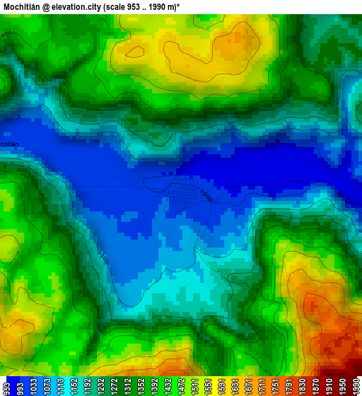
Below is the Elevation map of Mochitlán, which displays elevation range with different colors. Scale of the first map is from 953 to 1990 m (3127 to 6529 ft) with average elevation of 1295.5 meters (=4250 ft) [note 1]
These maps also provides idea of topography and contour of this city, they are displayed at different zoom levels. More info about maps, scale and edge coordinates you can find below images.
| \ | Map #1 | Map #2 | Topo.Map |
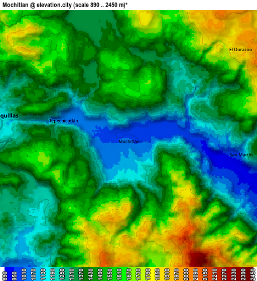
| Scale [m] | 953..1990 m | 890..2450 m | × |
| Scale [ft] | 3127..6529 ft | 2920..8038 ft | × |
| Average | 1295.5 m = 4250 ft | 1457.8 m = 4783 ft | × |
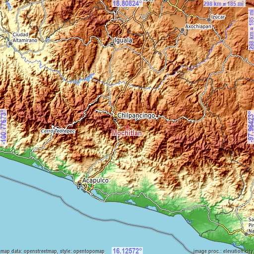
| Width | 9.32 km = 5.8 mi | 18.64 km = 11.6 mi | 298.3 km = 185.4 mi |
| Height | 9.32 km = 5.8 mi | 18.64 km = 11.6 mi | 298.3 km = 185.4 mi |
| ↑Max Latitude | 17.513833° | 17.555736° | 18.80824° |
| Latitude at center | 17.47192° | 17.47192° | 17.47192° |
| ↓Min Latitude | 17.429997° | 17.388065° | 16.12572° |
| ← Min Longitude | -99.414425° | -99.458371° | -100.77673° |
| Longitude center | -99.37048° | -99.37048° | -99.37048° |
| →Max Longitude | -99.326535° | -99.282589° | -97.96423° |
Nearby cities:
Cities around Mochitlán sort by population:
• Tixtla de Guerrero elevation 1354 m
11 km,  344°
344°
• Petaquillas 1153 m
9.2 km,  280°
280°
• Quechultenango 841 m
15 km,  115°
115°
• Mazatlán 1282 m
10.8 km,  248°
248°
• Palo Blanco 1175 m
12.7 km,  233°
233°
• Cuonetzingo 1946 m
12.7 km,  61°
61°
• Tepechicotlán 1042 m
4.9 km, 284°
• Zoquiapa 1881 m
12.8 km,  50°
50°
• San Martín 1017 m
8.1 km,  96°
96°
• El Durazno 1917 m
10.5 km, 53°
• Ahuexotitlán 1545 m
14.8 km, 64°
• Tonalapa 1525 m
13.8 km,  81°
81°
Multilingual:
 En español:
Mochitlán elevación 1010 m.
 En France:
Mochitlán élévation 1010 m.
 Auf Deutsch:
Mochitlán höhe über dem Meeresspiegel ist 1010 m.

Sources and notes:
- [note 1] Map square and city borders are not equal. Map elevation data is calculated only from area inside that square.
- [src 1] Elevation data from geonames database provided with same terms of usage.
- [src 2] The elevation map of Mochitlán is generated using elevation data from NASA's 3 arcsec (90m) resolution SRTM data.
- [src 3] Base (background) map © OpenStreetMap contributors tiles are generated by Geofabrik and OpenTopoMap.
Copyright & License:
This Mochitlán Elevation Map is licensed under CC BY-SA. You may reuse any part from this page, if you give a proper credit by linking to this URL:
 More info on terms of use page.