Omealca elevation
Omealca (Veracruz), Mexico elevation is 423 meters and Omealca elevation in feet is 1388 ft above sea level [src 1]. Omealca is a seat of a second-order administrative division (feature code) with elevation that is 891 meters (2923 ft) smaller than average city elevation in Mexico.
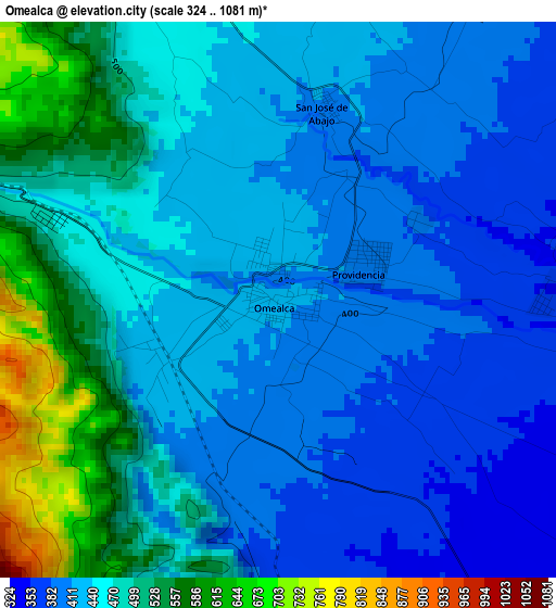
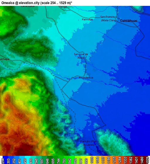
Below is the Elevation map of Omealca, which displays elevation range with different colors. Scale of the first map is from 324 to 1081 m (1063 to 3547 ft) with average elevation of 452.2 meters (=1484 ft) [note 1]
These maps also provides idea of topography and contour of this city, they are displayed at different zoom levels. More info about maps, scale and edge coordinates you can find below images.
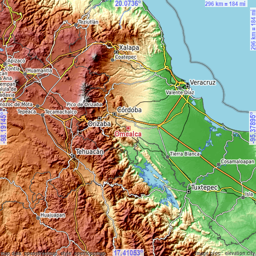
| \ | Map #1 | Map #2 | Topo.Map |
| Scale [m] | 324..1081 m | 254..1529 m | × |
| Scale [ft] | 1063..3547 ft | 833..5016 ft | × |
| Average | 452.2 m = 1484 ft | 551 m = 1808 ft | × |
| Width | 9.25 km = 5.7 mi | 18.51 km = 11.5 mi | 296.1 km = 184 mi |
| Height | 9.25 km = 5.7 mi | 18.51 km = 11.5 mi | 296.1 km = 184 mi |
| ↑Max Latitude | 18.788929° | 18.830527° | 20.0736° |
| Latitude at center | 18.74732° | 18.74732° | 18.74732° |
| ↓Min Latitude | 18.705701° | 18.664072° | 17.41053° |
| ← Min Longitude | -96.829145° | -96.873091° | -98.19145° |
| Longitude center | -96.7852° | -96.7852° | -96.7852° |
| →Max Longitude | -96.741255° | -96.697309° | -95.37895° |
Nearby cities:
Cities around Omealca sort by population:
• Cuitláhuac elevation 378 m
9.9 km,  41°
41°
• Yanga 518 m
9.6 km,  351°
351°
• La Providencia 402 m
1.6 km,  67°
67°
• Cuichapa 570 m
9.2 km,  286°
286°
• Presidio (Plan de Libres) 340 m
7.6 km,  169°
169°
• San Francisco (Mata Clara) 417 m
8.5 km,  28°
28°
• Palmillas 458 m
7.7 km,  10°
10°
• San José de Abajo 408 m
3.3 km, 14°
• General Juan José Baz (San José del Corral) 531 m
9 km,  337°
337°
• General Alatriste (San Joaquín) 512 m
10.4 km,  355°
355°
• Mata Naranjo 336 m
8.3 km, 66°
• Rincón de Buena Vista 544 m
8.8 km,  275°
275°
Multilingual:
 En español:
Omealca elevación 423 m.
 En France:
Omealca élévation 423 m.


Sources and notes:
- [note 1] Map square and city borders are not equal. Map elevation data is calculated only from area inside that square.
- [src 1] Elevation data from geonames database provided with same terms of usage.
- [src 2] The elevation map of Omealca is generated using elevation data from NASA's 3 arcsec (90m) resolution SRTM data.
- [src 3] Base (background) map © OpenStreetMap contributors tiles are generated by Geofabrik and OpenTopoMap.
Copyright & License:
This Omealca Elevation Map is licensed under CC BY-SA. You may reuse any part from this page, if you give a proper credit by linking to this URL:
 More info on terms of use page.