Tuxtepec elevation
Tuxtepec (Oaxaca, San Juan Bautista Tuxtepec), Mexico elevation is 31 meters and Tuxtepec elevation in feet is 102 ft above sea level [src 1]. Tuxtepec is a populated place (feature code) with elevation that is 1283 meters (4209 ft) smaller than average city elevation in Mexico.
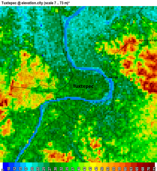
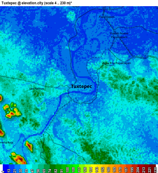
Below is the Elevation map of Tuxtepec, which displays elevation range with different colors. Scale of the first map is from 7 to 73 m (23 to 240 ft) with average elevation of 33.7 meters (=111 ft) [note 1]
These maps also provides idea of topography and contour of this city, they are displayed at different zoom levels. More info about maps, scale and edge coordinates you can find below images.
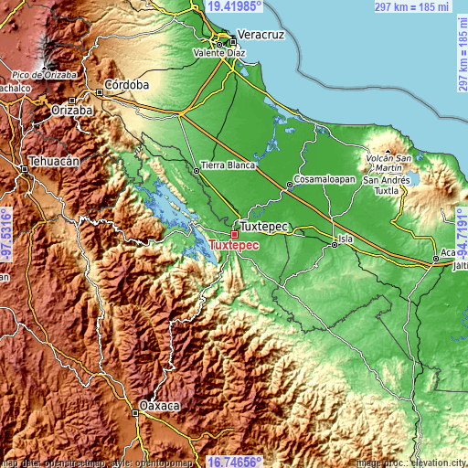
| \ | Map #1 | Map #2 | Topo.Map |
| Scale [m] | 7..73 m | 4..230 m | × |
| Scale [ft] | 23..240 ft | 13..755 ft | × |
| Average | 33.7 m = 111 ft | 37.5 m = 123 ft | × |
| Width | 9.29 km = 5.8 mi | 18.58 km = 11.5 mi | 297.2 km = 184.7 mi |
| Height | 9.29 km = 5.8 mi | 18.58 km = 11.5 mi | 297.3 km = 184.7 mi |
| ↑Max Latitude | 18.130069° | 18.171827° | 19.41985° |
| Latitude at center | 18.0883° | 18.0883° | 18.0883° |
| ↓Min Latitude | 18.046522° | 18.004733° | 16.74656° |
| ← Min Longitude | -96.169295° | -96.213241° | -97.5316° |
| Longitude center | -96.12535° | -96.12535° | -96.12535° |
| →Max Longitude | -96.081405° | -96.037459° | -94.7191° |
Nearby cities:
Cities around Tuxtepec sort by population:
• Gabino Barreda elevation 33 m
10.7 km,  19°
19°
• Otatitlán 23 m
13.8 km,  44°
44°
• San Bartolo 29 m
1.9 km,  76°
76°
• Benemérito Juárez 32 m
13.5 km, 75°
• Novara 49 m
12.5 km,  8°
8°
• Papaloapan 26 m
8.7 km, 22°
• Arroyo Choápam 53 m
13.5 km,  194°
194°
• Camelia Roja 46 m
11 km,  232°
232°
• La Mina 50 m
11.6 km,  166°
166°
• Macín Chico 76 m
15.6 km,  261°
261°
• Paso Canoa 53 m
14.6 km, 234°
• La Guadalupe 46 m
16.2 km,  347°
347°
Multilingual:
 En español:
Tuxtepec elevación 31 m.
 En France:
Tuxtepec élévation 31 m.


Sources and notes:
- [note 1] Map square and city borders are not equal. Map elevation data is calculated only from area inside that square.
- [src 1] Elevation data from geonames database provided with same terms of usage.
- [src 2] The elevation map of Tuxtepec is generated using elevation data from NASA's 3 arcsec (90m) resolution SRTM data.
- [src 3] Base (background) map © OpenStreetMap contributors tiles are generated by Geofabrik and OpenTopoMap.
Copyright & License:
This Tuxtepec Elevation Map is licensed under CC BY-SA. You may reuse any part from this page, if you give a proper credit by linking to this URL:
 More info on terms of use page.